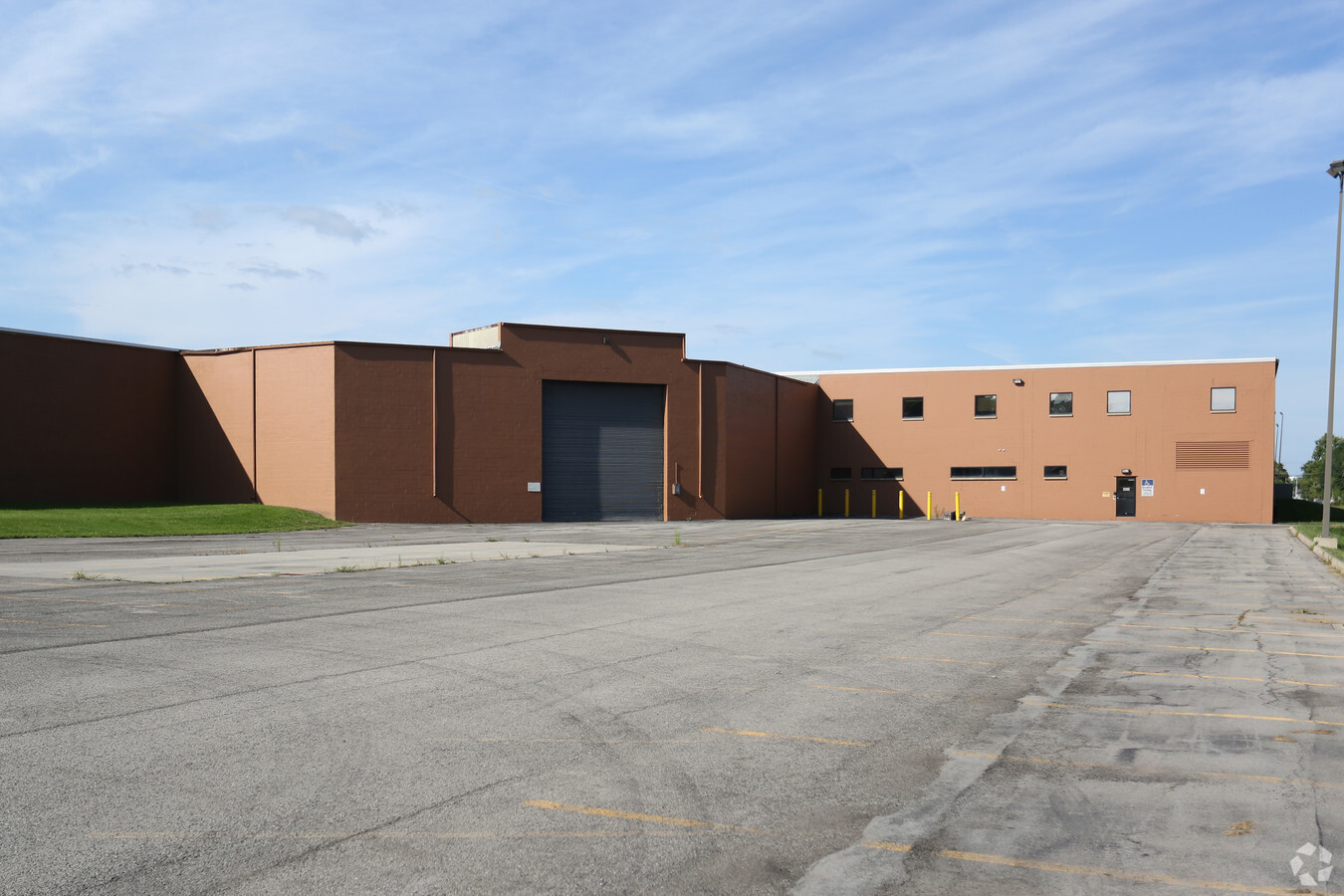
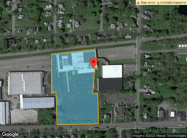
Property Record
231 East Ave, Albion, NY 14411
NEARBY LISTINGS FOR SALE OR LEASE
Property Detail
231 East Ave
Rochester, NY
BLDG C HC 35-15-1 WASHINGTON MUTUAL
342001-073-010-0001-012-012
Orleans
Professionalbldglegalinsurancerealestateetc
New York
2024
12.012
2023
4.20 AC
040701
Orleans County
128,092 SF
Rochester
DEMOGRAPHICS near 231 East Ave
1 Mile
3 Mile
5 Mile
2024 Total Population
5,406
7,489
9,839
2029 Population
5,316
7,340
9,619
Pop Growth 2024-2029
(1.66%)
(1.99%)
(2.24%)
Average Age
40
41
42
2024 Total Households
2,269
3,133
4,076
HH Growth 2024-2029
(1.63%)
(1.95%)
(2.21%)
Median Household Inc
$42,704
$42,849
$45,714
Avg Household Size
2.30
2.30
2.30
2024 Avg HH Vehicles
2.00
2.00
2.00
Median Home Value
$82,871
$95,299
$108,961
Median Year Built
1949
1949
1949
Nearby Places
- Restaurants
- Banks
- Shops
- Fitness
- Groceries
PUBLIC TRANSPORTATION
AIRPORT
Frederick Douglass/Greater Rochester International
DRIVE
WALK
Distance
Frederick Douglass/Greater Rochester International
42 min
33.8 mi
Freight Ports
Albany, NY Port
DRIVE
WALK
Distance
Albany, NY Port
307 min
260.0 mi
SALE & LEASE HISTORY
LISTING DATE
SALE/LEASE

Sep 25, 2016
For Lease
Sep 23, 2016
For Sale
Nov 06, 2017
For Sale
Jun 25, 2019
For Sale
Jun 04, 2018
For Sale
Jun 01, 2018
For Sale
Jun 01, 2018
For Lease
Jul 27, 2018
For Sale
Dec 12, 2023
For Lease
Nearby Properties
Address
Land Use
TOTAL SIZE
Lot Size
Zoning
Address
Land Use
TOTAL SIZE
Lot Size
Zoning
310,554 SF
64.90 AC
R1
Address
Land Use
TOTAL SIZE
Lot Size
Zoning
155,000 SF
22.41 AC
B
Address
Land Use
TOTAL SIZE
Lot Size
Zoning
201.80 AC
Address
Land Use
TOTAL SIZE
Lot Size
Zoning
1,560 SF
116.61 AC
Address
Land Use
TOTAL SIZE
Lot Size
Zoning
5.10 AC
Address
Land Use
TOTAL SIZE
Lot Size
Zoning
94,556 SF
9.31 AC
B
Address
Land Use
TOTAL SIZE
Lot Size
Zoning
1,680 SF
39.70 AC
C
Address
Land Use
TOTAL SIZE
Lot Size
Zoning
110,968 SF
17.40 AC
Address
Land Use
TOTAL SIZE
Lot Size
Zoning
29,180 SF
9.65 AC
B
Address
Land Use
TOTAL SIZE
Lot Size
Zoning
152,402 SF
22.10 AC
Address
Land Use
TOTAL SIZE
Lot Size
Zoning
45,378 SF
9.85 AC
GC
Address
Land Use
TOTAL SIZE
Lot Size
Zoning
81,840 SF
6.32 AC
Address
Land Use
TOTAL SIZE
Lot Size
Zoning
3,544 SF
6.10 AC
01 - NOT Z
Address
Land Use
TOTAL SIZE
Lot Size
Zoning
24,096 SF
0.62 AC
07 - MIXED
Address
Land Use
TOTAL SIZE
Lot Size
Zoning
13,997 SF
1.80 AC
GC
Address
Land Use
TOTAL SIZE
Lot Size
Zoning
0.92 AC
06 - INDUS
Address
Land Use
TOTAL SIZE
Lot Size
Zoning
Address
Land Use
TOTAL SIZE
Lot Size
Zoning
Address
Land Use
TOTAL SIZE
Lot Size
Zoning
0.43 AC
05 - COMME
Address
Land Use
TOTAL SIZE
Lot Size
Zoning
Address
Land Use
TOTAL SIZE
Lot Size
Zoning
419.70 AC
Address
Land Use
TOTAL SIZE
Lot Size
Zoning
45,058 SF
2.24 AC
07
Address
Land Use
TOTAL SIZE
Lot Size
Zoning
Address
Land Use
TOTAL SIZE
Lot Size
Zoning
Address
Land Use
TOTAL SIZE
Lot Size
Zoning
23,462 SF
3.20 AC
B
Address
Land Use
TOTAL SIZE
Lot Size
Zoning
8,319 SF
7 AC
06 - INDUS
Address
Land Use
TOTAL SIZE
Lot Size
Zoning
Address
Land Use
TOTAL SIZE
Lot Size
Zoning
284.40 AC
Address
Land Use
TOTAL SIZE
Lot Size
Zoning
31,993 SF
3.01 AC
06 - INDUS
The World's #1 Commercial Real Estate Marketplace
Connect with us
© 2025 CoStar Group
The information above has been obtained from sources believed reliable. While we do not doubt its accuracy we have not verified it and make no guarantee, warranty or representation about it. It is your responsibility to independently confirm its accuracy and completeness. Any projections, opinions, assumptions, or estimates used are for example only and do not represent the current or future performance of the property. The value of this transaction to you depends on tax and other factors which should be evaluated by your tax, financial, and legal advisors. You and your advisors should conduct a careful, independent investigation of the property to determine to your satisfaction the suitability of the property for your needs.