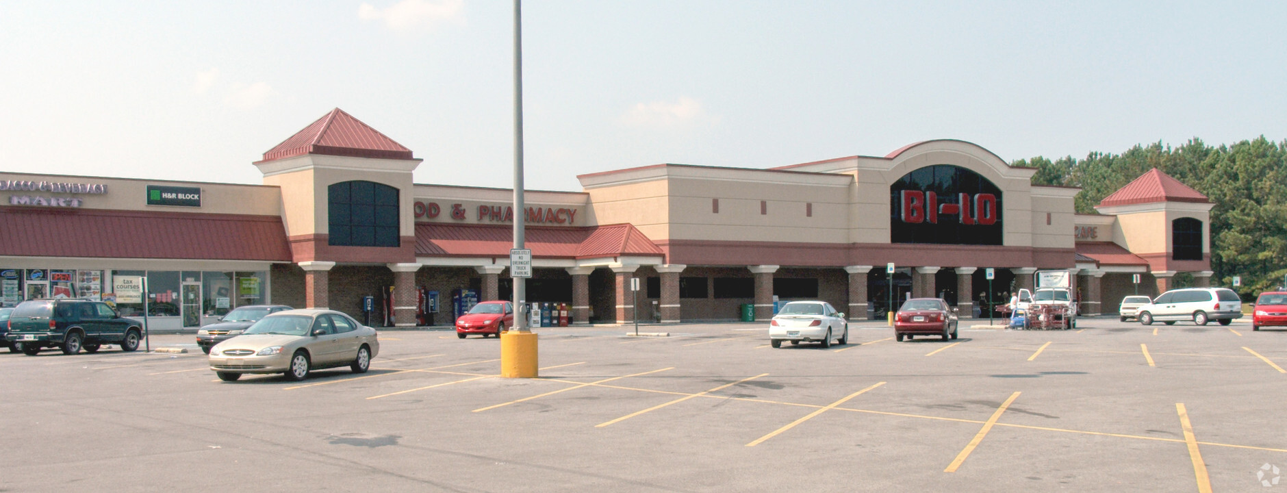
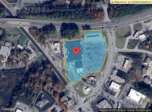
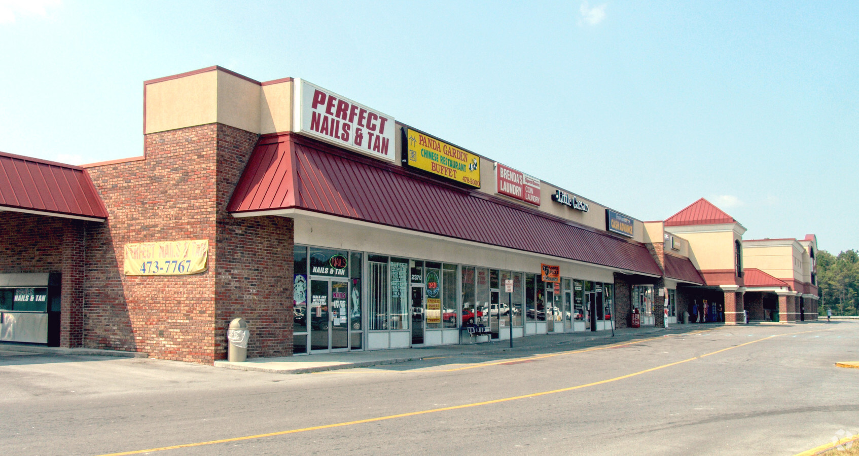
Property Record
2310 Mcgrady Dr Se, Cleveland, TN 37323
NEARBY LISTINGS FOR SALE OR LEASE
Property Detail
2310 Mcgrady Dr Se
Cleveland, TN
Food City
066H-A-002.01
FOOD CITY PB: 35 PG: 62 LOT 6 & PART OF LOTS 2;3;4;5;7;8 &10 FOOD CITY SHOPPING CNTER
Commercialnec
Bradley
X
Tennessee
47011C0138E
6,2
2024
6.21 AC
2024
Tennessee East Area
010900
Other Market Areas
56,425 SF
DEMOGRAPHICS near 2310 Mcgrady Dr Se
1 Mile
3 Mile
5 Mile
2024 Total Population
6,701
32,448
62,941
2029 Population
7,061
34,288
66,381
Pop Growth 2024-2029
+ 5.37%
+ 5.67%
+ 5.47%
Average Age
38
37
39
2024 Total Households
2,550
12,394
24,486
HH Growth 2024-2029
+ 5.61%
+ 5.91%
+ 5.67%
Median Household Inc
$45,188
$43,286
$49,621
Avg Household Size
2.50
2.40
2.50
2024 Avg HH Vehicles
2.00
2.00
2.00
Median Home Value
$141,947
$165,700
$204,035
Median Year Built
1978
1977
1982
Nearby Places
- Restaurants
- Banks
- Shops
- Fitness
- Groceries
PUBLIC TRANSPORTATION
AIRPORT
Lovell Field
DRIVE
WALK
Distance
Lovell Field
35 min
24.9 mi
Freight Ports
Georgia Ports - Savannah
DRIVE
WALK
Distance
Georgia Ports - Savannah
416 min
364.1 mi
SALE & LEASE HISTORY
LISTING DATE
SALE/LEASE

Sep 07, 2022
For Lease
Nearby Properties
Address
Land Use
TOTAL SIZE
Lot Size
Zoning
Address
Land Use
TOTAL SIZE
Lot Size
Zoning
400,000 SF
123.44 AC
IH
Address
Land Use
TOTAL SIZE
Lot Size
Zoning
178,664 SF
14.80 AC
IH
Address
Land Use
TOTAL SIZE
Lot Size
Zoning
357,110 SF
52.96 AC
FAR
Address
Land Use
TOTAL SIZE
Lot Size
Zoning
68,785 SF
8.70 AC
R1
Address
Land Use
TOTAL SIZE
Lot Size
Zoning
65,382 SF
63.70 AC
FAR
Address
Land Use
TOTAL SIZE
Lot Size
Zoning
724,048 SF
20.29 AC
IL
Address
Land Use
TOTAL SIZE
Lot Size
Zoning
50,400 SF
1.04 AC
CBD
Address
Land Use
TOTAL SIZE
Lot Size
Zoning
30,526 SF
0.92 AC
CBD
Address
Land Use
TOTAL SIZE
Lot Size
Zoning
305,064 SF
36.84 AC
IL
Address
Land Use
TOTAL SIZE
Lot Size
Zoning
48,494 SF
4.70 AC
R3
Address
Land Use
TOTAL SIZE
Lot Size
Zoning
74,229 SF
1 AC
R1
Address
Land Use
TOTAL SIZE
Lot Size
Zoning
205,800 SF
30.93 AC
CH
Address
Land Use
TOTAL SIZE
Lot Size
Zoning
24,948 SF
4.95 AC
PI
Address
Land Use
TOTAL SIZE
Lot Size
Zoning
104,319 SF
2.63 AC
IH
Address
Land Use
TOTAL SIZE
Lot Size
Zoning
37,787 SF
49.10 AC
FAR
Address
Land Use
TOTAL SIZE
Lot Size
Zoning
196,358 SF
16.50 AC
A
Address
Land Use
TOTAL SIZE
Lot Size
Zoning
122,596 SF
5.98 AC
PUD
Address
Land Use
TOTAL SIZE
Lot Size
Zoning
82,628 SF
9.50 AC
R3
Address
Land Use
TOTAL SIZE
Lot Size
Zoning
18,912 SF
1.22 AC
CBD
Address
Land Use
TOTAL SIZE
Lot Size
Zoning
23,022 SF
1.72 AC
HP
Address
Land Use
TOTAL SIZE
Lot Size
Zoning
57,408 SF
0.98 AC
CBD
Address
Land Use
TOTAL SIZE
Lot Size
Zoning
122,792 SF
12.85 AC
R3
Address
Land Use
TOTAL SIZE
Lot Size
Zoning
184,153 SF
15.39 AC
IL
Address
Land Use
TOTAL SIZE
Lot Size
Zoning
197,504 SF
14.15 AC
CH
Address
Land Use
TOTAL SIZE
Lot Size
Zoning
32 AC
CH
Address
Land Use
TOTAL SIZE
Lot Size
Zoning
22,004 SF
5.30 AC
R2
Address
Land Use
TOTAL SIZE
Lot Size
Zoning
196,480 SF
17.83 AC
IL
Address
Land Use
TOTAL SIZE
Lot Size
Zoning
28,786 SF
0.78 AC
CBD
Address
Land Use
TOTAL SIZE
Lot Size
Zoning
40,755 SF
10.27 AC
R1
Address
Land Use
TOTAL SIZE
Lot Size
Zoning
39,680 SF
2.14 AC
R2
The World's #1 Commercial Real Estate Marketplace
Connect with us
© 2025 CoStar Group
The information above has been obtained from sources believed reliable. While we do not doubt its accuracy we have not verified it and make no guarantee, warranty or representation about it. It is your responsibility to independently confirm its accuracy and completeness. Any projections, opinions, assumptions, or estimates used are for example only and do not represent the current or future performance of the property. The value of this transaction to you depends on tax and other factors which should be evaluated by your tax, financial, and legal advisors. You and your advisors should conduct a careful, independent investigation of the property to determine to your satisfaction the suitability of the property for your needs.