Property Record
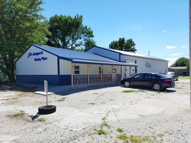
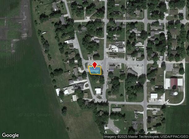
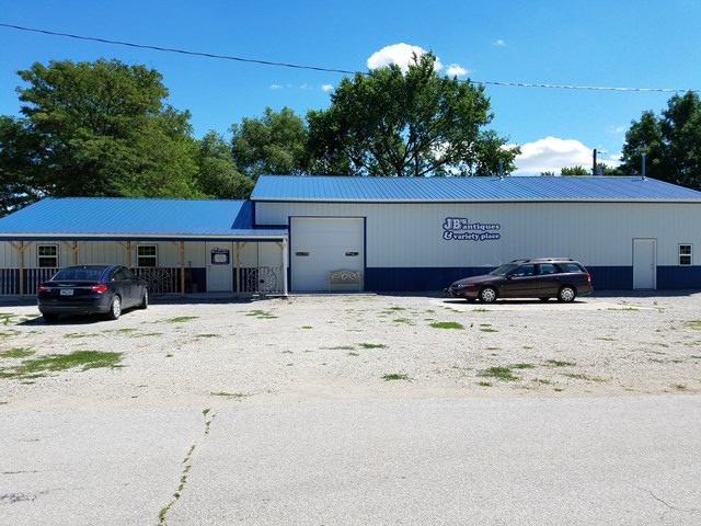
232 Main St, Otho, IA 50569
NEARBY LISTINGS FOR SALE OR LEASE
-
-
View all Otho listings for sale on LoopNet.com
Property Detail
232 Main St
11-19-254-001
Fd Otho Inc O T
Lightindustrial
FD OTHO INC O T BLK 7 N 73'
X
Webster
19187C0325C
Iowa
2023
0.18 AC
2023
Other Market Areas
010400
Fort Dodge, IA
3,008 SF
DEMOGRAPHICS near 232 Main St
1 Mile
3 Mile
5 Mile
2024 Total Population
469
1,623
5,613
2029 Population
460
1,616
5,580
Pop Growth 2024-2029
(1.92%)
(0.43%)
(0.59%)
Average Age
46
43
42
2024 Total Households
226
682
2,012
HH Growth 2024-2029
(1.77%)
(0.73%)
(0.80%)
Median Household Inc
$57,856
$57,327
$55,723
Avg Household Size
2.10
2.20
2.20
2024 Avg HH Vehicles
2.00
2.00
2.00
Median Home Value
$74,369
$91,488
$85,525
Median Year Built
1962
1958
1954
Nearby Places
- Restaurants
- Banks
- Shops
- Fitness
- Groceries
SALE & LEASE HISTORY
LISTING DATE
SALE/LEASE

Dec 13, 2017
For Sale
Aug 07, 2017
For Sale
Nearby Properties
Address
Land Use
TOTAL SIZE
Lot Size
Zoning
Address
Land Use
TOTAL SIZE
Lot Size
Zoning
1,535 SF
11.54 AC
Address
Land Use
TOTAL SIZE
Lot Size
Zoning
Address
Land Use
TOTAL SIZE
Lot Size
Zoning
20,000 SF
16.28 AC
Address
Land Use
TOTAL SIZE
Lot Size
Zoning
1,152 SF
18.70 AC
Address
Land Use
TOTAL SIZE
Lot Size
Zoning
900 SF
13.27 AC
Address
Land Use
TOTAL SIZE
Lot Size
Zoning
208 SF
40 AC
Address
Land Use
TOTAL SIZE
Lot Size
Zoning
2,438 SF
1.05 AC
Address
Land Use
TOTAL SIZE
Lot Size
Zoning
3,280 SF
1.88 AC
Address
Land Use
TOTAL SIZE
Lot Size
Zoning
2.93 AC
Address
Land Use
TOTAL SIZE
Lot Size
Zoning
8,000 SF
5.94 AC
Address
Land Use
TOTAL SIZE
Lot Size
Zoning
4,000 SF
4.93 AC
Address
Land Use
TOTAL SIZE
Lot Size
Zoning
3,520 SF
8.84 AC
Address
Land Use
TOTAL SIZE
Lot Size
Zoning
2,016 SF
3.95 AC
Address
Land Use
TOTAL SIZE
Lot Size
Zoning
1,919 SF
0.16 AC
Address
Land Use
TOTAL SIZE
Lot Size
Zoning
2,424 SF
0.41 AC
Address
Land Use
TOTAL SIZE
Lot Size
Zoning
7,080 SF
0.97 AC
Address
Land Use
TOTAL SIZE
Lot Size
Zoning
38.87 AC
Address
Land Use
TOTAL SIZE
Lot Size
Zoning
39 AC
Address
Land Use
TOTAL SIZE
Lot Size
Zoning
Address
Land Use
TOTAL SIZE
Lot Size
Zoning
37.17 AC
Address
Land Use
TOTAL SIZE
Lot Size
Zoning
3,000 SF
0.37 AC
Address
Land Use
TOTAL SIZE
Lot Size
Zoning
36.86 AC
Address
Land Use
TOTAL SIZE
Lot Size
Zoning
Address
Land Use
TOTAL SIZE
Lot Size
Zoning
800 SF
40 AC
Address
Land Use
TOTAL SIZE
Lot Size
Zoning
Address
Land Use
TOTAL SIZE
Lot Size
Zoning
36.30 AC
Address
Land Use
TOTAL SIZE
Lot Size
Zoning
36.67 AC
Address
Land Use
TOTAL SIZE
Lot Size
Zoning
36.21 AC
Address
Land Use
TOTAL SIZE
Lot Size
Zoning
944 SF
38.12 AC
The World's #1 Commercial Real Estate Marketplace
Connect with us
© 2025 CoStar Group
The information above has been obtained from sources believed reliable. While we do not doubt its accuracy we have not verified it and make no guarantee, warranty or representation about it. It is your responsibility to independently confirm its accuracy and completeness. Any projections, opinions, assumptions, or estimates used are for example only and do not represent the current or future performance of the property. The value of this transaction to you depends on tax and other factors which should be evaluated by your tax, financial, and legal advisors. You and your advisors should conduct a careful, independent investigation of the property to determine to your satisfaction the suitability of the property for your needs.