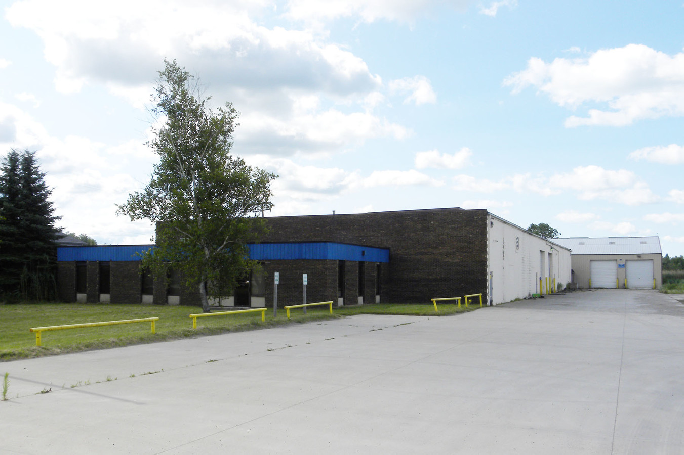
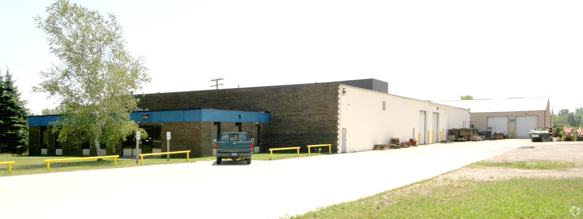
Property Record
2321 Parrotts Pointe Rd, Greensboro, GA 30642
NEARBY LISTINGS FOR SALE OR LEASE
Property Detail
2321 Parrotts Pointe Rd
23-004-1003-100
BEG N 89D 43M E 822.45' FROM NW SECTION COR, TH N 89D 43M E 225.55', TH S 644.36', TH S 89D 49M 3S W 225.55', TH N 643.97' TO
Manufacturinglight
St. Clair
X
Michigan
26147C0481D
3.33 AC
2023
St Clair & Lapeer Counties
2024
Detroit
650100
Detroit-Warren-Dearborn, MI
37,240 SF
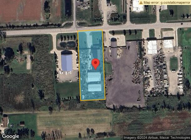
DEMOGRAPHICS near 2321 Parrotts Pointe Rd
1 Mile
3 Mile
5 Mile
2024 Total Population
187
9,677
28,344
2029 Population
184
9,731
28,292
Pop Growth 2024-2029
(1.60%)
+ 0.56%
(0.18%)
Average Age
44
41
41
2024 Total Households
68
3,336
10,244
HH Growth 2024-2029
(1.47%)
+ 0.69%
(0.15%)
Median Household Inc
$113,888
$80,913
$79,676
Avg Household Size
2.70
2.60
2.60
2024 Avg HH Vehicles
3.00
2.00
2.00
Median Home Value
$291,666
$232,322
$256,921
Median Year Built
1971
1993
1992
Nearby Places
- Restaurants
- Banks
- Shops
- Fitness
- Groceries
Nearby Properties
Address
Land Use
TOTAL SIZE
Lot Size
Zoning
Address
Land Use
TOTAL SIZE
Lot Size
Zoning
115695
Address
Land Use
TOTAL SIZE
Lot Size
Zoning
210688
20.13 AC
CG
Address
Land Use
TOTAL SIZE
Lot Size
Zoning
7262
127.87 AC
MH
Address
Land Use
TOTAL SIZE
Lot Size
Zoning
276497
31.19 AC
I-1
Address
Land Use
TOTAL SIZE
Lot Size
Zoning
89620
17.89 AC
Address
Land Use
TOTAL SIZE
Lot Size
Zoning
60123
120 AC
I-2
Address
Land Use
TOTAL SIZE
Lot Size
Zoning
176142
21.95 AC
IND
Address
Land Use
TOTAL SIZE
Lot Size
Zoning
49600
14.50 AC
I-2
Address
Land Use
TOTAL SIZE
Lot Size
Zoning
56505
I-1
Address
Land Use
TOTAL SIZE
Lot Size
Zoning
80600
6.52 AC
I-2
Address
Land Use
TOTAL SIZE
Lot Size
Zoning
5682
47.12 AC
RT
Address
Land Use
TOTAL SIZE
Lot Size
Zoning
45 AC
RT
Address
Land Use
TOTAL SIZE
Lot Size
Zoning
1.94 AC
CG
Address
Land Use
TOTAL SIZE
Lot Size
Zoning
67040
15 AC
I-1
Address
Land Use
TOTAL SIZE
Lot Size
Zoning
10030
3.88 AC
I-2
Address
Land Use
TOTAL SIZE
Lot Size
Zoning
33320
2.34 AC
I-2
Address
Land Use
TOTAL SIZE
Lot Size
Zoning
3321
72.15 AC
AEC
Address
Land Use
TOTAL SIZE
Lot Size
Zoning
28912
5 AC
IND
Address
Land Use
TOTAL SIZE
Lot Size
Zoning
20000
10.01 AC
IND
Address
Land Use
TOTAL SIZE
Lot Size
Zoning
5244
4.32 AC
B-2
Address
Land Use
TOTAL SIZE
Lot Size
Zoning
21017
1.68 AC
I-1
Address
Land Use
TOTAL SIZE
Lot Size
Zoning
4554
15.98 AC
AEC
Address
Land Use
TOTAL SIZE
Lot Size
Zoning
16383
1.38 AC
I-2
Address
Land Use
TOTAL SIZE
Lot Size
Zoning
24000
1.51 AC
I-1
Address
Land Use
TOTAL SIZE
Lot Size
Zoning
30306
4.79 AC
I-1
Address
Land Use
TOTAL SIZE
Lot Size
Zoning
9150
10.04 AC
IND
Address
Land Use
TOTAL SIZE
Lot Size
Zoning
15200
9.95 AC
M1 LIG
Address
Land Use
TOTAL SIZE
Lot Size
Zoning
4875
1.55 AC
CG
Address
Land Use
TOTAL SIZE
Lot Size
Zoning
29600
I-1
Address
Land Use
TOTAL SIZE
Lot Size
Zoning
3114
4.47 AC
WM
Start a new search to find other properties for sale or lease
Connect with us
© 2024 CoStar Group
The information above has been obtained from sources believed reliable. While we do not doubt its accuracy we have not verified it and make no guarantee, warranty or representation about it. It is your responsibility to independently confirm its accuracy and completeness. Any projections, opinions, assumptions, or estimates used are for example only and do not represent the current or future performance of the property. The value of this transaction to you depends on tax and other factors which should be evaluated by your tax, financial, and legal advisors. You and your advisors should conduct a careful, independent investigation of the property to determine to your satisfaction the suitability of the property for your needs.