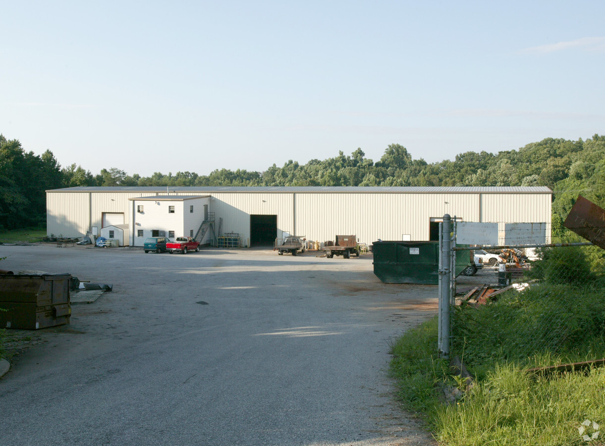
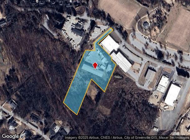
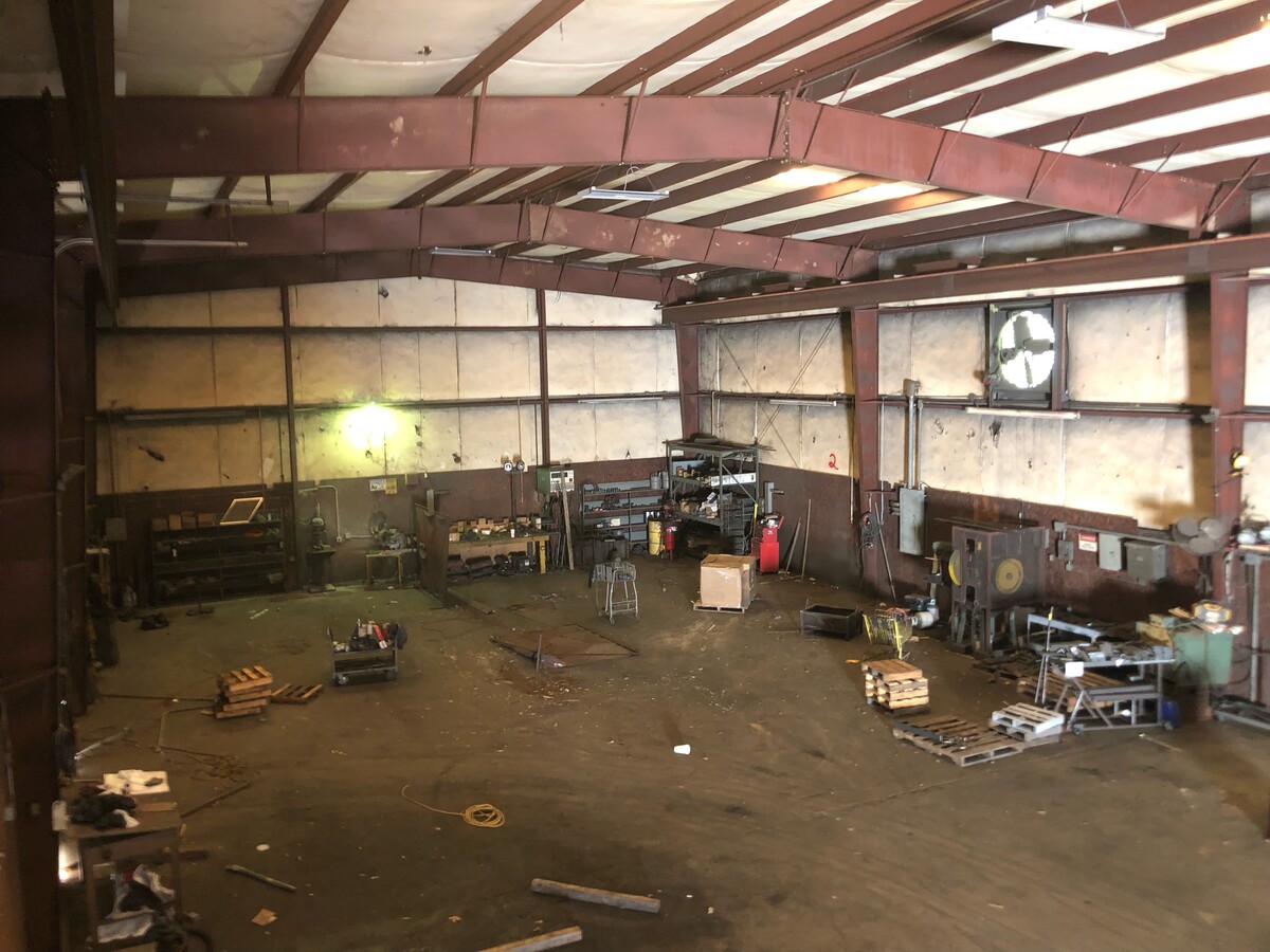
Property Record
233 Beverly Rd, Greenville, SC 29609

NEARBY LISTINGS FOR SALE OR LEASE
Property Detail
233 Beverly Rd
Greenville-Anderson-Mauldin, SC
Beverly Hills
P009.01-01-009.00
PT.21,PT.22
Warehouse
Greenville
X
South Carolina
45045C0319E
009.00
2024
4.39 AC
2024
Rt 29 Rutherford Rd
001600
Greenville/Spartanburg
DEMOGRAPHICS near 233 Beverly Rd
1 Mile
3 Mile
5 Mile
2024 Total Population
5,651
60,646
168,319
2029 Population
6,210
66,867
186,173
Pop Growth 2024-2029
+ 9.89%
+ 10.26%
+ 10.61%
Average Age
38
39
39
2024 Total Households
2,213
25,300
71,207
HH Growth 2024-2029
+ 9.94%
+ 10.46%
+ 10.89%
Median Household Inc
$63,637
$60,774
$59,392
Avg Household Size
2.40
2.20
2.20
2024 Avg HH Vehicles
2.00
2.00
2.00
Median Home Value
$257,565
$267,404
$253,518
Median Year Built
1977
1975
1980
Nearby Places
- Restaurants
- Banks
- Shops
- Fitness
- Groceries
PUBLIC TRANSPORTATION
COMMUTER RAIL
Greenville Amtrak Station (Crescent - Amtrak)
DRIVE
WALK
Distance
Greenville Amtrak Station (Crescent - Amtrak)
10 min
4.3 mi
AIRPORT
Greenville Spartanburg International
DRIVE
WALK
Distance
Greenville Spartanburg International
25 min
14.7 mi
Freight Ports
North Charleston Terminal
DRIVE
WALK
Distance
North Charleston Terminal
232 min
205.3 mi
SALE & LEASE HISTORY
LISTING DATE
SALE/LEASE

Jul 06, 2022
For Lease
Apr 26, 2022
For Sale
Nearby Properties
Address
Land Use
TOTAL SIZE
Lot Size
Zoning
Address
Land Use
TOTAL SIZE
Lot Size
Zoning
22.97 AC
R12
Address
Land Use
TOTAL SIZE
Lot Size
Zoning
14.41 AC
RM2
Address
Land Use
TOTAL SIZE
Lot Size
Zoning
11.99 AC
RM2
Address
Land Use
TOTAL SIZE
Lot Size
Zoning
11.82 AC
RM2
Address
Land Use
TOTAL SIZE
Lot Size
Zoning
8.94 AC
RM2
Address
Land Use
TOTAL SIZE
Lot Size
Zoning
9.13 AC
RM2
Address
Land Use
TOTAL SIZE
Lot Size
Zoning
10 AC
RM
Address
Land Use
TOTAL SIZE
Lot Size
Zoning
10.59 AC
RM2
Address
Land Use
TOTAL SIZE
Lot Size
Zoning
28.88 AC
RM
Address
Land Use
TOTAL SIZE
Lot Size
Zoning
5.61 AC
RM2
Address
Land Use
TOTAL SIZE
Lot Size
Zoning
97.93 AC
OD
Address
Land Use
TOTAL SIZE
Lot Size
Zoning
4.18 AC
C2
Address
Land Use
TOTAL SIZE
Lot Size
Zoning
Address
Land Use
TOTAL SIZE
Lot Size
Zoning
61.73 AC
OD
Address
Land Use
TOTAL SIZE
Lot Size
Zoning
3.22 AC
OD
Address
Land Use
TOTAL SIZE
Lot Size
Zoning
4.70 AC
C3
Address
Land Use
TOTAL SIZE
Lot Size
Zoning
8.95 AC
OD
Address
Land Use
TOTAL SIZE
Lot Size
Zoning
26.30 AC
R20
Address
Land Use
TOTAL SIZE
Lot Size
Zoning
10.03 AC
R6
Address
Land Use
TOTAL SIZE
Lot Size
Zoning
85.24 AC
C2,R12
Address
Land Use
TOTAL SIZE
Lot Size
Zoning
0.66 AC
C4
Address
Land Use
TOTAL SIZE
Lot Size
Zoning
19.31 AC
R6
Address
Land Use
TOTAL SIZE
Lot Size
Zoning
9.28 AC
C3
Address
Land Use
TOTAL SIZE
Lot Size
Zoning
32.18 AC
C2
Address
Land Use
TOTAL SIZE
Lot Size
Zoning
3.40 AC
C2
Address
Land Use
TOTAL SIZE
Lot Size
Zoning
149.88 AC
ESDPM
Address
Land Use
TOTAL SIZE
Lot Size
Zoning
30.52 AC
C2
Address
Land Use
TOTAL SIZE
Lot Size
Zoning
0.92 AC
C2
Address
Land Use
TOTAL SIZE
Lot Size
Zoning
8.40 AC
I1
Address
Land Use
TOTAL SIZE
Lot Size
Zoning
8,752 SF
0.48 AC
SEM*
The World's #1 Commercial Real Estate Marketplace
Connect with us
© 2025 CoStar Group
The information above has been obtained from sources believed reliable. While we do not doubt its accuracy we have not verified it and make no guarantee, warranty or representation about it. It is your responsibility to independently confirm its accuracy and completeness. Any projections, opinions, assumptions, or estimates used are for example only and do not represent the current or future performance of the property. The value of this transaction to you depends on tax and other factors which should be evaluated by your tax, financial, and legal advisors. You and your advisors should conduct a careful, independent investigation of the property to determine to your satisfaction the suitability of the property for your needs.