Property Record
2330 Rockdale Rd, Dubuque, IA 52003

NEARBY LISTINGS FOR SALE OR LEASE
-
-
View all Dubuque listings for lease on LoopNet.com
Property Detail
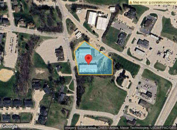
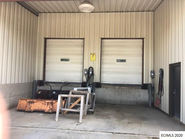
2330 Rockdale Rd
Dubuque, IA
Table Mound
15-01-330-001
LOT 2-1-1-1-1-1 MIN LOT 482
Warehouse
Dubuque
X
Iowa
19097C0025E
1-2,482
2023
2.03 AC
2024
Iowa Northeast Area
010101
Other Market Areas
12,467 SF
DEMOGRAPHICS near 2330 Rockdale Rd
1 Mile
3 Mile
5 Mile
2024 Total Population
2,402
20,384
59,805
2029 Population
2,417
20,275
59,314
Pop Growth 2024-2029
+ 0.62%
(0.53%)
(0.82%)
Average Age
43
41
40
2024 Total Households
1,002
8,360
25,089
HH Growth 2024-2029
+ 0.60%
(0.61%)
(0.86%)
Median Household Inc
$66,696
$74,258
$66,862
Avg Household Size
2.30
2.20
2.20
2024 Avg HH Vehicles
2.00
2.00
2.00
Median Home Value
$162,951
$189,331
$171,811
Median Year Built
1981
1960
1962
Nearby Places
- Restaurants
- Banks
- Shops
- Fitness
- Groceries
SALE & LEASE HISTORY
LISTING DATE
SALE/LEASE

Jun 25, 2020
For Lease
Feb 12, 2021
For Lease
Nearby Properties
Address
Land Use
TOTAL SIZE
Lot Size
Zoning
Address
Land Use
TOTAL SIZE
Lot Size
Zoning
182,880 SF
1.98 AC
Address
Land Use
TOTAL SIZE
Lot Size
Zoning
6.48 AC
Address
Land Use
TOTAL SIZE
Lot Size
Zoning
148,824 SF
6.79 AC
Address
Land Use
TOTAL SIZE
Lot Size
Zoning
32.27 AC
Address
Land Use
TOTAL SIZE
Lot Size
Zoning
Address
Land Use
TOTAL SIZE
Lot Size
Zoning
262,314 SF
0.67 AC
CI
Address
Land Use
TOTAL SIZE
Lot Size
Zoning
117,636 SF
23.52 AC
Address
Land Use
TOTAL SIZE
Lot Size
Zoning
132,465 SF
CI
Address
Land Use
TOTAL SIZE
Lot Size
Zoning
137,515 SF
2.02 AC
CI
Address
Land Use
TOTAL SIZE
Lot Size
Zoning
8.17 AC
Address
Land Use
TOTAL SIZE
Lot Size
Zoning
3.46 AC
Address
Land Use
TOTAL SIZE
Lot Size
Zoning
93,480 SF
1.83 AC
Address
Land Use
TOTAL SIZE
Lot Size
Zoning
27.31 AC
Address
Land Use
TOTAL SIZE
Lot Size
Zoning
85,281 SF
7.57 AC
CI
Address
Land Use
TOTAL SIZE
Lot Size
Zoning
1.17 AC
Address
Land Use
TOTAL SIZE
Lot Size
Zoning
43,393 SF
0.62 AC
Address
Land Use
TOTAL SIZE
Lot Size
Zoning
77,526 SF
6.97 AC
CI
Address
Land Use
TOTAL SIZE
Lot Size
Zoning
100,141 SF
1.72 AC
CI
Address
Land Use
TOTAL SIZE
Lot Size
Zoning
31,215 SF
31.92 AC
Address
Land Use
TOTAL SIZE
Lot Size
Zoning
6.82 AC
Address
Land Use
TOTAL SIZE
Lot Size
Zoning
14,952 SF
120.76 AC
CI
Address
Land Use
TOTAL SIZE
Lot Size
Zoning
5.88 AC
Address
Land Use
TOTAL SIZE
Lot Size
Zoning
55,284 SF
0.48 AC
Address
Land Use
TOTAL SIZE
Lot Size
Zoning
114,954 SF
0.91 AC
CI
Address
Land Use
TOTAL SIZE
Lot Size
Zoning
70,306 SF
1.35 AC
Address
Land Use
TOTAL SIZE
Lot Size
Zoning
41,927 SF
3.53 AC
Address
Land Use
TOTAL SIZE
Lot Size
Zoning
40,800 SF
8.05 AC
CO
Address
Land Use
TOTAL SIZE
Lot Size
Zoning
50,950 SF
1.06 AC
Address
Land Use
TOTAL SIZE
Lot Size
Zoning
68,336 SF
0.39 AC
CI
Address
Land Use
TOTAL SIZE
Lot Size
Zoning
86,830 SF
12.86 AC
The World's #1 Commercial Real Estate Marketplace
Connect with us
© 2025 CoStar Group
The information above has been obtained from sources believed reliable. While we do not doubt its accuracy we have not verified it and make no guarantee, warranty or representation about it. It is your responsibility to independently confirm its accuracy and completeness. Any projections, opinions, assumptions, or estimates used are for example only and do not represent the current or future performance of the property. The value of this transaction to you depends on tax and other factors which should be evaluated by your tax, financial, and legal advisors. You and your advisors should conduct a careful, independent investigation of the property to determine to your satisfaction the suitability of the property for your needs.