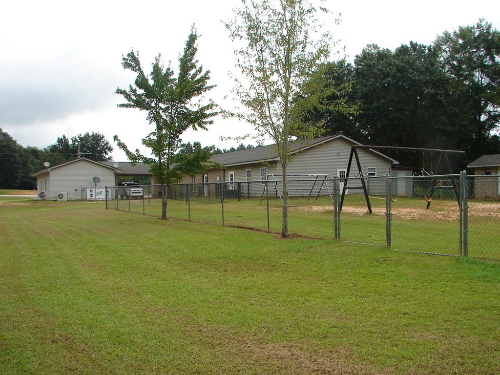
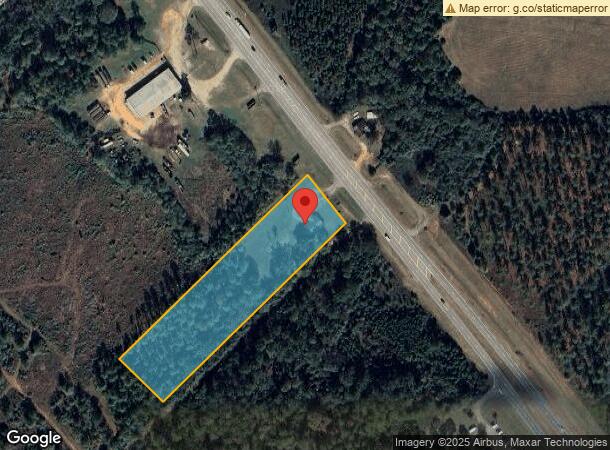
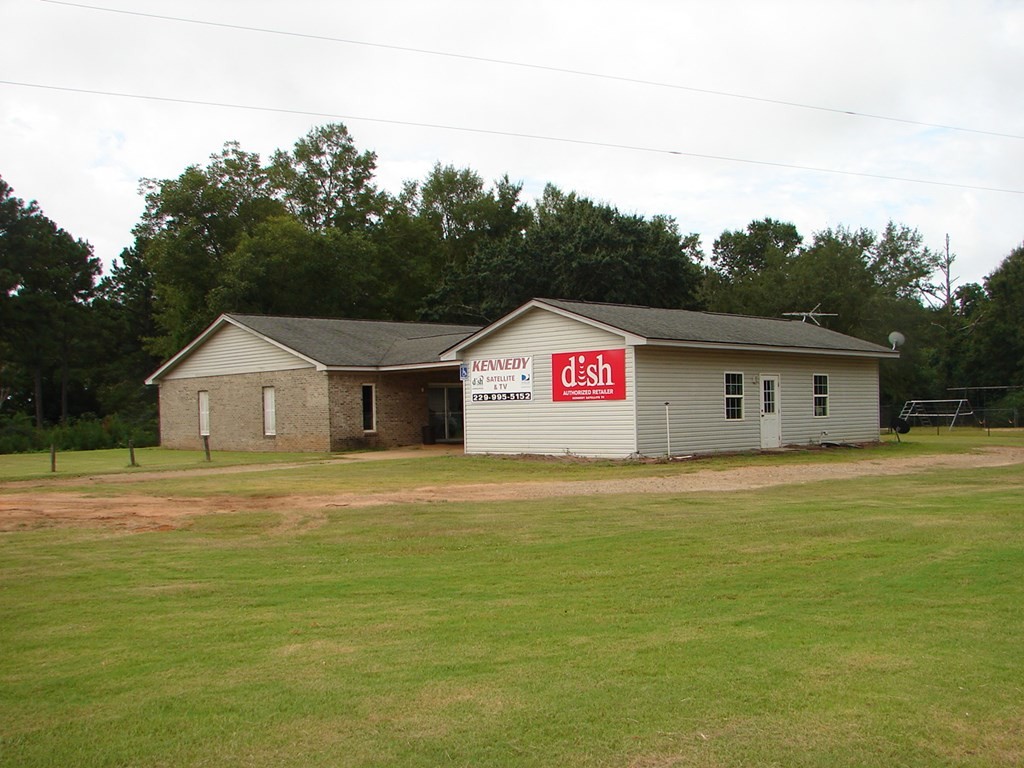
Property Record
2340 Albany Hwy, Dawson, GA 39842
NEARBY LISTINGS FOR SALE OR LEASE
Property Detail
2340 Albany Hwy
042-010
DAYCARE & SATELLITE
Daycare
Terrell
X
Georgia
13273C0120A
4 AC
2024
Albany/Southwest
2024
Other Market Areas
120400
Albany, GA
4,081 SF
DEMOGRAPHICS near 2340 Albany Hwy
1 Mile
3 Mile
5 Mile
2024 Total Population
277
4,919
6,053
2029 Population
257
4,683
5,750
Pop Growth 2024-2029
(7.22%)
(4.80%)
(5.01%)
Average Age
42
40
41
2024 Total Households
98
1,915
2,373
HH Growth 2024-2029
(8.16%)
(4.60%)
(4.85%)
Median Household Inc
$78,846
$36,096
$37,923
Avg Household Size
2.10
2.40
2.40
2024 Avg HH Vehicles
2.00
2.00
2.00
Median Home Value
$214,000
$89,902
$97,798
Median Year Built
1979
1971
1972
Nearby Places
- Restaurants
- Banks
- Shops
- Fitness
- Groceries
PUBLIC TRANSPORTATION
AIRPORT
Southwest Georgia Regional
DRIVE
WALK
Distance
Southwest Georgia Regional
34 min
22.8 mi
Freight Ports
Port of Panama City
DRIVE
WALK
Distance
Port of Panama City
228 min
169.6 mi
SALE & LEASE HISTORY
LISTING DATE
SALE/LEASE

Jul 02, 2019
For Sale
Dec 11, 2018
For Sale
Nearby Properties
Address
Land Use
TOTAL SIZE
Lot Size
Zoning
Address
Land Use
TOTAL SIZE
Lot Size
Zoning
Address
Land Use
TOTAL SIZE
Lot Size
Zoning
9,000 SF
100.93 AC
001
Address
Land Use
TOTAL SIZE
Lot Size
Zoning
67,959 SF
18.17 AC
003
Address
Land Use
TOTAL SIZE
Lot Size
Zoning
34,464 SF
5.06 AC
001
Address
Land Use
TOTAL SIZE
Lot Size
Zoning
60,329 SF
22.53 AC
001
Address
Land Use
TOTAL SIZE
Lot Size
Zoning
9,898 SF
1.62 AC
001
Address
Land Use
TOTAL SIZE
Lot Size
Zoning
20,472 SF
2.98 AC
001
Address
Land Use
TOTAL SIZE
Lot Size
Zoning
1.07 AC
001
Address
Land Use
TOTAL SIZE
Lot Size
Zoning
10,857 SF
3.04 AC
002
Address
Land Use
TOTAL SIZE
Lot Size
Zoning
8,375 SF
0.80 AC
001
Address
Land Use
TOTAL SIZE
Lot Size
Zoning
3,915 SF
1.02 AC
002
Address
Land Use
TOTAL SIZE
Lot Size
Zoning
40,328 SF
4.30 AC
001
Address
Land Use
TOTAL SIZE
Lot Size
Zoning
8,988 SF
2.47 AC
Address
Land Use
TOTAL SIZE
Lot Size
Zoning
97.10 AC
001
Address
Land Use
TOTAL SIZE
Lot Size
Zoning
15.72 AC
001
Address
Land Use
TOTAL SIZE
Lot Size
Zoning
1,200 SF
15.53 AC
002
Address
Land Use
TOTAL SIZE
Lot Size
Zoning
3,146 SF
4.25 AC
001
Address
Land Use
TOTAL SIZE
Lot Size
Zoning
3,350 SF
2.98 AC
001
Address
Land Use
TOTAL SIZE
Lot Size
Zoning
5.10 AC
001
Address
Land Use
TOTAL SIZE
Lot Size
Zoning
16,000 SF
13 AC
002
Address
Land Use
TOTAL SIZE
Lot Size
Zoning
5,425 SF
1.60 AC
002
Address
Land Use
TOTAL SIZE
Lot Size
Zoning
2,698 SF
0.78 AC
001
Address
Land Use
TOTAL SIZE
Lot Size
Zoning
132,100 SF
14.53 AC
002
Address
Land Use
TOTAL SIZE
Lot Size
Zoning
7,136 SF
0.43 AC
001
Address
Land Use
TOTAL SIZE
Lot Size
Zoning
13,504 SF
4.39 AC
002
Address
Land Use
TOTAL SIZE
Lot Size
Zoning
3,861 SF
0.61 AC
001
Address
Land Use
TOTAL SIZE
Lot Size
Zoning
60,310 SF
39.94 AC
003
The World's #1 Commercial Real Estate Marketplace
Connect with us
© 2025 CoStar Group
The information above has been obtained from sources believed reliable. While we do not doubt its accuracy we have not verified it and make no guarantee, warranty or representation about it. It is your responsibility to independently confirm its accuracy and completeness. Any projections, opinions, assumptions, or estimates used are for example only and do not represent the current or future performance of the property. The value of this transaction to you depends on tax and other factors which should be evaluated by your tax, financial, and legal advisors. You and your advisors should conduct a careful, independent investigation of the property to determine to your satisfaction the suitability of the property for your needs.