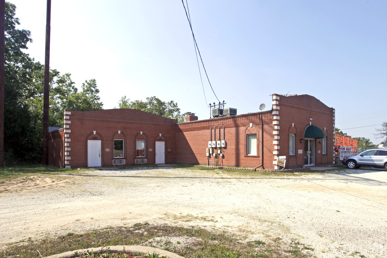
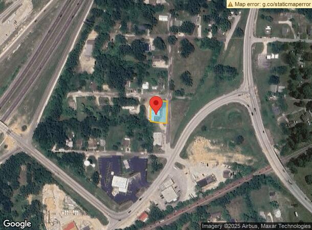
Property Record
235 Chestnut St, Saint Clair, MO 63077

NEARBY LISTINGS FOR SALE OR LEASE
-
-
View all Saint Clair listings for sale on LoopNet.com
Property Detail
235 Chestnut St
St. Louis, MO-IL
Cedar Crest (Loc 22)
22-7-350-1-002-119000
ZUFALL & SONS, INC. PT LOTS 17 & 18 CEDAR CREST ADDN
Officebuilding
Franklin
X
Missouri
29071C0455E
17,18
2024
0.30 AC
2023
Franklin County
800903
St. Louis
2,947 SF
DEMOGRAPHICS near 235 Chestnut St
1 Mile
3 Mile
5 Mile
2024 Total Population
3,473
9,016
12,148
2029 Population
3,581
9,316
12,581
Pop Growth 2024-2029
+ 3.11%
+ 3.33%
+ 3.56%
Average Age
38
40
40
2024 Total Households
1,376
3,559
4,792
HH Growth 2024-2029
+ 3.05%
+ 3.32%
+ 3.55%
Median Household Inc
$42,812
$51,701
$58,109
Avg Household Size
2.50
2.50
2.50
2024 Avg HH Vehicles
2.00
2.00
2.00
Median Home Value
$144,433
$151,637
$161,134
Median Year Built
1969
1976
1980
Nearby Places
- Restaurants
- Banks
- Shops
- Fitness
- Groceries
Nearby Properties
Address
Land Use
TOTAL SIZE
Lot Size
Zoning
Address
Land Use
TOTAL SIZE
Lot Size
Zoning
217,254 SF
8.80 AC
Address
Land Use
TOTAL SIZE
Lot Size
Zoning
2,052 SF
48.40 AC
Address
Land Use
TOTAL SIZE
Lot Size
Zoning
19,266 SF
0.60 AC
Address
Land Use
TOTAL SIZE
Lot Size
Zoning
23,591 SF
2.30 AC
Address
Land Use
TOTAL SIZE
Lot Size
Zoning
2,401 SF
4.10 AC
Address
Land Use
TOTAL SIZE
Lot Size
Zoning
9,113 SF
1 AC
Address
Land Use
TOTAL SIZE
Lot Size
Zoning
7,600 SF
4.20 AC
Address
Land Use
TOTAL SIZE
Lot Size
Zoning
5,408 SF
2.40 AC
Address
Land Use
TOTAL SIZE
Lot Size
Zoning
2,435 SF
4.10 AC
Address
Land Use
TOTAL SIZE
Lot Size
Zoning
1,600 SF
3.40 AC
Address
Land Use
TOTAL SIZE
Lot Size
Zoning
5,100 SF
2.60 AC
Address
Land Use
TOTAL SIZE
Lot Size
Zoning
3,883 SF
18.60 AC
Address
Land Use
TOTAL SIZE
Lot Size
Zoning
87,860 SF
6 AC
Address
Land Use
TOTAL SIZE
Lot Size
Zoning
17,100 SF
10 AC
Address
Land Use
TOTAL SIZE
Lot Size
Zoning
7,500 SF
7.60 AC
Address
Land Use
TOTAL SIZE
Lot Size
Zoning
2,622 SF
2.20 AC
Address
Land Use
TOTAL SIZE
Lot Size
Zoning
15,114 SF
2.20 AC
Address
Land Use
TOTAL SIZE
Lot Size
Zoning
5,500 SF
2.20 AC
Address
Land Use
TOTAL SIZE
Lot Size
Zoning
76,745 SF
5 AC
Address
Land Use
TOTAL SIZE
Lot Size
Zoning
15,334 SF
0.80 AC
Address
Land Use
TOTAL SIZE
Lot Size
Zoning
1,288 SF
5 AC
Address
Land Use
TOTAL SIZE
Lot Size
Zoning
20,000 SF
2.90 AC
Address
Land Use
TOTAL SIZE
Lot Size
Zoning
36,960 SF
3 AC
Address
Land Use
TOTAL SIZE
Lot Size
Zoning
8,988 SF
1.60 AC
Address
Land Use
TOTAL SIZE
Lot Size
Zoning
8,040 SF
3 AC
Address
Land Use
TOTAL SIZE
Lot Size
Zoning
6,496 SF
2.70 AC
ANU
Address
Land Use
TOTAL SIZE
Lot Size
Zoning
9,534 SF
2.30 AC
Address
Land Use
TOTAL SIZE
Lot Size
Zoning
63,230 SF
3.40 AC
Address
Land Use
TOTAL SIZE
Lot Size
Zoning
89,644 SF
11.80 AC
Address
Land Use
TOTAL SIZE
Lot Size
Zoning
124,500 SF
12.50 AC
The World's #1 Commercial Real Estate Marketplace
Connect with us
© 2025 CoStar Group
The information above has been obtained from sources believed reliable. While we do not doubt its accuracy we have not verified it and make no guarantee, warranty or representation about it. It is your responsibility to independently confirm its accuracy and completeness. Any projections, opinions, assumptions, or estimates used are for example only and do not represent the current or future performance of the property. The value of this transaction to you depends on tax and other factors which should be evaluated by your tax, financial, and legal advisors. You and your advisors should conduct a careful, independent investigation of the property to determine to your satisfaction the suitability of the property for your needs.