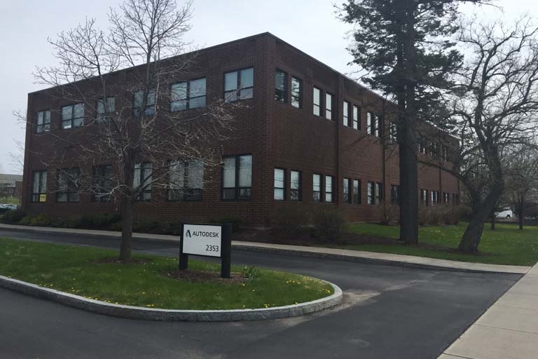
Property Record
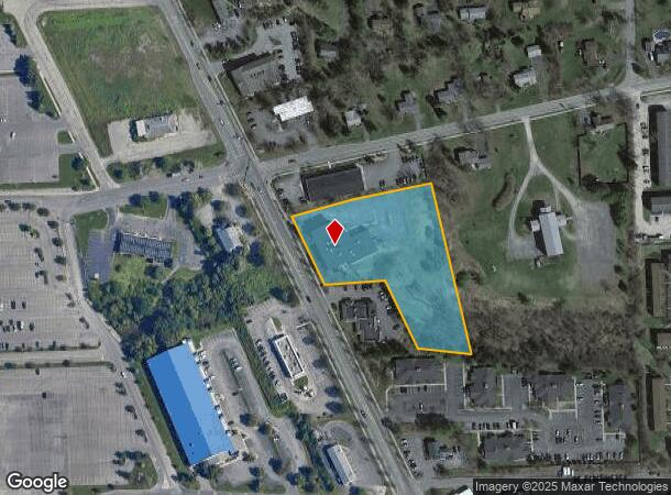
2353 N Triphammer Rd, Ithaca, NY 14850
NEARBY LISTINGS FOR SALE OR LEASE
Property Detail
2353 N Triphammer Rd
503201-047-001-0003-004-001-0000
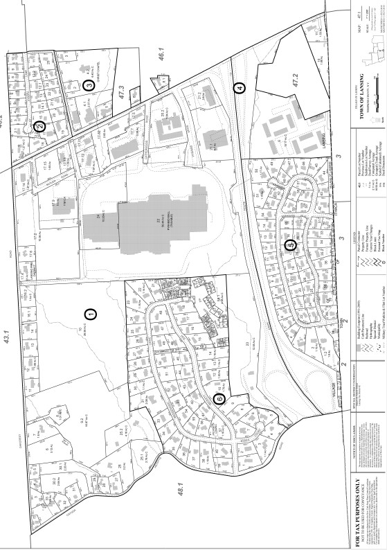
Tompkins
Professionalbldglegalinsurancerealestateetc
New York
2024
4.001
2023
2.49 AC
001500
Other Market Areas
19,312 SF
Ithaca, NY
DEMOGRAPHICS near 2353 N Triphammer Rd
1 Mile
3 Mile
5 Mile
2024 Total Population
5,080
28,813
61,418
2029 Population
4,449
25,570
53,779
Pop Growth 2024-2029
(12.42%)
(11.26%)
(12.44%)
Average Age
43
35
35
2024 Total Households
2,379
9,547
23,199
HH Growth 2024-2029
(14.46%)
(15.66%)
(16.34%)
Median Household Inc
$98,194
$74,999
$64,107
Avg Household Size
2.10
2.10
2.00
2024 Avg HH Vehicles
2.00
1.00
1.00
Median Home Value
$381,359
$363,831
$330,087
Median Year Built
1979
1972
1973
Nearby Places
- Restaurants
- Banks
- Shops
- Fitness
- Groceries
PUBLIC TRANSPORTATION
AIRPORT
Ithaca Tompkins International
DRIVE
WALK
Distance
Ithaca Tompkins International
5 min
2.1 mi
Freight Ports
Albany, NY Port
DRIVE
WALK
Distance
Albany, NY Port
223 min
171.9 mi
SALE & LEASE HISTORY
LISTING DATE
SALE/LEASE

Sep 26, 2016
For Lease
Sep 23, 2016
For Sale
Mar 20, 2017
For Lease
Jul 10, 2018
For Sale
Nearby Properties
Address
Land Use
TOTAL SIZE
Lot Size
Zoning
Address
Land Use
TOTAL SIZE
Lot Size
Zoning
5,000 SF
154.28 AC
U-1
Address
Land Use
TOTAL SIZE
Lot Size
Zoning
43 AC
Address
Land Use
TOTAL SIZE
Lot Size
Zoning
378,445 SF
4.39 AC
Address
Land Use
TOTAL SIZE
Lot Size
Zoning
36,275 SF
157.84 AC
Address
Land Use
TOTAL SIZE
Lot Size
Zoning
338,706 SF
2.08 AC
U-1
Address
Land Use
TOTAL SIZE
Lot Size
Zoning
1.30 AC
U-1
Address
Land Use
TOTAL SIZE
Lot Size
Zoning
50,319 SF
25.92 AC
Address
Land Use
TOTAL SIZE
Lot Size
Zoning
150,015 SF
4.94 AC
U-1
Address
Land Use
TOTAL SIZE
Lot Size
Zoning
364,128 SF
107.14 AC
Address
Land Use
TOTAL SIZE
Lot Size
Zoning
140,488 SF
5.90 AC
Address
Land Use
TOTAL SIZE
Lot Size
Zoning
255,371 SF
22.51 AC
P-1
Address
Land Use
TOTAL SIZE
Lot Size
Zoning
32,162 SF
351.71 AC
Address
Land Use
TOTAL SIZE
Lot Size
Zoning
131,532 SF
2.20 AC
U-1
Address
Land Use
TOTAL SIZE
Lot Size
Zoning
93,573 SF
0.91 AC
Address
Land Use
TOTAL SIZE
Lot Size
Zoning
116,854 SF
1.16 AC
Address
Land Use
TOTAL SIZE
Lot Size
Zoning
0.93 AC
U-1
Address
Land Use
TOTAL SIZE
Lot Size
Zoning
75,168 SF
22.92 AC
Address
Land Use
TOTAL SIZE
Lot Size
Zoning
562 SF
49.84 AC
Address
Land Use
TOTAL SIZE
Lot Size
Zoning
5,555 SF
12.07 AC
P-1
Address
Land Use
TOTAL SIZE
Lot Size
Zoning
17,427 SF
12.77 AC
Address
Land Use
TOTAL SIZE
Lot Size
Zoning
18.70 AC
Address
Land Use
TOTAL SIZE
Lot Size
Zoning
792 SF
49.77 AC
Address
Land Use
TOTAL SIZE
Lot Size
Zoning
117,890 SF
180.20 AC
Address
Land Use
TOTAL SIZE
Lot Size
Zoning
20,834 SF
32.98 AC
Address
Land Use
TOTAL SIZE
Lot Size
Zoning
6,910 SF
19.46 AC
Address
Land Use
TOTAL SIZE
Lot Size
Zoning
17,427 SF
13.17 AC
Address
Land Use
TOTAL SIZE
Lot Size
Zoning
11,821 SF
10.67 AC
Address
Land Use
TOTAL SIZE
Lot Size
Zoning
222,572 SF
0.92 AC
CBD-100
Address
Land Use
TOTAL SIZE
Lot Size
Zoning
40,995 SF
5.54 AC
R-3A
The World's #1 Commercial Real Estate Marketplace
Connect with us
© 2025 CoStar Group
The information above has been obtained from sources believed reliable. While we do not doubt its accuracy we have not verified it and make no guarantee, warranty or representation about it. It is your responsibility to independently confirm its accuracy and completeness. Any projections, opinions, assumptions, or estimates used are for example only and do not represent the current or future performance of the property. The value of this transaction to you depends on tax and other factors which should be evaluated by your tax, financial, and legal advisors. You and your advisors should conduct a careful, independent investigation of the property to determine to your satisfaction the suitability of the property for your needs.