Property Record
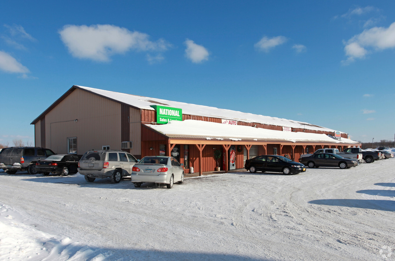
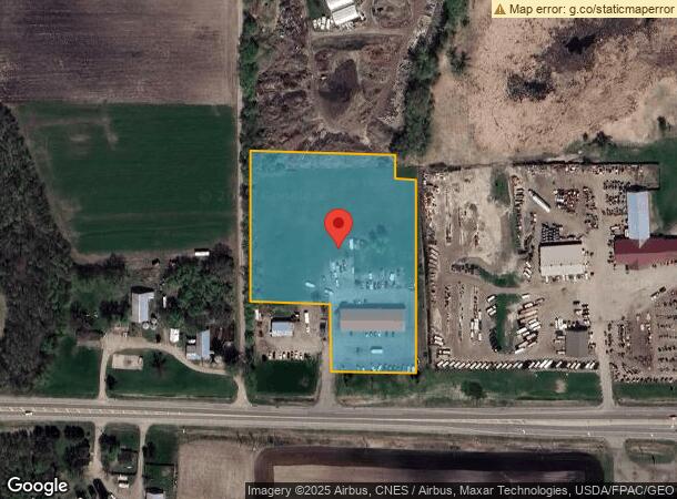
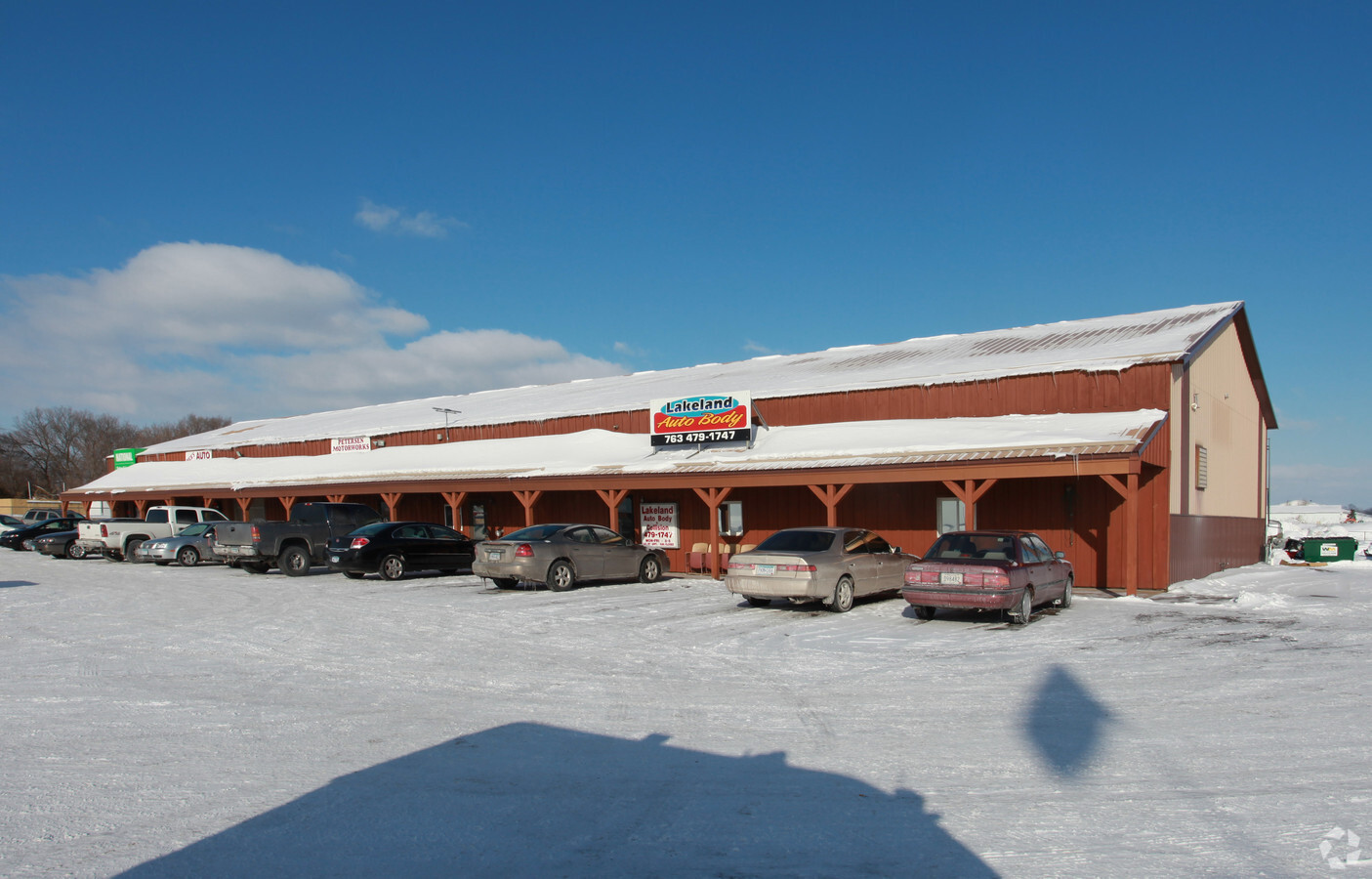
23600 State Highway 55, Loretto, MN 55357
NEARBY LISTINGS FOR SALE OR LEASE
-
-
View all Loretto listings for sale on LoopNet.com
Property Detail
23600 State Highway 55
Minneapolis-St. Paul-Bloomington, MN-WI
Unplatted 31 119 23
31-119-23-34-0006
UNPLATTED 31 119 23 ALL THAT PART OF THE EAST 1/2 OF THE SOUTHWEST 1/4 OF SECTION 31 TOWNSHIP 119 RANGE 23 DESCRIBED AS FOLLOWS COMMENCING AT THE SOUTHWEST CORNER OF T IRREGULAR
Commercialnec
Hennepin
X
Minnesota
27053C0134F
4.32 AC
2024
Maple Grove
2023
Minneapolis/St Paul
0271024027
DEMOGRAPHICS near 23600 State Highway 55
1 Mile
3 Mile
5 Mile
2024 Total Population
945
4,115
13,140
2029 Population
925
4,027
12,965
Pop Growth 2024-2029
(2.12%)
(2.14%)
(1.33%)
Average Age
42
42
41
2024 Total Households
363
1,463
4,686
HH Growth 2024-2029
(1.93%)
(2.32%)
(1.34%)
Median Household Inc
$123,499
$139,166
$131,324
Avg Household Size
2.60
2.80
2.80
2024 Avg HH Vehicles
2.00
3.00
2.00
Median Home Value
$374,528
$487,258
$493,291
Median Year Built
1986
1981
1983
Nearby Places
- Restaurants
- Banks
- Shops
- Fitness
- Groceries
PUBLIC TRANSPORTATION
AIRPORT
Minneapolis-St Paul International/Wold-Chamberlain
DRIVE
WALK
Distance
Minneapolis-St Paul International/Wold-Chamberlain
46 min
32.2 mi
Freight Ports
Port Milwaukee
DRIVE
WALK
Distance
Port Milwaukee
406 min
359.9 mi
Nearby Properties
Address
Land Use
TOTAL SIZE
Lot Size
Zoning
Address
Land Use
TOTAL SIZE
Lot Size
Zoning
25.53 AC
Address
Land Use
TOTAL SIZE
Lot Size
Zoning
42.53 AC
Address
Land Use
TOTAL SIZE
Lot Size
Zoning
11.52 AC
Address
Land Use
TOTAL SIZE
Lot Size
Zoning
Address
Land Use
TOTAL SIZE
Lot Size
Zoning
10.29 AC
Address
Land Use
TOTAL SIZE
Lot Size
Zoning
15.21 AC
Address
Land Use
TOTAL SIZE
Lot Size
Zoning
10.01 AC
Address
Land Use
TOTAL SIZE
Lot Size
Zoning
17.93 AC
Address
Land Use
TOTAL SIZE
Lot Size
Zoning
2.02 AC
Address
Land Use
TOTAL SIZE
Lot Size
Zoning
5.85 AC
Address
Land Use
TOTAL SIZE
Lot Size
Zoning
0.95 AC
Address
Land Use
TOTAL SIZE
Lot Size
Zoning
67.54 AC
Address
Land Use
TOTAL SIZE
Lot Size
Zoning
1,582 SF
74 AC
Address
Land Use
TOTAL SIZE
Lot Size
Zoning
60.18 AC
Address
Land Use
TOTAL SIZE
Lot Size
Zoning
4.67 AC
Address
Land Use
TOTAL SIZE
Lot Size
Zoning
Address
Land Use
TOTAL SIZE
Lot Size
Zoning
41.66 AC
Address
Land Use
TOTAL SIZE
Lot Size
Zoning
1.25 AC
Address
Land Use
TOTAL SIZE
Lot Size
Zoning
22.75 AC
Address
Land Use
TOTAL SIZE
Lot Size
Zoning
53.19 AC
Address
Land Use
TOTAL SIZE
Lot Size
Zoning
1.73 AC
Address
Land Use
TOTAL SIZE
Lot Size
Zoning
Address
Land Use
TOTAL SIZE
Lot Size
Zoning
18.96 AC
Address
Land Use
TOTAL SIZE
Lot Size
Zoning
7.24 AC
Address
Land Use
TOTAL SIZE
Lot Size
Zoning
1.89 AC
Address
Land Use
TOTAL SIZE
Lot Size
Zoning
74.80 AC
Address
Land Use
TOTAL SIZE
Lot Size
Zoning
7.44 AC
Address
Land Use
TOTAL SIZE
Lot Size
Zoning
2,232 SF
113.85 AC
Address
Land Use
TOTAL SIZE
Lot Size
Zoning
1,217 SF
76.77 AC
The World's #1 Commercial Real Estate Marketplace
Connect with us
© 2025 CoStar Group
The information above has been obtained from sources believed reliable. While we do not doubt its accuracy we have not verified it and make no guarantee, warranty or representation about it. It is your responsibility to independently confirm its accuracy and completeness. Any projections, opinions, assumptions, or estimates used are for example only and do not represent the current or future performance of the property. The value of this transaction to you depends on tax and other factors which should be evaluated by your tax, financial, and legal advisors. You and your advisors should conduct a careful, independent investigation of the property to determine to your satisfaction the suitability of the property for your needs.