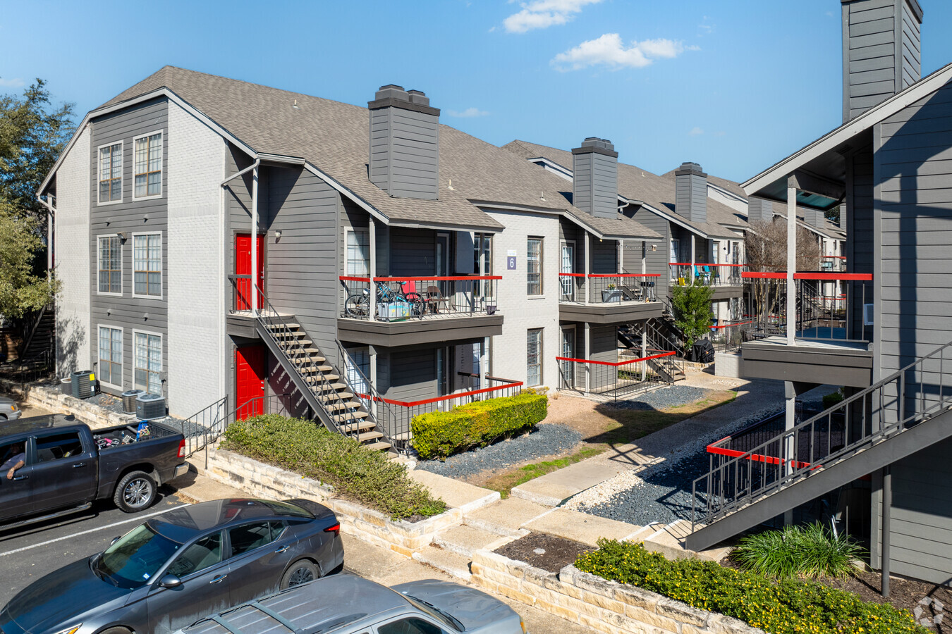
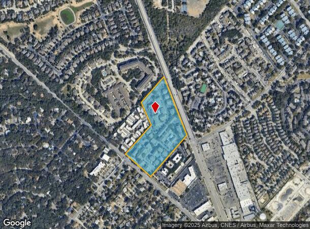
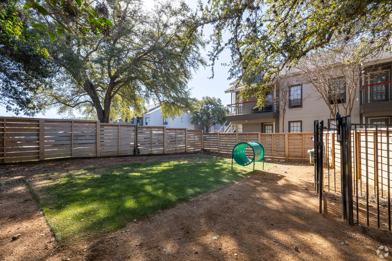
Property Record
2370 Nw Military Hwy, San Antonio, TX 78231

NEARBY LISTINGS FOR SALE OR LEASE
-
-
View all San Antonio listings for sale on LoopNet.com
Property Detail
2370 Nw Military Hwy
San Antonio-New Braunfels, TX
Cappamore Sub Bl 11696
11696-001-0080
NCB 11696 BLK 1 LOT 8 (5.103 AC), 9 (4.518 AC), 10 (2.146 AC) 2012- MERGED PROPERTIES PER COMMERCIAL LINK PROJECT -2012" . IF THE CUSTOMER WANTS US TO PUT IT BACK THE WAY IT WAS THEY'LL HAVE TO FILE A PROTEST. IN SOME CASES, THE NUMERICAL SITUS WAS L
Multifamilydwelling
Bexar
X
Texas
48029C0245G
8
2023
11.77 AC
2023
Vance Jackson
191506
San Antonio
287,235 SF
DEMOGRAPHICS near 2370 Nw Military Hwy
1 Mile
3 Mile
5 Mile
2024 Total Population
15,801
125,256
301,109
2029 Population
17,019
133,427
320,521
Pop Growth 2024-2029
+ 7.71%
+ 6.52%
+ 6.45%
Average Age
38
38
38
2024 Total Households
7,174
55,635
133,525
HH Growth 2024-2029
+ 7.90%
+ 6.75%
+ 6.73%
Median Household Inc
$53,281
$56,370
$57,287
Avg Household Size
2.20
2.20
2.20
2024 Avg HH Vehicles
1.00
2.00
2.00
Median Home Value
$301,038
$303,549
$276,511
Median Year Built
1984
1983
1984
Nearby Places
- Restaurants
- Banks
- Shops
- Fitness
- Groceries
PUBLIC TRANSPORTATION
AIRPORT
San Antonio International
DRIVE
WALK
Distance
San Antonio International
9 min
4.8 mi
Freight Ports
Calhoun Port
DRIVE
WALK
Distance
Calhoun Port
193 min
157.6 mi
Nearby Properties
Address
Land Use
TOTAL SIZE
Lot Size
Zoning
Address
Land Use
TOTAL SIZE
Lot Size
Zoning
4,465,972 SF
231.60 AC
Address
Land Use
TOTAL SIZE
Lot Size
Zoning
632,091 SF
27.82 AC
Address
Land Use
TOTAL SIZE
Lot Size
Zoning
609,267 SF
30.47 AC
Address
Land Use
TOTAL SIZE
Lot Size
Zoning
429,561 SF
25.70 AC
Address
Land Use
TOTAL SIZE
Lot Size
Zoning
152,266 SF
18.72 AC
Address
Land Use
TOTAL SIZE
Lot Size
Zoning
331,715 SF
9.04 AC
Address
Land Use
TOTAL SIZE
Lot Size
Zoning
480,363 SF
28.52 AC
Address
Land Use
TOTAL SIZE
Lot Size
Zoning
295,141 SF
15.40 AC
Address
Land Use
TOTAL SIZE
Lot Size
Zoning
338,255 SF
29.62 AC
Address
Land Use
TOTAL SIZE
Lot Size
Zoning
482,412 SF
22.97 AC
Address
Land Use
TOTAL SIZE
Lot Size
Zoning
183,249 SF
21.94 AC
Address
Land Use
TOTAL SIZE
Lot Size
Zoning
724,148 SF
18.70 AC
Address
Land Use
TOTAL SIZE
Lot Size
Zoning
349,074 SF
27.84 AC
Address
Land Use
TOTAL SIZE
Lot Size
Zoning
559,808 SF
24.43 AC
Address
Land Use
TOTAL SIZE
Lot Size
Zoning
250,174 SF
14.26 AC
Address
Land Use
TOTAL SIZE
Lot Size
Zoning
329,440 SF
14.89 AC
Address
Land Use
TOTAL SIZE
Lot Size
Zoning
293,420 SF
9.24 AC
Address
Land Use
TOTAL SIZE
Lot Size
Zoning
201,339 SF
9.32 AC
Address
Land Use
TOTAL SIZE
Lot Size
Zoning
69,860 SF
20.10 AC
Address
Land Use
TOTAL SIZE
Lot Size
Zoning
121,989 SF
18.03 AC
Address
Land Use
TOTAL SIZE
Lot Size
Zoning
353,293 SF
18.74 AC
Address
Land Use
TOTAL SIZE
Lot Size
Zoning
273,257 SF
17.62 AC
Address
Land Use
TOTAL SIZE
Lot Size
Zoning
506,058 SF
25.23 AC
Address
Land Use
TOTAL SIZE
Lot Size
Zoning
356,342 SF
16.02 AC
Address
Land Use
TOTAL SIZE
Lot Size
Zoning
317,537 SF
25.06 AC
Address
Land Use
TOTAL SIZE
Lot Size
Zoning
305,379 SF
12.04 AC
Address
Land Use
TOTAL SIZE
Lot Size
Zoning
99,301 SF
13.49 AC
Address
Land Use
TOTAL SIZE
Lot Size
Zoning
152,676 SF
13.74 AC
Address
Land Use
TOTAL SIZE
Lot Size
Zoning
240,711 SF
16.77 AC
Address
Land Use
TOTAL SIZE
Lot Size
Zoning
219,400 SF
6.16 AC
The World's #1 Commercial Real Estate Marketplace
Connect with us
© 2025 CoStar Group
The information above has been obtained from sources believed reliable. While we do not doubt its accuracy we have not verified it and make no guarantee, warranty or representation about it. It is your responsibility to independently confirm its accuracy and completeness. Any projections, opinions, assumptions, or estimates used are for example only and do not represent the current or future performance of the property. The value of this transaction to you depends on tax and other factors which should be evaluated by your tax, financial, and legal advisors. You and your advisors should conduct a careful, independent investigation of the property to determine to your satisfaction the suitability of the property for your needs.