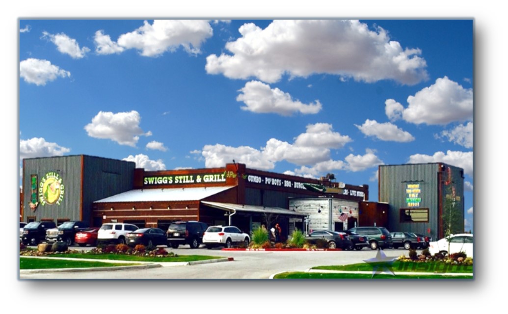
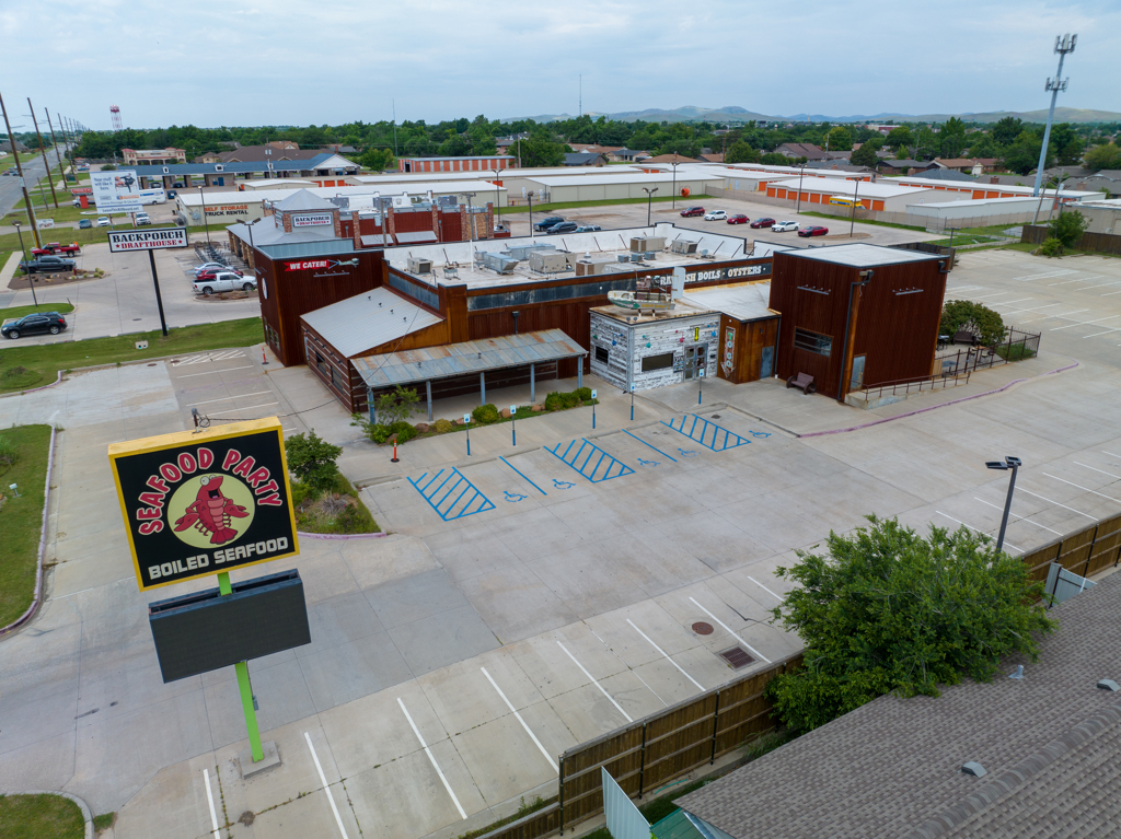
Property Record
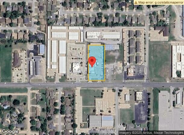
7401 Nw Cache Rd, Lawton, OK 73505
NEARBY LISTINGS FOR SALE OR LEASE
Property Detail
7401 Nw Cache Rd
Lawton, OK
2N-12W City Tracts
0026778
20-2N-12W C T BEG 2007.3' W & 50' N OF SE/C SEC 20 THEN N'RLY 400' W'RLY 175', S'RLY 400', E'RLY 175' ALNG R/W OF HWY 62 TO P
Restaurantbuilding
Comanche
X
Oklahoma
40031C0426E
14
2024
1.61 AC
2024
Oklahoma West Area
000402
Other Market Areas
10,700 SF
DEMOGRAPHICS near 7401 Nw Cache Rd
1 Mile
3 Mile
5 Mile
2024 Total Population
9,931
36,933
67,976
2029 Population
10,203
37,921
70,359
Pop Growth 2024-2029
+ 2.74%
+ 2.68%
+ 3.51%
Average Age
40
38
37
2024 Total Households
4,169
15,039
27,134
HH Growth 2024-2029
+ 2.69%
+ 2.69%
+ 3.59%
Median Household Inc
$53,113
$50,528
$45,717
Avg Household Size
2.30
2.40
2.30
2024 Avg HH Vehicles
2.00
2.00
2.00
Median Home Value
$174,409
$165,763
$141,421
Median Year Built
1980
1976
1973
Nearby Places
- Restaurants
- Banks
- Shops
- Fitness
- Groceries
PUBLIC TRANSPORTATION
AIRPORT
Lawton-Fort Sill Regional
DRIVE
WALK
Distance
Lawton-Fort Sill Regional
18 min
7.9 mi
Freight Ports
Tulsa Port Of Catoosa
DRIVE
WALK
Distance
Tulsa Port Of Catoosa
230 min
213.5 mi
SALE & LEASE HISTORY
LISTING DATE
SALE/LEASE

May 31, 2023
For Sale
Jun 21, 2017
For Lease
Jun 21, 2017
For Sale
Jan 29, 2019
For Sale
Nearby Properties
Address
Land Use
TOTAL SIZE
Lot Size
Zoning
Address
Land Use
TOTAL SIZE
Lot Size
Zoning
44,900 SF
484.43 AC
Address
Land Use
TOTAL SIZE
Lot Size
Zoning
55,256 SF
6.30 AC
Address
Land Use
TOTAL SIZE
Lot Size
Zoning
9,000 SF
25.35 AC
Address
Land Use
TOTAL SIZE
Lot Size
Zoning
30,000 SF
17.22 AC
Address
Land Use
TOTAL SIZE
Lot Size
Zoning
40,284 SF
7.19 AC
Address
Land Use
TOTAL SIZE
Lot Size
Zoning
25,930 SF
5.47 AC
Address
Land Use
TOTAL SIZE
Lot Size
Zoning
7,752 SF
6.30 AC
Address
Land Use
TOTAL SIZE
Lot Size
Zoning
8,800 SF
30.05 AC
Address
Land Use
TOTAL SIZE
Lot Size
Zoning
1,488 SF
19.43 AC
Address
Land Use
TOTAL SIZE
Lot Size
Zoning
9,240 SF
6.43 AC
Address
Land Use
TOTAL SIZE
Lot Size
Zoning
13,326 SF
8.47 AC
Address
Land Use
TOTAL SIZE
Lot Size
Zoning
2,330 SF
19.42 AC
Address
Land Use
TOTAL SIZE
Lot Size
Zoning
906 SF
5.51 AC
Address
Land Use
TOTAL SIZE
Lot Size
Zoning
39,546 SF
10.62 AC
Address
Land Use
TOTAL SIZE
Lot Size
Zoning
131,736 SF
10.23 AC
Address
Land Use
TOTAL SIZE
Lot Size
Zoning
16,996 SF
12.16 AC
Address
Land Use
TOTAL SIZE
Lot Size
Zoning
83,945 SF
46.95 AC
Address
Land Use
TOTAL SIZE
Lot Size
Zoning
39,791 SF
20.50 AC
Address
Land Use
TOTAL SIZE
Lot Size
Zoning
25,800 SF
3.82 AC
Address
Land Use
TOTAL SIZE
Lot Size
Zoning
68,844 SF
10.42 AC
Address
Land Use
TOTAL SIZE
Lot Size
Zoning
2,376 SF
8.64 AC
Address
Land Use
TOTAL SIZE
Lot Size
Zoning
3,349 SF
1.30 AC
Address
Land Use
TOTAL SIZE
Lot Size
Zoning
3,470 SF
10.11 AC
Address
Land Use
TOTAL SIZE
Lot Size
Zoning
117,301 SF
13.82 AC
Address
Land Use
TOTAL SIZE
Lot Size
Zoning
63,224 SF
2.66 AC
Address
Land Use
TOTAL SIZE
Lot Size
Zoning
65,320 SF
4.80 AC
Address
Land Use
TOTAL SIZE
Lot Size
Zoning
29,498 SF
8.02 AC
Address
Land Use
TOTAL SIZE
Lot Size
Zoning
82,509 SF
6.29 AC
Address
Land Use
TOTAL SIZE
Lot Size
Zoning
3,366 SF
5.97 AC
Address
Land Use
TOTAL SIZE
Lot Size
Zoning
50,002 SF
7.66 AC
The World's #1 Commercial Real Estate Marketplace
Connect with us
© 2025 CoStar Group
The information above has been obtained from sources believed reliable. While we do not doubt its accuracy we have not verified it and make no guarantee, warranty or representation about it. It is your responsibility to independently confirm its accuracy and completeness. Any projections, opinions, assumptions, or estimates used are for example only and do not represent the current or future performance of the property. The value of this transaction to you depends on tax and other factors which should be evaluated by your tax, financial, and legal advisors. You and your advisors should conduct a careful, independent investigation of the property to determine to your satisfaction the suitability of the property for your needs.