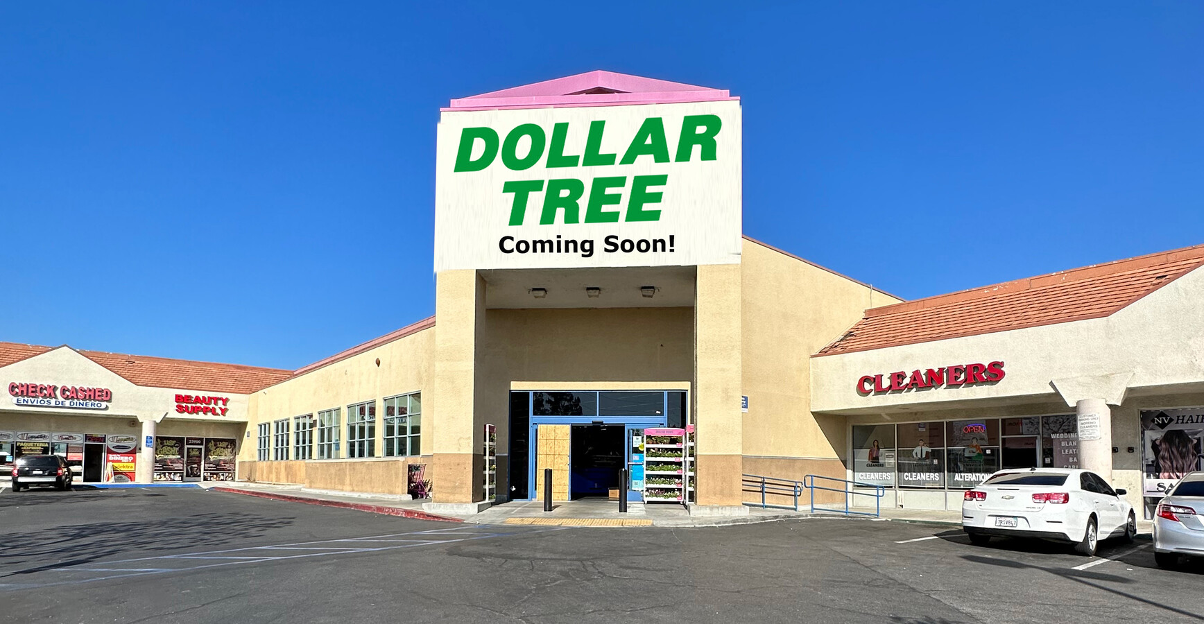
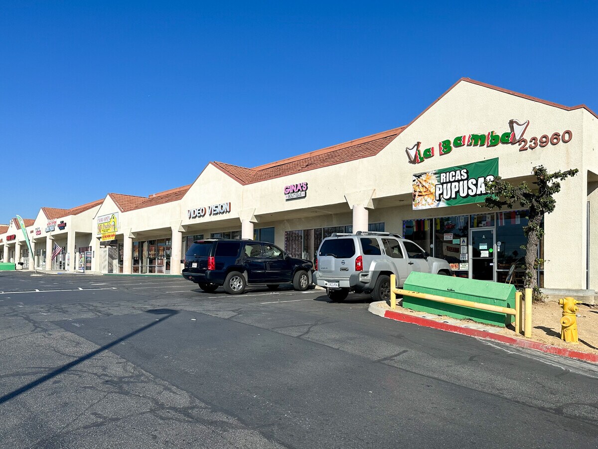
Property Record
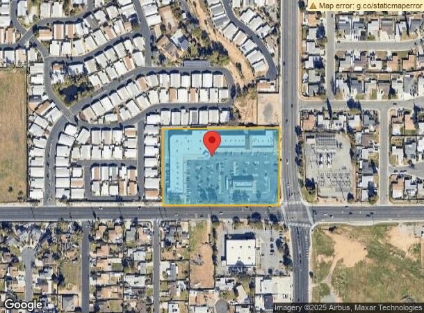
23920 Ironwood Ave, Moreno Valley, CA 92557
NEARBY LISTINGS FOR SALE OR LEASE
Property Detail
23920 Ironwood Ave
264-100-010
4.50 ACRES NET IN PAR 1 PM 047/070 PM 9865
Regionalshoppingcenterormallwithanchorstore
Riverside
A
California
06065C0753G
1
2023
4.50 AC
2023
Moreno Valley/Perris
042406
Inland Empire (California)
54,539 SF
Riverside-San Bernardino-Ontario, CA
DEMOGRAPHICS near 23920 Ironwood Ave
1 Mile
3 Mile
5 Mile
2024 Total Population
24,451
130,744
217,516
2029 Population
25,768
137,314
228,673
Pop Growth 2024-2029
+ 5.39%
+ 5.03%
+ 5.13%
Average Age
34
34
34
2024 Total Households
6,922
34,846
59,188
HH Growth 2024-2029
+ 5.07%
+ 4.60%
+ 4.76%
Median Household Inc
$61,209
$71,215
$77,136
Avg Household Size
3.30
3.60
3.50
2024 Avg HH Vehicles
2.00
2.00
2.00
Median Home Value
$358,282
$385,208
$402,498
Median Year Built
1984
1985
1987
Nearby Places
- Restaurants
- Banks
- Shops
- Fitness
- Groceries
PUBLIC TRANSPORTATION
COMMUTER RAIL
Moreno Valley/March Field (Metrolink 91-Perris Valley Line - Metrolink Trains)
DRIVE
WALK
Distance
Moreno Valley/March Field (Metrolink 91-Perris Valley Line - Metrolink Trains)
8 min
6.0 mi
Riverside-Hunter Park/Ucr (Metrolink 91-Perris Valley Line - Metrolink Trains)
DRIVE
WALK
Distance
Riverside-Hunter Park/Ucr (Metrolink 91-Perris Valley Line - Metrolink Trains)
12 min
8.7 mi
AIRPORT
Ontario International
DRIVE
WALK
Distance
Ontario International
32 min
25.5 mi
Freight Ports
Port of Long Beach
DRIVE
WALK
Distance
Port of Long Beach
83 min
64.7 mi
SALE & LEASE HISTORY
LISTING DATE
SALE/LEASE

Nov 16, 2022
For Lease
May 09, 2017
For Lease
Mar 12, 2018
For Lease
Nearby Properties
Address
Land Use
TOTAL SIZE
Lot Size
Zoning
Address
Land Use
TOTAL SIZE
Lot Size
Zoning
617,000 SF
23.91 AC
W2
Address
Land Use
TOTAL SIZE
Lot Size
Zoning
1,280,446 SF
51.47 AC
Address
Land Use
TOTAL SIZE
Lot Size
Zoning
607,644 SF
26.09 AC
O
Address
Land Use
TOTAL SIZE
Lot Size
Zoning
397,994 SF
19.70 AC
H
Address
Land Use
TOTAL SIZE
Lot Size
Zoning
283,209 SF
16.91 AC
R20
Address
Land Use
TOTAL SIZE
Lot Size
Zoning
91,891 SF
20.61 AC
R20
Address
Land Use
TOTAL SIZE
Lot Size
Zoning
430,647 SF
31.09 AC
Address
Land Use
TOTAL SIZE
Lot Size
Zoning
532,926 SF
24.37 AC
Address
Land Use
TOTAL SIZE
Lot Size
Zoning
38,400 SF
15.73 AC
R3
Address
Land Use
TOTAL SIZE
Lot Size
Zoning
252,504 SF
13.11 AC
SP
Address
Land Use
TOTAL SIZE
Lot Size
Zoning
37,010 SF
12.13 AC
Address
Land Use
TOTAL SIZE
Lot Size
Zoning
522,772 SF
26.26 AC
LI
Address
Land Use
TOTAL SIZE
Lot Size
Zoning
25.72 AC
C0
Address
Land Use
TOTAL SIZE
Lot Size
Zoning
366,698 SF
16.03 AC
LI
Address
Land Use
TOTAL SIZE
Lot Size
Zoning
172,944 SF
11.79 AC
20
Address
Land Use
TOTAL SIZE
Lot Size
Zoning
126,104 SF
7.73 AC
CC
Address
Land Use
TOTAL SIZE
Lot Size
Zoning
170,192 SF
10.42 AC
CC
Address
Land Use
TOTAL SIZE
Lot Size
Zoning
256,795 SF
12 AC
Address
Land Use
TOTAL SIZE
Lot Size
Zoning
Address
Land Use
TOTAL SIZE
Lot Size
Zoning
164,120 SF
9.63 AC
R3
Address
Land Use
TOTAL SIZE
Lot Size
Zoning
212,680 SF
9.78 AC
Address
Land Use
TOTAL SIZE
Lot Size
Zoning
203,944 SF
7.88 AC
Address
Land Use
TOTAL SIZE
Lot Size
Zoning
87,617 SF
2.32 AC
Address
Land Use
TOTAL SIZE
Lot Size
Zoning
104,282 SF
6.71 AC
BP
Address
Land Use
TOTAL SIZE
Lot Size
Zoning
180,043 SF
8.76 AC
Address
Land Use
TOTAL SIZE
Lot Size
Zoning
51,210 SF
4.47 AC
Address
Land Use
TOTAL SIZE
Lot Size
Zoning
110,000 SF
4.60 AC
The World's #1 Commercial Real Estate Marketplace
Connect with us
© 2025 CoStar Group
The information above has been obtained from sources believed reliable. While we do not doubt its accuracy we have not verified it and make no guarantee, warranty or representation about it. It is your responsibility to independently confirm its accuracy and completeness. Any projections, opinions, assumptions, or estimates used are for example only and do not represent the current or future performance of the property. The value of this transaction to you depends on tax and other factors which should be evaluated by your tax, financial, and legal advisors. You and your advisors should conduct a careful, independent investigation of the property to determine to your satisfaction the suitability of the property for your needs.