Property Record
5001 25Th Ave, Woodside, NY 11377


NEARBY LISTINGS FOR SALE OR LEASE
Property Detail
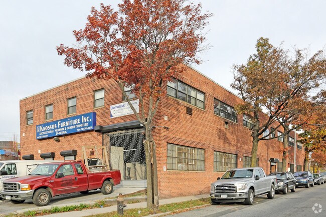
5001 25Th Ave
01016-0060
Queens
Warehouse
New York
X
60
3604970094F
0.48 AC
2024
Northwest Queens
2025
Long Island (New York)
029700
New York-Jersey City-White Plains, NY-NJ
29,000 SF
DEMOGRAPHICS near 5001 25Th Ave
1 Mile
3 Mile
5 Mile
2024 Total Population
107,289
896,437
2,834,794
2029 Population
100,310
837,431
2,644,079
Pop Growth 2024-2029
(6.50%)
(6.58%)
(6.73%)
Average Age
40
40
40
2024 Total Households
44,518
358,838
1,177,746
HH Growth 2024-2029
(6.70%)
(6.70%)
(7.02%)
Median Household Inc
$81,760
$77,479
$73,339
Avg Household Size
2.30
2.40
2.30
2024 Avg HH Vehicles
1.00
.00
.00
Median Home Value
$815,584
$776,281
$807,958
Median Year Built
1948
1955
1955
Nearby Places
Map Layers
Map Styles
 Street
 Aerial
- Restaurants
- Banks
- Shops
- Fitness
- Groceries
PUBLIC TRANSPORTATION
COMMUTER RAIL
Woodside Station (Babylon Branch - Long Island Rail Road, Far Rockaway Branch - Long Island Rail Road, Hempstead Branch - Long Island Rail Road, Long Beach Branch - Long Island Rail Road, Montauk Branch - Long Island Rail Road, Port Jefferson Branch - Long Island Rail Road, Port Washington Branch - Long Island Rail Road, Ronkonkoma Branch - Long Island Rail Road)
DRIVE
WALK
Distance
Woodside Station (Babylon Branch - Long Island Rail Road, Far Rockaway Branch - Long Island Rail Road, Hempstead Branch - Long Island Rail Road, Long Beach Branch - Long Island Rail Road, Montauk Branch - Long Island Rail Road, Port Jefferson Branch - Long Island Rail Road, Port Washington Branch - Long Island Rail Road, Ronkonkoma Branch - Long Island Rail Road)
4 min
1.7 mi
Hunterspoint Avenue Station (Hempstead Branch - Long Island Rail Road, Oyster Bay Branch - Long Island Rail Road)
DRIVE
WALK
Distance
Hunterspoint Avenue Station (Hempstead Branch - Long Island Rail Road, Oyster Bay Branch - Long Island Rail Road)
10 min
4.1 mi
AIRPORT
LaGuardia
DRIVE
WALK
Distance
LaGuardia
6 min
2.1 mi
John F Kennedy International
DRIVE
WALK
Distance
John F Kennedy International
21 min
13.4 mi
Newark Liberty International
DRIVE
WALK
Distance
Newark Liberty International
34 min
21.1 mi
Freight Ports
NY - Red Hook Container Terminal
DRIVE
WALK
Distance
NY - Red Hook Container Terminal
18 min
9.9 mi
SALE & LEASE HISTORY
LISTING DATE
SALE/LEASE

Oct 20, 2020
For Lease
Jan 17, 2017
For Lease
Nearby Properties
Address
Land Use
TOTAL SIZE
Lot Size
Zoning
Address
Land Use
TOTAL SIZE
Lot Size
Zoning
5,519,372 SF
409.21 AC
C8-2
Address
Land Use
TOTAL SIZE
Lot Size
Zoning
2,230,742 SF
6.33 AC
R9
Address
Land Use
TOTAL SIZE
Lot Size
Zoning
1,200,000 SF
10.24 AC
R9
Address
Land Use
TOTAL SIZE
Lot Size
Zoning
1,065,915 SF
2.13 AC
M16R10
Address
Land Use
TOTAL SIZE
Lot Size
Zoning
757,439 SF
0.91 AC
C1-9
Address
Land Use
TOTAL SIZE
Lot Size
Zoning
733,747 SF
0.98 AC
R10
Address
Land Use
TOTAL SIZE
Lot Size
Zoning
1,502,532 SF
6.35 AC
R7B
Address
Land Use
TOTAL SIZE
Lot Size
Zoning
714,224 SF
0.70 AC
R8
Address
Land Use
TOTAL SIZE
Lot Size
Zoning
1,075,000 SF
6.74 AC
R7-2
Address
Land Use
TOTAL SIZE
Lot Size
Zoning
772,163 SF
5.24 AC
C4-5X
Address
Land Use
TOTAL SIZE
Lot Size
Zoning
984,760 SF
2.04 AC
M3-1
Address
Land Use
TOTAL SIZE
Lot Size
Zoning
407,259 SF
0.93 AC
C5-2
Address
Land Use
TOTAL SIZE
Lot Size
Zoning
661,538 SF
11.26 AC
R7-2
Address
Land Use
TOTAL SIZE
Lot Size
Zoning
1,359,110 SF
1.89 AC
C5-3
Address
Land Use
TOTAL SIZE
Lot Size
Zoning
527,900 SF
0.57 AC
R10
Address
Land Use
TOTAL SIZE
Lot Size
Zoning
334,675 SF
10.24 AC
R9
Address
Land Use
TOTAL SIZE
Lot Size
Zoning
908,799 SF
2.13 AC
R10
Address
Land Use
TOTAL SIZE
Lot Size
Zoning
538,454 SF
2.37 AC
R9
Address
Land Use
TOTAL SIZE
Lot Size
Zoning
234,891 SF
3.17 AC
C4-5X
Address
Land Use
TOTAL SIZE
Lot Size
Zoning
804,200 SF
5.28 AC
R7-2
Address
Land Use
TOTAL SIZE
Lot Size
Zoning
207.09 AC
PARK
Address
Land Use
TOTAL SIZE
Lot Size
Zoning
882,579 SF
0.51 AC
M16R10
Address
Land Use
TOTAL SIZE
Lot Size
Zoning
648,703 SF
1.45 AC
C28A
Address
Land Use
TOTAL SIZE
Lot Size
Zoning
505,416 SF
M16R10
Address
Land Use
TOTAL SIZE
Lot Size
Zoning
710,860 SF
1.52 AC
M15R9
Address
Land Use
TOTAL SIZE
Lot Size
Zoning
504,420 SF
0.97 AC
R10
Address
Land Use
TOTAL SIZE
Lot Size
Zoning
507,265 SF
4.04 AC
C4-4
Address
Land Use
TOTAL SIZE
Lot Size
Zoning
948 SF
282.37 AC
PARK
Address
Land Use
TOTAL SIZE
Lot Size
Zoning
465,294 SF
0.82 AC
C1-9
Address
Land Use
TOTAL SIZE
Lot Size
Zoning
777,258 SF
4.67 AC
M3-2
The World's #1 Commercial Real Estate Marketplace
Connect with us
© 2026 CoStar Group
The information above has been obtained from sources believed reliable. While we do not doubt its accuracy we have not verified it and make no guarantee, warranty or representation about it. It is your responsibility to independently confirm its accuracy and completeness. Any projections, opinions, assumptions, or estimates used are for example only and do not represent the current or future performance of the property. The value of this transaction to you depends on tax and other factors which should be evaluated by your tax, financial, and legal advisors. You and your advisors should conduct a careful, independent investigation of the property to determine to your satisfaction the suitability of the property for your needs.