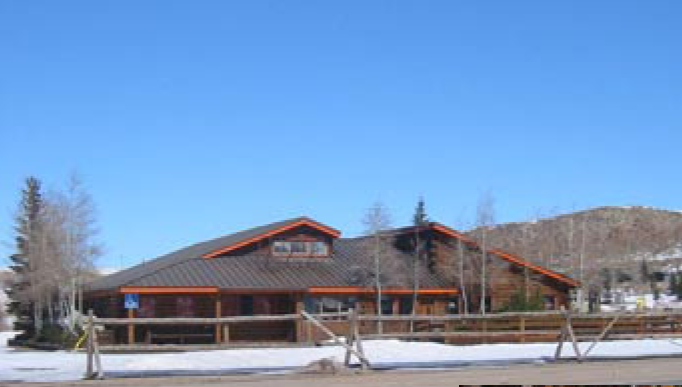
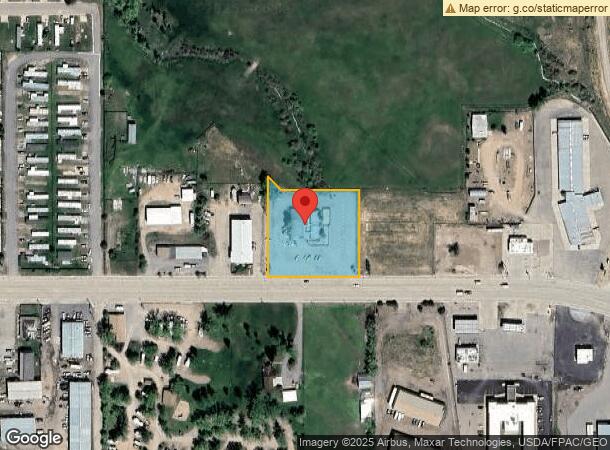
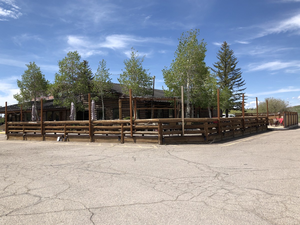
Property Record
240 Bear River Dr, Evanston, WY 82930
NEARBY LISTINGS FOR SALE OR LEASE
Property Detail
240 Bear River Dr
15201530000800
T15 R120 SEC 15 PT SW1/4SW1/4
Restaurantbuilding
Uinta
X
Wyoming
56041C0489C
1.17 AC
2023
I-80 Corridor/Cheyenne
2024
Other Market Areas
975402
Evanston, WY
6,840 SF
DEMOGRAPHICS near 240 Bear River Dr
1 Mile
3 Mile
5 Mile
2024 Total Population
2,068
12,885
13,604
2029 Population
2,202
13,454
14,179
Pop Growth 2024-2029
+ 6.48%
+ 4.42%
+ 4.23%
Average Age
39
37
37
2024 Total Households
844
4,948
5,206
HH Growth 2024-2029
+ 6.40%
+ 4.32%
+ 4.13%
Median Household Inc
$62,083
$66,359
$66,694
Avg Household Size
2.30
2.50
2.50
2024 Avg HH Vehicles
2.00
2.00
2.00
Median Home Value
$137,561
$183,964
$184,078
Median Year Built
1977
1982
1982
Nearby Places
- Restaurants
- Banks
- Shops
- Fitness
- Groceries
SALE & LEASE HISTORY
LISTING DATE
SALE/LEASE

Sep 24, 2016
For Sale
Nov 05, 2019
For Lease
Jun 07, 2019
For Sale
Dec 28, 2016
For Sale
Dec 16, 2020
For Sale
Nearby Properties
Address
Land Use
TOTAL SIZE
Lot Size
Zoning
Address
Land Use
TOTAL SIZE
Lot Size
Zoning
154.18 AC
Address
Land Use
TOTAL SIZE
Lot Size
Zoning
153,198 SF
16.36 AC
Address
Land Use
TOTAL SIZE
Lot Size
Zoning
47,260 SF
2.06 AC
Address
Land Use
TOTAL SIZE
Lot Size
Zoning
62,682 SF
11.13 AC
Address
Land Use
TOTAL SIZE
Lot Size
Zoning
7,916 SF
5.91 AC
Address
Land Use
TOTAL SIZE
Lot Size
Zoning
2,786 SF
5 AC
Address
Land Use
TOTAL SIZE
Lot Size
Zoning
8,640 SF
7.13 AC
Address
Land Use
TOTAL SIZE
Lot Size
Zoning
9,744 SF
3.70 AC
Address
Land Use
TOTAL SIZE
Lot Size
Zoning
51,569 SF
3.80 AC
Address
Land Use
TOTAL SIZE
Lot Size
Zoning
33,948 SF
1.50 AC
Address
Land Use
TOTAL SIZE
Lot Size
Zoning
62,370 SF
2.72 AC
Address
Land Use
TOTAL SIZE
Lot Size
Zoning
69,146 SF
6.54 AC
Address
Land Use
TOTAL SIZE
Lot Size
Zoning
61,180 SF
4.05 AC
Address
Land Use
TOTAL SIZE
Lot Size
Zoning
13,160 SF
5 AC
Address
Land Use
TOTAL SIZE
Lot Size
Zoning
18,737 SF
3.33 AC
Address
Land Use
TOTAL SIZE
Lot Size
Zoning
3,881 SF
0.58 AC
Address
Land Use
TOTAL SIZE
Lot Size
Zoning
1,154 SF
2.62 AC
Address
Land Use
TOTAL SIZE
Lot Size
Zoning
36,552 SF
4.40 AC
Address
Land Use
TOTAL SIZE
Lot Size
Zoning
25,886 SF
1.52 AC
Address
Land Use
TOTAL SIZE
Lot Size
Zoning
14,560 SF
2.92 AC
Address
Land Use
TOTAL SIZE
Lot Size
Zoning
13,194 SF
3.81 AC
Address
Land Use
TOTAL SIZE
Lot Size
Zoning
3.14 AC
Address
Land Use
TOTAL SIZE
Lot Size
Zoning
3.12 AC
Address
Land Use
TOTAL SIZE
Lot Size
Zoning
15,835 SF
2.88 AC
Address
Land Use
TOTAL SIZE
Lot Size
Zoning
7,000 SF
0.75 AC
Address
Land Use
TOTAL SIZE
Lot Size
Zoning
8,259 SF
0.96 AC
Address
Land Use
TOTAL SIZE
Lot Size
Zoning
15,000 SF
2.82 AC
Address
Land Use
TOTAL SIZE
Lot Size
Zoning
22,827 SF
2.52 AC
Address
Land Use
TOTAL SIZE
Lot Size
Zoning
19,242 SF
2.64 AC
Address
Land Use
TOTAL SIZE
Lot Size
Zoning
29,135 SF
1.07 AC
The World's #1 Commercial Real Estate Marketplace
Connect with us
© 2025 CoStar Group
The information above has been obtained from sources believed reliable. While we do not doubt its accuracy we have not verified it and make no guarantee, warranty or representation about it. It is your responsibility to independently confirm its accuracy and completeness. Any projections, opinions, assumptions, or estimates used are for example only and do not represent the current or future performance of the property. The value of this transaction to you depends on tax and other factors which should be evaluated by your tax, financial, and legal advisors. You and your advisors should conduct a careful, independent investigation of the property to determine to your satisfaction the suitability of the property for your needs.