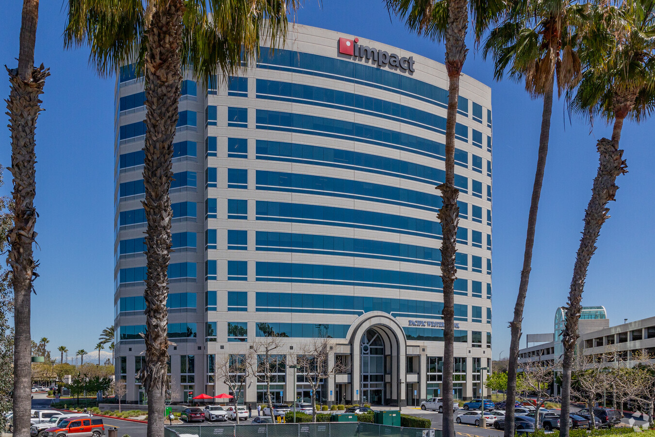
Property Record
2400 E Katella Ave, Anaheim, CA 92806

Current Lease Availabilities
NEARBY LISTINGS FOR SALE OR LEASE
Property Detail
2400 E Katella Ave
Anaheim-Santa Ana-Irvine, CA
Parcel Map 86-321
253-532-06
P BK 220 PG 42 PAR 1
Commercialnec
Orange
X
California
06059C0142J
1
2024
0.94 AC
2024
Stadium Area
086303
Orange County (California)
DEMOGRAPHICS near 2400 E Katella Ave
1 Mile
3 Mile
5 Mile
2024 Total Population
18,493
229,314
684,704
2029 Population
18,639
227,320
676,033
Pop Growth 2024-2029
+ 0.79%
(0.87%)
(1.27%)
Average Age
34
37
37
2024 Total Households
7,684
70,077
193,533
HH Growth 2024-2029
+ 0.94%
(0.83%)
(1.32%)
Median Household Inc
$94,311
$85,703
$81,213
Avg Household Size
2.20
3.10
3.30
2024 Avg HH Vehicles
2.00
2.00
2.00
Median Home Value
$611,760
$714,368
$714,579
Median Year Built
2010
1969
1967
Nearby Places
- Restaurants
- Banks
- Shops
- Fitness
- Groceries
PUBLIC TRANSPORTATION
COMMUTER RAIL
Anaheim-Artic Metrolink Station (Metrolink Orange County Line - Metrolink Trains)
DRIVE
WALK
Distance
Anaheim-Artic Metrolink Station (Metrolink Orange County Line - Metrolink Trains)
2 min
8 min
0.4 mi
Anaheim (Pacific Surfliner - Amtrak)
DRIVE
WALK
Distance
Anaheim (Pacific Surfliner - Amtrak)
2 min
11 min
0.6 mi
AIRPORT
John Wayne/Orange County
DRIVE
WALK
Distance
John Wayne/Orange County
15 min
11.4 mi
Long Beach (Daugherty Field)
DRIVE
WALK
Distance
Long Beach (Daugherty Field)
26 min
20.9 mi
Ontario International
DRIVE
WALK
Distance
Ontario International
40 min
31.7 mi
Freight Ports
Port of Long Beach
DRIVE
WALK
Distance
Port of Long Beach
31 min
20.4 mi
Nearby Properties
Address
Land Use
TOTAL SIZE
Lot Size
Zoning
Address
Land Use
TOTAL SIZE
Lot Size
Zoning
31.01 AC
Address
Land Use
TOTAL SIZE
Lot Size
Zoning
2.60 AC
Address
Land Use
TOTAL SIZE
Lot Size
Zoning
16.07 AC
Address
Land Use
TOTAL SIZE
Lot Size
Zoning
24.50 AC
Address
Land Use
TOTAL SIZE
Lot Size
Zoning
Address
Land Use
TOTAL SIZE
Lot Size
Zoning
2.86 AC
Address
Land Use
TOTAL SIZE
Lot Size
Zoning
6.45 AC
Address
Land Use
TOTAL SIZE
Lot Size
Zoning
860 SF
13 AC
Address
Land Use
TOTAL SIZE
Lot Size
Zoning
Address
Land Use
TOTAL SIZE
Lot Size
Zoning
41.12 AC
Address
Land Use
TOTAL SIZE
Lot Size
Zoning
5.07 AC
Address
Land Use
TOTAL SIZE
Lot Size
Zoning
4.89 AC
Address
Land Use
TOTAL SIZE
Lot Size
Zoning
Address
Land Use
TOTAL SIZE
Lot Size
Zoning
46,514 SF
9.18 AC
Address
Land Use
TOTAL SIZE
Lot Size
Zoning
4.13 AC
Address
Land Use
TOTAL SIZE
Lot Size
Zoning
12.20 AC
Address
Land Use
TOTAL SIZE
Lot Size
Zoning
6.60 AC
Address
Land Use
TOTAL SIZE
Lot Size
Zoning
4.54 AC
Address
Land Use
TOTAL SIZE
Lot Size
Zoning
4.94 AC
Address
Land Use
TOTAL SIZE
Lot Size
Zoning
Address
Land Use
TOTAL SIZE
Lot Size
Zoning
Address
Land Use
TOTAL SIZE
Lot Size
Zoning
11.61 AC
Address
Land Use
TOTAL SIZE
Lot Size
Zoning
4.71 AC
Address
Land Use
TOTAL SIZE
Lot Size
Zoning
9.22 AC
Address
Land Use
TOTAL SIZE
Lot Size
Zoning
52.51 AC
Address
Land Use
TOTAL SIZE
Lot Size
Zoning
8.80 AC
Address
Land Use
TOTAL SIZE
Lot Size
Zoning
Address
Land Use
TOTAL SIZE
Lot Size
Zoning
7,939 SF
9.37 AC
Address
Land Use
TOTAL SIZE
Lot Size
Zoning
Address
Land Use
TOTAL SIZE
Lot Size
Zoning
The World's #1 Commercial Real Estate Marketplace
Connect with us
© 2025 CoStar Group
The information above has been obtained from sources believed reliable. While we do not doubt its accuracy we have not verified it and make no guarantee, warranty or representation about it. It is your responsibility to independently confirm its accuracy and completeness. Any projections, opinions, assumptions, or estimates used are for example only and do not represent the current or future performance of the property. The value of this transaction to you depends on tax and other factors which should be evaluated by your tax, financial, and legal advisors. You and your advisors should conduct a careful, independent investigation of the property to determine to your satisfaction the suitability of the property for your needs.