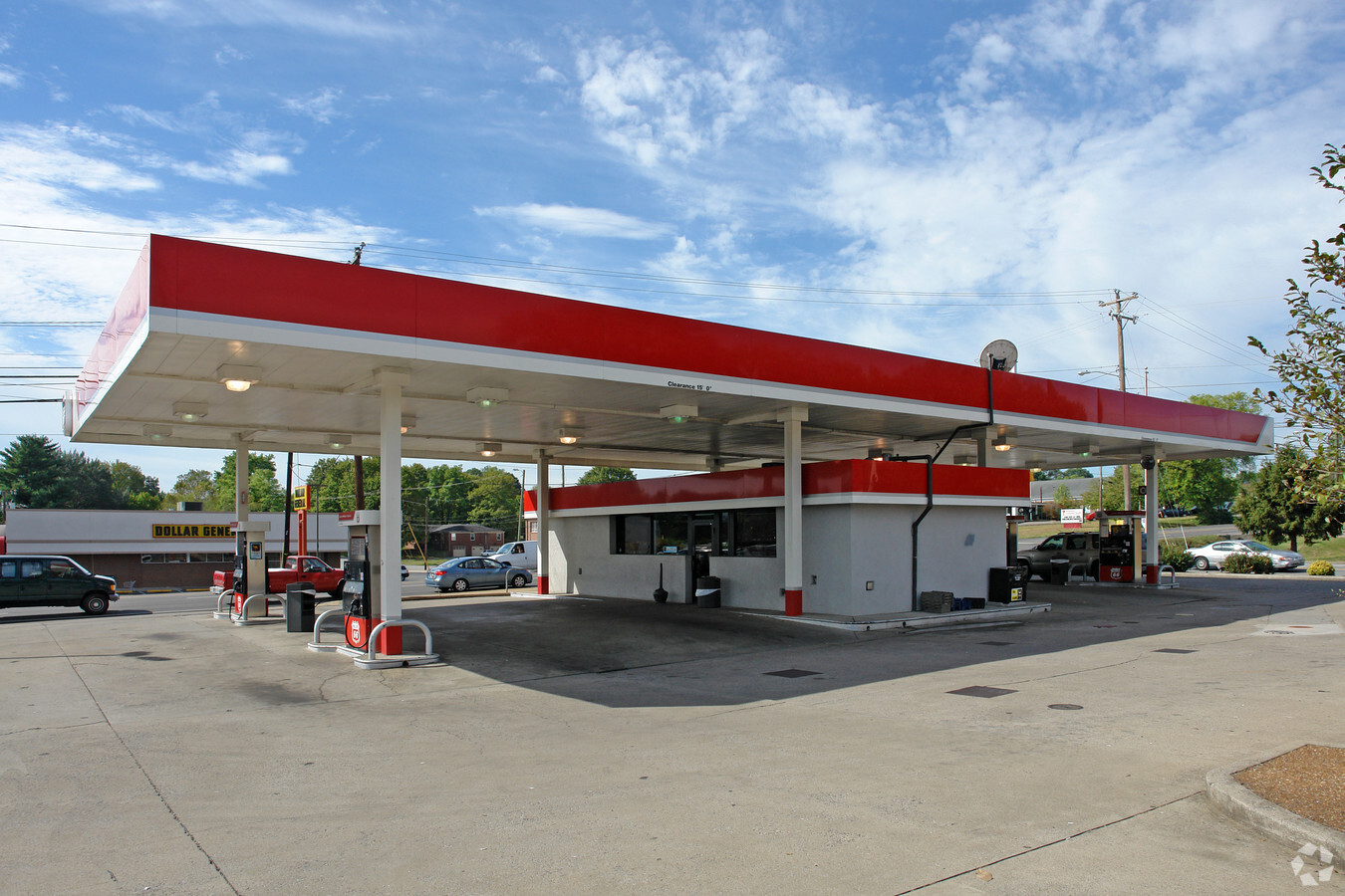
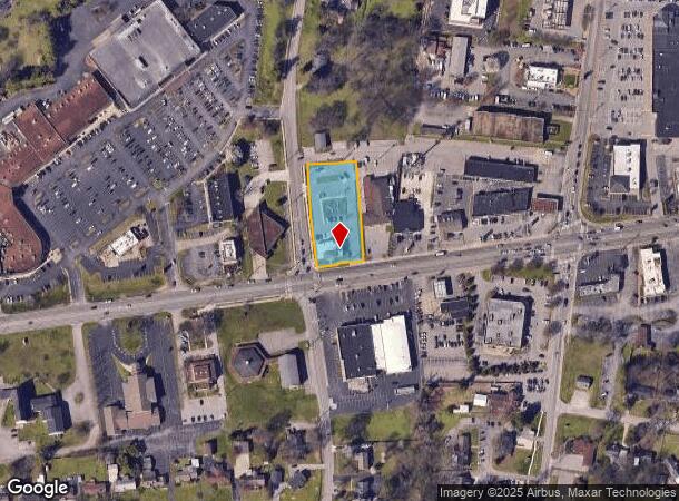
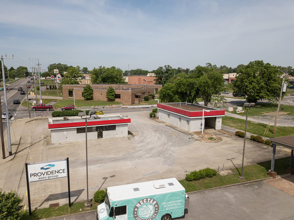
Property Record
2400 Lebanon Pike, Nashville, TN 37214
NEARBY LISTINGS FOR SALE OR LEASE
Property Detail
2400 Lebanon Pike
095-03-0-124
Plan Of R D Stanford Subdivision
Financialbuilding
PT LOT 1 2400 & 2408 LEBANON PIKE SUB
X
Davidson
47037C0266H
Tennessee
2024
0.92 AC
2024
Donelson-Hermitage
015200
Nashville
2,944 SF
Nashville-Davidson--Murfreesboro--Franklin, TN
DEMOGRAPHICS near 2400 Lebanon Pike
1 Mile
3 Mile
5 Mile
2024 Total Population
5,138
33,329
138,575
2029 Population
5,050
32,700
137,536
Pop Growth 2024-2029
(1.71%)
(1.89%)
(0.75%)
Average Age
43
40
37
2024 Total Households
2,284
14,976
60,717
HH Growth 2024-2029
(2.10%)
(2.27%)
(1.06%)
Median Household Inc
$66,510
$64,389
$62,416
Avg Household Size
2.20
2.10
2.20
2024 Avg HH Vehicles
2.00
2.00
2.00
Median Home Value
$344,465
$333,647
$343,795
Median Year Built
1957
1966
1978
Nearby Places
- Restaurants
- Banks
- Shops
- Fitness
- Groceries
PUBLIC TRANSPORTATION
COMMUTER RAIL
Donelson (East Corridor Line - Tennessee Regional Transportation Authority Music City Star (Music City Star))
DRIVE
WALK
Distance
Donelson (East Corridor Line - Tennessee Regional Transportation Authority Music City Star (Music City Star))
2 min
19 min
1.0 mi
Hermitage (East Corridor Line - Tennessee Regional Transportation Authority Music City Star (Music City Star))
DRIVE
WALK
Distance
Hermitage (East Corridor Line - Tennessee Regional Transportation Authority Music City Star (Music City Star))
11 min
6.2 mi
AIRPORT
Nashville International
DRIVE
WALK
Distance
Nashville International
9 min
5.2 mi
Freight Ports
Port of Mobile
DRIVE
WALK
Distance
Port of Mobile
490 min
449.8 mi
SALE & LEASE HISTORY
LISTING DATE
SALE/LEASE

Sep 25, 2018
For Lease
Dec 18, 2017
For Lease
Nearby Properties
Address
Land Use
TOTAL SIZE
Lot Size
Zoning
Address
Land Use
TOTAL SIZE
Lot Size
Zoning
511,497 SF
171.79 AC
CA
Address
Land Use
TOTAL SIZE
Lot Size
Zoning
969,698 SF
124.26 AC
MULTI-ZONE
Address
Land Use
TOTAL SIZE
Lot Size
Zoning
155,763 SF
2,110.61 AC
MULTI-ZONE
Address
Land Use
TOTAL SIZE
Lot Size
Zoning
292,815 SF
10.04 AC
ORI
Address
Land Use
TOTAL SIZE
Lot Size
Zoning
571,677 SF
28.37 AC
MULTI-ZONE
Address
Land Use
TOTAL SIZE
Lot Size
Zoning
9,956 SF
81.09 AC
RM9
Address
Land Use
TOTAL SIZE
Lot Size
Zoning
790,714 SF
Address
Land Use
TOTAL SIZE
Lot Size
Zoning
237,496 SF
5.41 AC
ORI
Address
Land Use
TOTAL SIZE
Lot Size
Zoning
336.43 AC
MULTI-ZONE
Address
Land Use
TOTAL SIZE
Lot Size
Zoning
49,660 SF
18.63 AC
MULTIZONE
Address
Land Use
TOTAL SIZE
Lot Size
Zoning
291,852 SF
14.94 AC
ORI
Address
Land Use
TOTAL SIZE
Lot Size
Zoning
313,498 SF
23.59 AC
ORI
Address
Land Use
TOTAL SIZE
Lot Size
Zoning
14,352 SF
24.19 AC
RM15
Address
Land Use
TOTAL SIZE
Lot Size
Zoning
18,522 SF
22.42 AC
MULTI-ZONE
Address
Land Use
TOTAL SIZE
Lot Size
Zoning
248,573 SF
25.36 AC
OL
Address
Land Use
TOTAL SIZE
Lot Size
Zoning
42,864 SF
32.73 AC
CA
Address
Land Use
TOTAL SIZE
Lot Size
Zoning
40,236 SF
34.21 AC
IR
Address
Land Use
TOTAL SIZE
Lot Size
Zoning
15,044 SF
20.63 AC
RM20
Address
Land Use
TOTAL SIZE
Lot Size
Zoning
12,385 SF
127.25 AC
IR
Address
Land Use
TOTAL SIZE
Lot Size
Zoning
185,608 SF
8.60 AC
ORI
Address
Land Use
TOTAL SIZE
Lot Size
Zoning
8,827 SF
935.50 AC
MULTI-ZONE
Address
Land Use
TOTAL SIZE
Lot Size
Zoning
261,082 SF
4.78 AC
CS
Address
Land Use
TOTAL SIZE
Lot Size
Zoning
72,752 SF
4.56 AC
ORI
Address
Land Use
TOTAL SIZE
Lot Size
Zoning
142,251 SF
3.68 AC
RM20
Address
Land Use
TOTAL SIZE
Lot Size
Zoning
51,846 SF
6.37 AC
MULTIZONE
Address
Land Use
TOTAL SIZE
Lot Size
Zoning
144,730 SF
8.78 AC
OR20
Address
Land Use
TOTAL SIZE
Lot Size
Zoning
8,626 SF
15.65 AC
OR20
Address
Land Use
TOTAL SIZE
Lot Size
Zoning
131,071 SF
Address
Land Use
TOTAL SIZE
Lot Size
Zoning
43,030 SF
7 AC
CL
Address
Land Use
TOTAL SIZE
Lot Size
Zoning
89,335 SF
22.28 AC
MULTIZONE
The World's #1 Commercial Real Estate Marketplace
Connect with us
© 2025 CoStar Group
The information above has been obtained from sources believed reliable. While we do not doubt its accuracy we have not verified it and make no guarantee, warranty or representation about it. It is your responsibility to independently confirm its accuracy and completeness. Any projections, opinions, assumptions, or estimates used are for example only and do not represent the current or future performance of the property. The value of this transaction to you depends on tax and other factors which should be evaluated by your tax, financial, and legal advisors. You and your advisors should conduct a careful, independent investigation of the property to determine to your satisfaction the suitability of the property for your needs.