Property Record
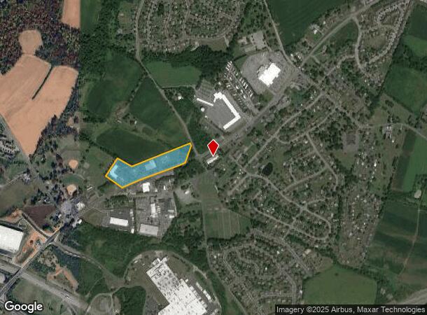
2400 N Reading Rd, Denver, PA 17517
NEARBY LISTINGS FOR SALE OR LEASE
Property Detail
2400 N Reading Rd
080-60966-0-0000
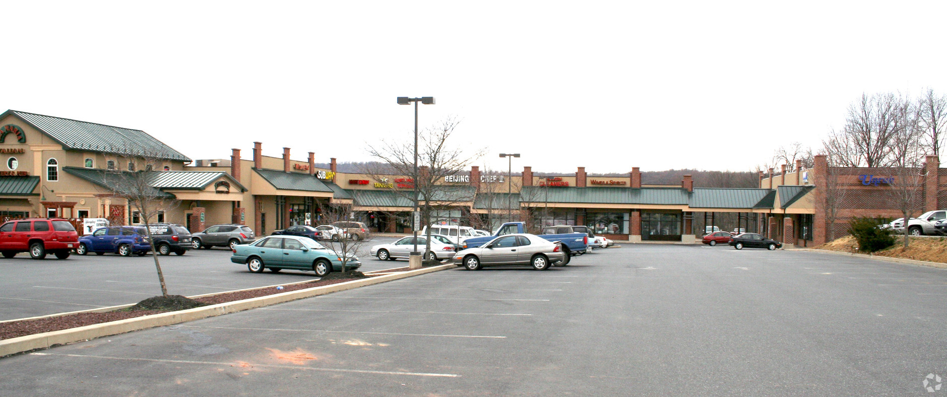
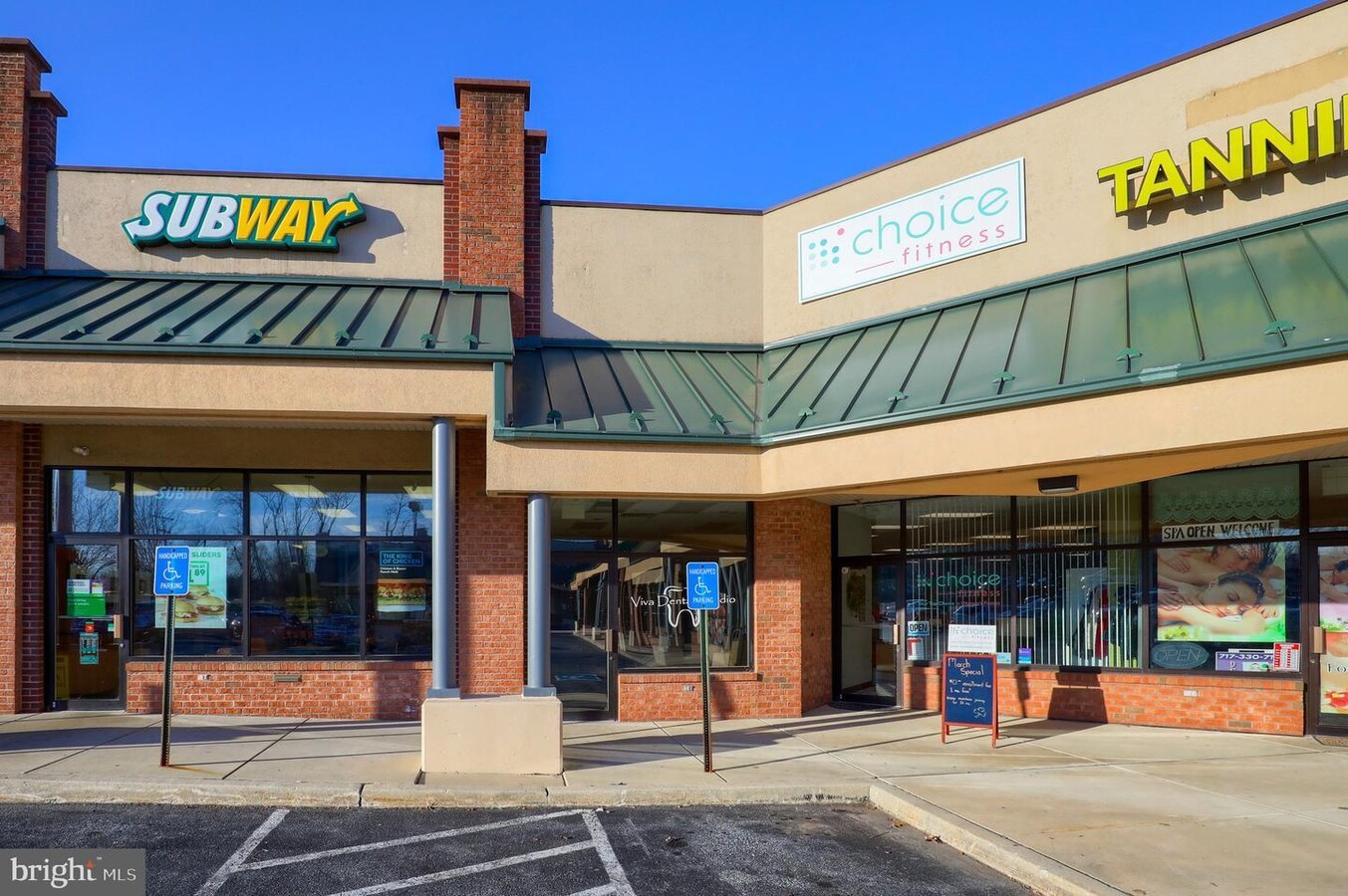
Muddy Creek Shopping Center
Regionalshoppingcenterormallwithanchorstore
2400 N READING RD
X
Lancaster
42071C0202F
Pennsylvania
2024
10.07 AC
2024
Lancaster County
012501
Philadelphia
50,389 SF
Lancaster, PA
DEMOGRAPHICS near 2400 N Reading Rd
1 Mile
3 Mile
5 Mile
2024 Total Population
3,194
16,602
36,665
2029 Population
3,206
16,548
36,652
Pop Growth 2024-2029
+ 0.38%
(0.33%)
(0.04%)
Average Age
41
40
40
2024 Total Households
1,213
6,091
13,107
HH Growth 2024-2029
+ 0.33%
(0.41%)
(0.06%)
Median Household Inc
$111,805
$86,288
$87,150
Avg Household Size
2.60
2.70
2.80
2024 Avg HH Vehicles
2.00
2.00
2.00
Median Home Value
$244,951
$239,988
$256,810
Median Year Built
1984
1980
1979
Nearby Places
- Restaurants
- Banks
- Shops
- Fitness
- Groceries
SALE & LEASE HISTORY
LISTING DATE
SALE/LEASE

Sep 29, 2020
For Lease
Sep 25, 2016
For Lease
Mar 16, 2020
For Lease
Mar 13, 2020
For Lease
Jan 31, 2019
For Lease
Nearby Properties
Address
Land Use
TOTAL SIZE
Lot Size
Zoning
Address
Land Use
TOTAL SIZE
Lot Size
Zoning
1,588,498 SF
150.55 AC
I-1
Address
Land Use
TOTAL SIZE
Lot Size
Zoning
561,324 SF
114.10 AC
I-1
Address
Land Use
TOTAL SIZE
Lot Size
Zoning
170,735 SF
18.76 AC
Address
Land Use
TOTAL SIZE
Lot Size
Zoning
95,121 SF
23.68 AC
Address
Land Use
TOTAL SIZE
Lot Size
Zoning
117,000 SF
12.98 AC
I-1
Address
Land Use
TOTAL SIZE
Lot Size
Zoning
213,220 SF
22.80 AC
I-1
Address
Land Use
TOTAL SIZE
Lot Size
Zoning
107,888 SF
28.30 AC
I-2
Address
Land Use
TOTAL SIZE
Lot Size
Zoning
75,227 SF
10.60 AC
R-60
Address
Land Use
TOTAL SIZE
Lot Size
Zoning
91,630 SF
16.56 AC
I-1
Address
Land Use
TOTAL SIZE
Lot Size
Zoning
87,504 SF
59.27 AC
Address
Land Use
TOTAL SIZE
Lot Size
Zoning
41,012 SF
2.49 AC
C-1
Address
Land Use
TOTAL SIZE
Lot Size
Zoning
270,732 SF
9.50 AC
I-1
Address
Land Use
TOTAL SIZE
Lot Size
Zoning
98,846 SF
32.95 AC
Address
Land Use
TOTAL SIZE
Lot Size
Zoning
40,793 SF
4 AC
C-1
Address
Land Use
TOTAL SIZE
Lot Size
Zoning
199,506 SF
20.60 AC
I
Address
Land Use
TOTAL SIZE
Lot Size
Zoning
142,935 SF
6.51 AC
I
Address
Land Use
TOTAL SIZE
Lot Size
Zoning
128,000 SF
8.28 AC
I-1
Address
Land Use
TOTAL SIZE
Lot Size
Zoning
91,642 SF
11.30 AC
I-1
Address
Land Use
TOTAL SIZE
Lot Size
Zoning
94,918 SF
10 AC
I-1
Address
Land Use
TOTAL SIZE
Lot Size
Zoning
121,954 SF
8.50 AC
I-1
Address
Land Use
TOTAL SIZE
Lot Size
Zoning
133,904 SF
6.70 AC
I-1
Address
Land Use
TOTAL SIZE
Lot Size
Zoning
82,750 SF
5.80 AC
I-1
Address
Land Use
TOTAL SIZE
Lot Size
Zoning
23,798 SF
209 AC
R
Address
Land Use
TOTAL SIZE
Lot Size
Zoning
52,974 SF
12.40 AC
Address
Land Use
TOTAL SIZE
Lot Size
Zoning
68,000 SF
8.10 AC
I-1
Address
Land Use
TOTAL SIZE
Lot Size
Zoning
90,256 SF
4.80 AC
I
Address
Land Use
TOTAL SIZE
Lot Size
Zoning
75,216 SF
0.30 AC
CB
Address
Land Use
TOTAL SIZE
Lot Size
Zoning
29,503 SF
6.39 AC
Address
Land Use
TOTAL SIZE
Lot Size
Zoning
28,857 SF
97.80 AC
Q
The World's #1 Commercial Real Estate Marketplace
Connect with us
© 2025 CoStar Group
The information above has been obtained from sources believed reliable. While we do not doubt its accuracy we have not verified it and make no guarantee, warranty or representation about it. It is your responsibility to independently confirm its accuracy and completeness. Any projections, opinions, assumptions, or estimates used are for example only and do not represent the current or future performance of the property. The value of this transaction to you depends on tax and other factors which should be evaluated by your tax, financial, and legal advisors. You and your advisors should conduct a careful, independent investigation of the property to determine to your satisfaction the suitability of the property for your needs.