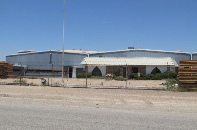
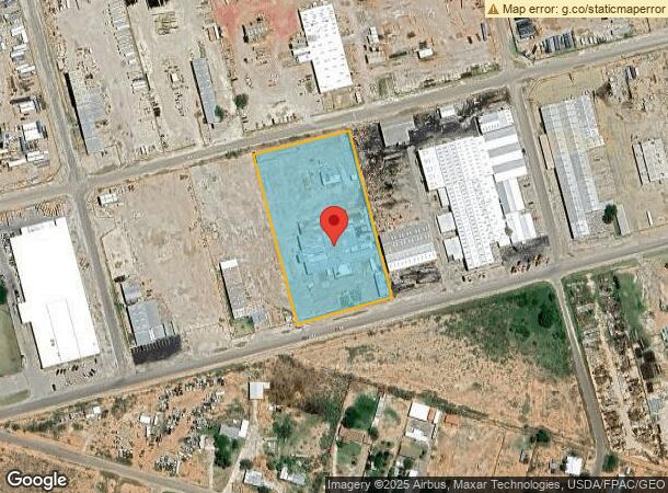
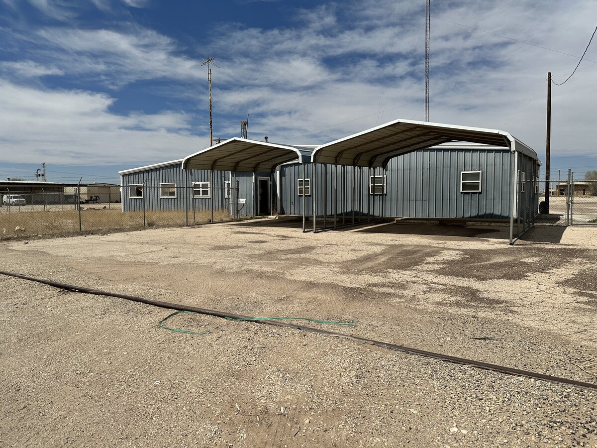
Property Record
2400 Steven Rd, Odessa, TX 79764
NEARBY LISTINGS FOR SALE OR LEASE
Property Detail
2400 Steven Rd
Odessa, TX
Odessa Industrial Park
21700-00192-00000
ODESSA INDUSTRIAL PARK BLOCK 4 LOTS 6-8
Commercialnec
Ector
AE
Texas
48135C0220E
6-8
2024
3.62 AC
2024
Midland & Odessa
000100
Other Market Areas
1,500 SF
DEMOGRAPHICS near 2400 Steven Rd
1 Mile
3 Mile
5 Mile
2024 Total Population
1,681
16,319
67,150
2029 Population
1,626
15,876
65,755
Pop Growth 2024-2029
(3.27%)
(2.71%)
(2.08%)
Average Age
36
33
34
2024 Total Households
603
5,670
23,674
HH Growth 2024-2029
(3.65%)
(3.10%)
(2.35%)
Median Household Inc
$66,895
$64,345
$59,084
Avg Household Size
2.70
2.80
2.70
2024 Avg HH Vehicles
2.00
2.00
2.00
Median Home Value
$219,289
$205,201
$169,090
Median Year Built
1983
1992
1976
Nearby Places
- Restaurants
- Banks
- Shops
- Fitness
- Groceries
PUBLIC TRANSPORTATION
AIRPORT
Midland International Air And Space Port
DRIVE
WALK
Distance
Midland International Air And Space Port
28 min
18.1 mi
Freight Ports
Port of Corpus Christi
DRIVE
WALK
Distance
Port of Corpus Christi
509 min
490.6 mi
SALE & LEASE HISTORY
LISTING DATE
SALE/LEASE

Feb 06, 2023
For Sale
Aug 05, 2021
For Sale
Nearby Properties
Address
Land Use
TOTAL SIZE
Lot Size
Zoning
Address
Land Use
TOTAL SIZE
Lot Size
Zoning
295,840 SF
12.04 AC
EC1
Address
Land Use
TOTAL SIZE
Lot Size
Zoning
136,794 SF
631.22 AC
EC3
Address
Land Use
TOTAL SIZE
Lot Size
Zoning
5,682 SF
9.17 AC
EC1
Address
Land Use
TOTAL SIZE
Lot Size
Zoning
Address
Land Use
TOTAL SIZE
Lot Size
Zoning
64,691 SF
9.90 AC
EC1
Address
Land Use
TOTAL SIZE
Lot Size
Zoning
16,800 SF
91.80 AC
EA7
Address
Land Use
TOTAL SIZE
Lot Size
Zoning
36,543 SF
11.50 AC
EC1
Address
Land Use
TOTAL SIZE
Lot Size
Zoning
31,200 SF
2.44 AC
EA6
Address
Land Use
TOTAL SIZE
Lot Size
Zoning
Address
Land Use
TOTAL SIZE
Lot Size
Zoning
1,250 SF
160 AC
EC1
Address
Land Use
TOTAL SIZE
Lot Size
Zoning
160 AC
EC4
Address
Land Use
TOTAL SIZE
Lot Size
Zoning
52,800 SF
9.16 AC
EA2
Address
Land Use
TOTAL SIZE
Lot Size
Zoning
28,800 SF
5.08 AC
EA2
Address
Land Use
TOTAL SIZE
Lot Size
Zoning
53,127 SF
10.24 AC
ED1
Address
Land Use
TOTAL SIZE
Lot Size
Zoning
42,835 SF
3.26 AC
EC1
Address
Land Use
TOTAL SIZE
Lot Size
Zoning
11,250 SF
10.15 AC
EA2
Address
Land Use
TOTAL SIZE
Lot Size
Zoning
7,560 SF
6.20 AC
EC1
Address
Land Use
TOTAL SIZE
Lot Size
Zoning
33,145 SF
14.99 AC
EA2
Address
Land Use
TOTAL SIZE
Lot Size
Zoning
12,487 SF
2.96 AC
EB1
Address
Land Use
TOTAL SIZE
Lot Size
Zoning
16,000 SF
4.12 AC
EA1
Address
Land Use
TOTAL SIZE
Lot Size
Zoning
3,500 SF
5.04 AC
EA2
Address
Land Use
TOTAL SIZE
Lot Size
Zoning
11,160 SF
3.85 AC
EC1
Address
Land Use
TOTAL SIZE
Lot Size
Zoning
31,920 SF
1.23 AC
EA6
Address
Land Use
TOTAL SIZE
Lot Size
Zoning
2,700 SF
14.44 AC
EA3
Address
Land Use
TOTAL SIZE
Lot Size
Zoning
42,000 SF
5.99 AC
EA2
Address
Land Use
TOTAL SIZE
Lot Size
Zoning
12,604 SF
1.04 AC
EA6
Address
Land Use
TOTAL SIZE
Lot Size
Zoning
46,670 SF
2.01 AC
EA2
Address
Land Use
TOTAL SIZE
Lot Size
Zoning
8.54 AC
EC2
Address
Land Use
TOTAL SIZE
Lot Size
Zoning
1,051 SF
13.86 AC
EC1
Address
Land Use
TOTAL SIZE
Lot Size
Zoning
39,918 SF
8.08 AC
EC3
The World's #1 Commercial Real Estate Marketplace
Connect with us
© 2025 CoStar Group
The information above has been obtained from sources believed reliable. While we do not doubt its accuracy we have not verified it and make no guarantee, warranty or representation about it. It is your responsibility to independently confirm its accuracy and completeness. Any projections, opinions, assumptions, or estimates used are for example only and do not represent the current or future performance of the property. The value of this transaction to you depends on tax and other factors which should be evaluated by your tax, financial, and legal advisors. You and your advisors should conduct a careful, independent investigation of the property to determine to your satisfaction the suitability of the property for your needs.