Property Record
2401 Liberty Heights Ave, Baltimore, MD 21215


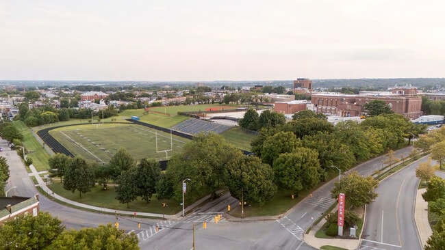
Property Detail
2401 Liberty Heights Ave
3262F-001
29.523 ACRES
Financialbuilding
BALTIMORE CITY
TOD-2
Maryland
B and X Area of moderate flood hazard, usually the area between the limits of the 100-year and 500-year floods.
1
2024
29.52 AC
2025
Baltimore Northwest
150500
Baltimore
457,289 SF
Baltimore-Columbia-Towson, MD
NEARBY LISTINGS FOR SALE OR LEASE
DEMOGRAPHICS near 2401 Liberty Heights Ave
1 mile
3 mile
5 mile
2025 Total Population
25,362
244,658
559,026
2030 Population
25,975
244,815
554,949
Pop Growth 2025-2030
+ 2.42%
+ 0.06%
(0.73%)
Average Age
41
40
39
2025 Total Households
10,499
108,395
239,478
HH Growth 2025-2030
+ 2.30%
(0.22%)
(0.91%)
Median Household Inc
$39,198
$52,407
$62,913
Avg Household Size
2.30
2.10
2.20
2025 Avg HH Vehicles
1.00
1.00
1.00
Median Home Value
$173,747
$232,487
$262,152
Median Year Built
1947
1948
1950
Nearby Places
Map Layers
Map Styles
 Street
 Aerial
Layers
 Traffic
 Biking
Places
Listings with unknown addresses are not visible on the map
- Restaurants
- Banks
- Shops
- Fitness
- Groceries
PUBLIC TRANSPORTATION
TRANSIT/SUBWAY
Mondawmin (Metro Subway - Maryland Transit Administration Metro Subway (Baltimore Metro))
Drive
Walk
Distance
Mondawmin (Metro Subway - Maryland Transit Administration Metro Subway (Baltimore Metro))
2 min
4 min
0.2 mi
Penn-North (Metro Subway - Maryland Transit Administration Metro Subway (Baltimore Metro))
Drive
Walk
Distance
Penn-North (Metro Subway - Maryland Transit Administration Metro Subway (Baltimore Metro))
3 min
20 min
1.0 mi
COMMUTER RAIL
West Baltimore Marc Sb (PENN - WASHINGTON - Maryland Transit Administration)
Drive
Walk
Distance
West Baltimore Marc Sb (PENN - WASHINGTON - Maryland Transit Administration)
7 min
2.1 mi
Penn Station (PENN - WASHINGTON - Maryland Area Regional Commuter Trains (The MARC), Penn Line - Maryland Area Regional Commuter Trains (The MARC), Penn Station & Camden Yards - Maryland Area Regional Commuter Trains (The MARC))
Drive
Walk
Distance
Penn Station (PENN - WASHINGTON - Maryland Area Regional Commuter Trains (The MARC), Penn Line - Maryland Area Regional Commuter Trains (The MARC), Penn Station & Camden Yards - Maryland Area Regional Commuter Trains (The MARC))
9 min
2.9 mi
AIRPORT
Baltimore/Washington International Thurgood Marshall
Drive
Walk
Distance
Baltimore/Washington International Thurgood Marshall
24 min
12.1 mi
Freight Ports
Port of Baltimore
Drive
Walk
Distance
Port of Baltimore
18 min
6.4 mi
SALE & LEASE HISTORY
LISTING DATE
SALE/LEASE

Sep 19, 2025
For Lease
Oct 28, 2020
For Lease
Oct 28, 2020
For Lease
Oct 01, 2019
For Lease
Mar 14, 2018
For Lease
Feb 18, 2025
For Lease
Dec 27, 2016
For Lease
Apr 04, 2023
For Lease
Nearby Properties
Address
Land Use
TOTAL SIZE
Lot Size
Zoning
Address
Land Use
TOTAL SIZE
Lot Size
Zoning
1,871,691 SF
6.77 AC
C-5DC
Address
Land Use
TOTAL SIZE
Lot Size
Zoning
1,632,000 SF
106.32 AC
EC-2
Address
Land Use
TOTAL SIZE
Lot Size
Zoning
712,573 SF
1.32 AC
C-5DC
Address
Land Use
TOTAL SIZE
Lot Size
Zoning
21.27 AC
C-5DC
Address
Land Use
TOTAL SIZE
Lot Size
Zoning
739,000 SF
2.79 AC
C-5DC
Address
Land Use
TOTAL SIZE
Lot Size
Zoning
830,720 SF
1.90 AC
I-MU
Address
Land Use
TOTAL SIZE
Lot Size
Zoning
810,716 SF
28.88 AC
H
Address
Land Use
TOTAL SIZE
Lot Size
Zoning
1,228,117 SF
9.43 AC
C-2
Address
Land Use
TOTAL SIZE
Lot Size
Zoning
256,816 SF
1.27 AC
EC-2
Address
Land Use
TOTAL SIZE
Lot Size
Zoning
911,487 SF
5.27 AC
C-5DC
Address
Land Use
TOTAL SIZE
Lot Size
Zoning
381,152 SF
3.46 AC
C-5DC
Address
Land Use
TOTAL SIZE
Lot Size
Zoning
599,187 SF
30.14 AC
EC-2
Address
Land Use
TOTAL SIZE
Lot Size
Zoning
289,515 SF
1.10 AC
BSC
Address
Land Use
TOTAL SIZE
Lot Size
Zoning
10,386 SF
15.01 AC
C-5IH
Address
Land Use
TOTAL SIZE
Lot Size
Zoning
334,715 SF
1.77 AC
H
Address
Land Use
TOTAL SIZE
Lot Size
Zoning
189,700 SF
0.71 AC
TOD-4
Address
Land Use
TOTAL SIZE
Lot Size
Zoning
538,988 SF
8.40 AC
I-MU
Address
Land Use
TOTAL SIZE
Lot Size
Zoning
625,217 SF
2.12 AC
C-5DC
Address
Land Use
TOTAL SIZE
Lot Size
Zoning
765,243 SF
0.69 AC
C-5DC
Address
Land Use
TOTAL SIZE
Lot Size
Zoning
743.89 AC
OS
Address
Land Use
TOTAL SIZE
Lot Size
Zoning
774,803 SF
7.38 AC
IMU-1
Address
Land Use
TOTAL SIZE
Lot Size
Zoning
363,350 SF
3.22 AC
C-5DC
Address
Land Use
TOTAL SIZE
Lot Size
Zoning
22,912 SF
0.55 AC
C-5DC
Address
Land Use
TOTAL SIZE
Lot Size
Zoning
344,199 SF
1 AC
C-5DC
Address
Land Use
TOTAL SIZE
Lot Size
Zoning
372,287 SF
0.98 AC
R-10
Address
Land Use
TOTAL SIZE
Lot Size
Zoning
77,580 SF
1.68 AC
C-5DC
Address
Land Use
TOTAL SIZE
Lot Size
Zoning
208,941 SF
1.59 AC
C-5DC
Address
Land Use
TOTAL SIZE
Lot Size
Zoning
2.05 AC
C-5DC
Address
Land Use
TOTAL SIZE
Lot Size
Zoning
567,521 SF
8.12 AC
R-9
Address
Land Use
TOTAL SIZE
Lot Size
Zoning
5.03 AC
R-10
The World's #1 Commercial Real Estate Marketplace
Connect with us
© 2026 CoStar Group
The information above has been obtained from sources believed reliable. While we do not doubt its accuracy we have not verified it and make no guarantee, warranty or representation about it. It is your responsibility to independently confirm its accuracy and completeness. Any projections, opinions, assumptions, or estimates used are for example only and do not represent the current or future performance of the property. The value of this transaction to you depends on tax and other factors which should be evaluated by your tax, financial, and legal advisors. You and your advisors should conduct a careful, independent investigation of the property to determine to your satisfaction the suitability of the property for your needs.