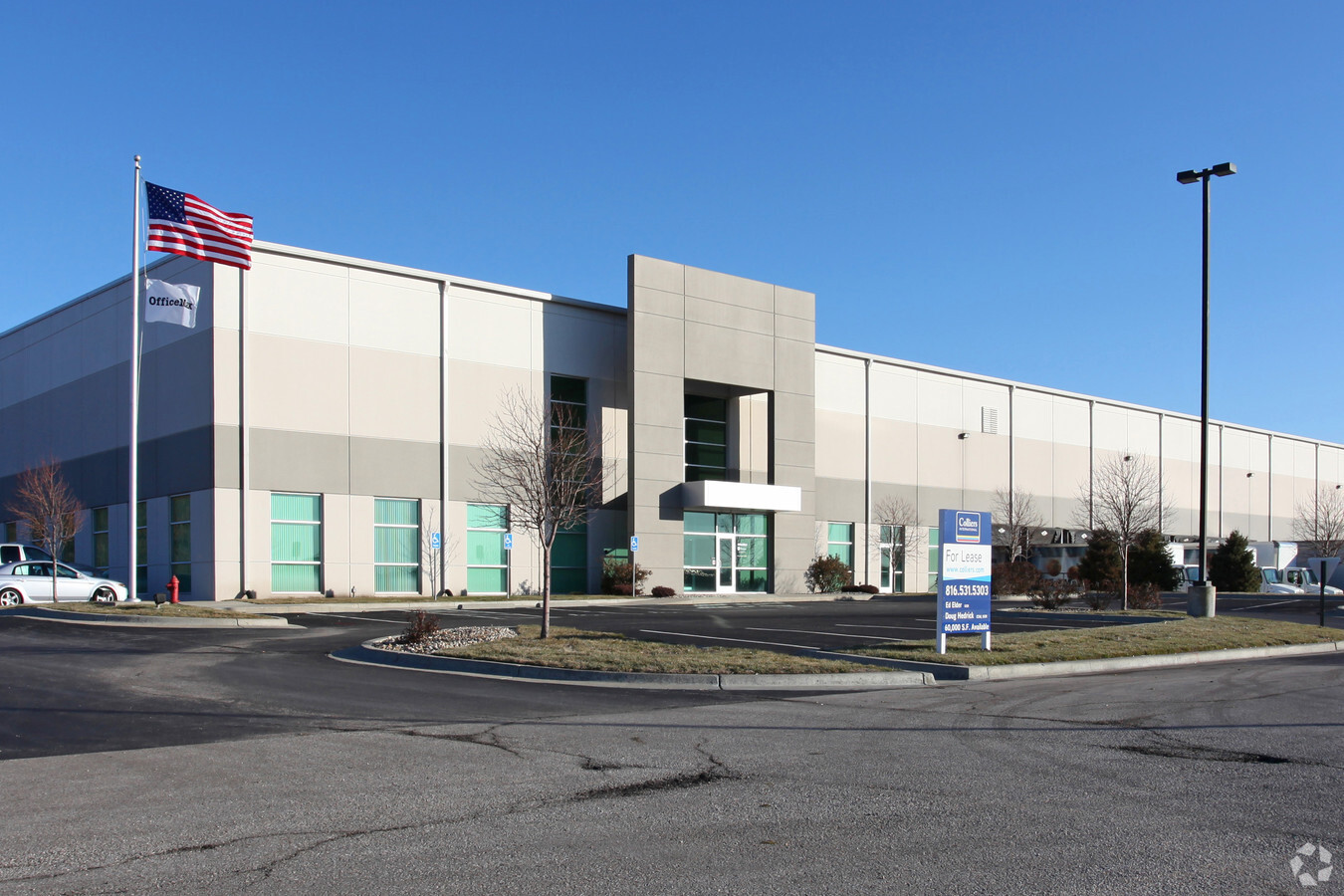
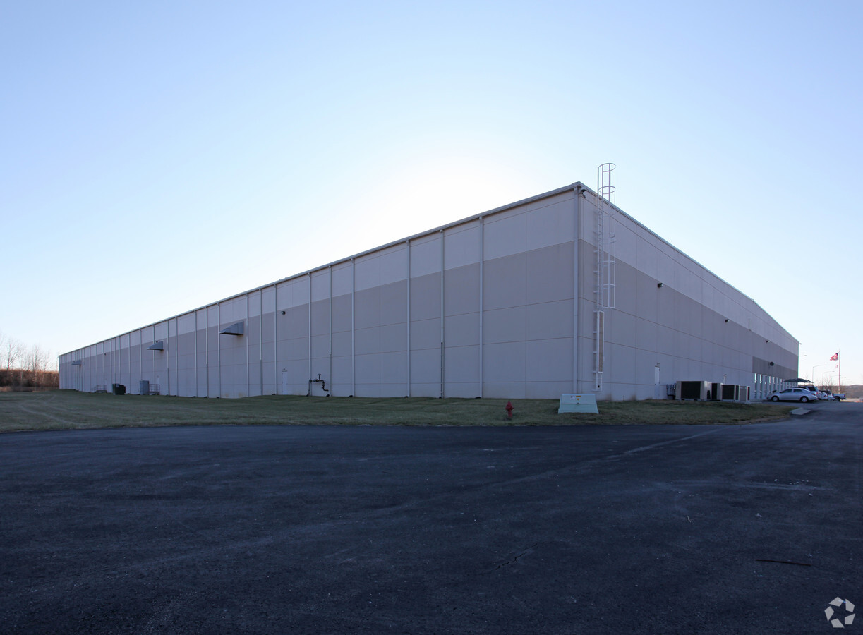
Property Record
2401 Midpoint Dr, Kansas City, KS 66111
NEARBY LISTINGS FOR SALE OR LEASE
Property Detail
2401 Midpoint Dr
Kansas City, MO-KS
Midpoint Corporate Centre 3Rd
418001
MIDPOINT CORPORATE CENTRE, S36, T11, R23, 676635 SQUARE FEET, L5 LS E 95FT, L6 LS E 60FT OF N 303.14FT LS E 95FT OF S 81.91FT & LOT 7A LS E 60FT; ALSO MIDPOINT CORPORATE CENTRE 2ND: S 147.94FT LOT 7B LS E 60FT
Shipyard
Wyandotte
X
Kansas
20209C0145E
5,6
2024
12.47 AC
2024
Bonner Springs
044702
Kansas City
180,000 SF
DEMOGRAPHICS near 2401 Midpoint Dr
1 Mile
3 Mile
5 Mile
2024 Total Population
430
16,559
70,853
2029 Population
413
16,616
71,659
Pop Growth 2024-2029
(3.95%)
+ 0.34%
+ 1.14%
Average Age
41
38
39
2024 Total Households
158
5,587
26,289
HH Growth 2024-2029
(3.80%)
+ 0.05%
+ 1.08%
Median Household Inc
$91,553
$111,423
$89,924
Avg Household Size
2.60
2.90
2.60
2024 Avg HH Vehicles
3.00
2.00
2.00
Median Home Value
$202,439
$285,436
$273,899
Median Year Built
1980
1993
1984
Nearby Places
- Restaurants
- Banks
- Shops
- Fitness
- Groceries
PUBLIC TRANSPORTATION
AIRPORT
Kansas City International
DRIVE
WALK
Distance
Kansas City International
38 min
28.9 mi
Freight Ports
Tulsa Port Of Catoosa
DRIVE
WALK
Distance
Tulsa Port Of Catoosa
267 min
235.5 mi
Nearby Properties
Address
Land Use
TOTAL SIZE
Lot Size
Zoning
Address
Land Use
TOTAL SIZE
Lot Size
Zoning
920,306 SF
90.21 AC
Address
Land Use
TOTAL SIZE
Lot Size
Zoning
368,816 SF
22.93 AC
Address
Land Use
TOTAL SIZE
Lot Size
Zoning
83,537 SF
27.65 AC
AG
Address
Land Use
TOTAL SIZE
Lot Size
Zoning
274,379 SF
17.32 AC
Address
Land Use
TOTAL SIZE
Lot Size
Zoning
66.54 AC
Address
Land Use
TOTAL SIZE
Lot Size
Zoning
96,144 SF
38.53 AC
Address
Land Use
TOTAL SIZE
Lot Size
Zoning
66,916 SF
14.72 AC
AG
Address
Land Use
TOTAL SIZE
Lot Size
Zoning
658,206 SF
56.76 AC
ER1
Address
Land Use
TOTAL SIZE
Lot Size
Zoning
34,641 SF
14.33 AC
AG
Address
Land Use
TOTAL SIZE
Lot Size
Zoning
285,041 SF
109.90 AC
EI1
Address
Land Use
TOTAL SIZE
Lot Size
Zoning
59,640 SF
12.92 AC
PI
Address
Land Use
TOTAL SIZE
Lot Size
Zoning
22,616 SF
31.78 AC
AG
Address
Land Use
TOTAL SIZE
Lot Size
Zoning
5,940 SF
77.81 AC
PI
Address
Land Use
TOTAL SIZE
Lot Size
Zoning
280,000 SF
24.54 AC
Address
Land Use
TOTAL SIZE
Lot Size
Zoning
12,097 SF
56.85 AC
PI
Address
Land Use
TOTAL SIZE
Lot Size
Zoning
6,380 SF
296.16 AC
BA1
Address
Land Use
TOTAL SIZE
Lot Size
Zoning
167,713 SF
78.95 AC
KR1
Address
Land Use
TOTAL SIZE
Lot Size
Zoning
15,264 SF
73.01 AC
KR1
Address
Land Use
TOTAL SIZE
Lot Size
Zoning
81,594 SF
14.08 AC
Address
Land Use
TOTAL SIZE
Lot Size
Zoning
402,811 SF
33.85 AC
Address
Land Use
TOTAL SIZE
Lot Size
Zoning
8.39 AC
PI
Address
Land Use
TOTAL SIZE
Lot Size
Zoning
329,330 SF
18.25 AC
Address
Land Use
TOTAL SIZE
Lot Size
Zoning
6,688 SF
11.19 AC
LU1
Address
Land Use
TOTAL SIZE
Lot Size
Zoning
86,667 SF
24.11 AC
EI1
Address
Land Use
TOTAL SIZE
Lot Size
Zoning
175,714 SF
22.94 AC
Address
Land Use
TOTAL SIZE
Lot Size
Zoning
175,620 SF
15.52 AC
Address
Land Use
TOTAL SIZE
Lot Size
Zoning
181,708 SF
20.29 AC
KR1
Address
Land Use
TOTAL SIZE
Lot Size
Zoning
178,880 SF
17.82 AC
Address
Land Use
TOTAL SIZE
Lot Size
Zoning
19,296 SF
1.76 AC
PI
The World's #1 Commercial Real Estate Marketplace
Connect with us
© 2025 CoStar Group
The information above has been obtained from sources believed reliable. While we do not doubt its accuracy we have not verified it and make no guarantee, warranty or representation about it. It is your responsibility to independently confirm its accuracy and completeness. Any projections, opinions, assumptions, or estimates used are for example only and do not represent the current or future performance of the property. The value of this transaction to you depends on tax and other factors which should be evaluated by your tax, financial, and legal advisors. You and your advisors should conduct a careful, independent investigation of the property to determine to your satisfaction the suitability of the property for your needs.