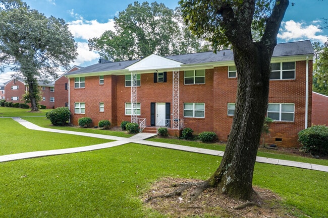
Property Record
2410 Benjamin E Mays Dr Sw, Atlanta, GA 30311


NEARBY LISTINGS FOR SALE OR LEASE
Property Detail
2410 Benjamin E Mays Dr Sw
Atlanta-Sandy Springs-Roswell, GA
Survey Prepared Alfred J Smith
14-0202-0005-012-7
KA IRENE COURT ID 4-752-4999
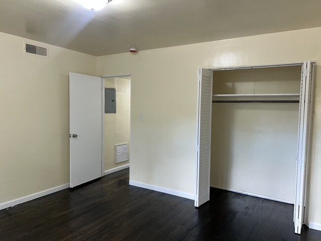
Apartment
Fulton
X
Georgia
13121C0352F
201
2024
1.72 AC
2025
Cascade Heights
008000
Atlanta
68,832 SF
DEMOGRAPHICS near 2410 Benjamin E Mays Dr Sw
1 Mile
3 Mile
5 Mile
2024 Total Population
4,154
80,217
229,959
2029 Population
4,295
83,938
240,307
Pop Growth 2024-2029
+ 3.39%
+ 4.64%
+ 4.50%
Average Age
46
40
39
2024 Total Households
1,753
33,553
94,044
HH Growth 2024-2029
+ 3.54%
+ 4.69%
+ 4.66%
Median Household Inc
$72,899
$45,889
$44,257
Avg Household Size
2.30
2.30
2.30
2024 Avg HH Vehicles
2.00
1.00
1.00
Median Home Value
$337,318
$257,193
$250,024
Median Year Built
1958
1963
1970
Nearby Places
Map Layers
Map Styles
 Street
 Aerial
- Restaurants
- Banks
- Shops
- Fitness
- Groceries
PUBLIC TRANSPORTATION
COMMUTER RAIL
Atlanta (Crescent - Amtrak)
DRIVE
WALK
Distance
Atlanta (Crescent - Amtrak)
18 min
9.2 mi
AIRPORT
Hartsfield - Jackson Atlanta International
DRIVE
WALK
Distance
Hartsfield - Jackson Atlanta International
21 min
10.7 mi
Freight Ports
Georgia Ports - Savannah
DRIVE
WALK
Distance
Georgia Ports - Savannah
284 min
250.1 mi
SALE & LEASE HISTORY
LISTING DATE
SALE/LEASE

Sep 19, 2024
For Sale
May 30, 2025
For Sale
Nearby Properties
Address
Land Use
TOTAL SIZE
Lot Size
Zoning
Address
Land Use
TOTAL SIZE
Lot Size
Zoning
11.74 AC
I1
Address
Land Use
TOTAL SIZE
Lot Size
Zoning
541,508 SF
110.88 AC
I1
Address
Land Use
TOTAL SIZE
Lot Size
Zoning
857,294 SF
101.10 AC
I1
Address
Land Use
TOTAL SIZE
Lot Size
Zoning
3,411,710 SF
25.97 AC
RG3
Address
Land Use
TOTAL SIZE
Lot Size
Zoning
282,610 SF
11.20 AC
C1
Address
Land Use
TOTAL SIZE
Lot Size
Zoning
425,270 SF
201.84 AC
I1
Address
Land Use
TOTAL SIZE
Lot Size
Zoning
814,536 SF
37 AC
R3
Address
Land Use
TOTAL SIZE
Lot Size
Zoning
274,442 SF
20.33 AC
RG2
Address
Land Use
TOTAL SIZE
Lot Size
Zoning
3,268,352 SF
23.31 AC
RG2
Address
Land Use
TOTAL SIZE
Lot Size
Zoning
1,825,146 SF
16.16 AC
RG3
Address
Land Use
TOTAL SIZE
Lot Size
Zoning
563,256 SF
22.69 AC
I1
Address
Land Use
TOTAL SIZE
Lot Size
Zoning
395,218 SF
21.61 AC
A1
Address
Land Use
TOTAL SIZE
Lot Size
Zoning
34.86 AC
R4
Address
Land Use
TOTAL SIZE
Lot Size
Zoning
4.25 AC
R3
Address
Land Use
TOTAL SIZE
Lot Size
Zoning
70.35 AC
R3
Address
Land Use
TOTAL SIZE
Lot Size
Zoning
6,834,480 SF
9.85 AC
RG3
Address
Land Use
TOTAL SIZE
Lot Size
Zoning
154,200 SF
3.09 AC
I2
Address
Land Use
TOTAL SIZE
Lot Size
Zoning
764,659 SF
51.57 AC
C1
Address
Land Use
TOTAL SIZE
Lot Size
Zoning
79,988 SF
4.05 AC
I1
Address
Land Use
TOTAL SIZE
Lot Size
Zoning
1,477,770 SF
13.60 AC
C1
Address
Land Use
TOTAL SIZE
Lot Size
Zoning
756 SF
52.20 AC
R4
Address
Land Use
TOTAL SIZE
Lot Size
Zoning
38.04 AC
I1
Address
Land Use
TOTAL SIZE
Lot Size
Zoning
910 SF
28.75 AC
R1
Address
Land Use
TOTAL SIZE
Lot Size
Zoning
7,668 SF
17.29 AC
C1
Address
Land Use
TOTAL SIZE
Lot Size
Zoning
2,183,740 SF
12.75 AC
RG3
Address
Land Use
TOTAL SIZE
Lot Size
Zoning
874,924 SF
10 AC
C1
Address
Land Use
TOTAL SIZE
Lot Size
Zoning
281,874 SF
14.72 AC
I1
Address
Land Use
TOTAL SIZE
Lot Size
Zoning
191,540 SF
7.74 AC
RG3
Address
Land Use
TOTAL SIZE
Lot Size
Zoning
1,454,400 SF
14.81 AC
RG3
Address
Land Use
TOTAL SIZE
Lot Size
Zoning
60.64 AC
R5
The World's #1 Commercial Real Estate Marketplace
Connect with us
© 2026 CoStar Group
The information above has been obtained from sources believed reliable. While we do not doubt its accuracy we have not verified it and make no guarantee, warranty or representation about it. It is your responsibility to independently confirm its accuracy and completeness. Any projections, opinions, assumptions, or estimates used are for example only and do not represent the current or future performance of the property. The value of this transaction to you depends on tax and other factors which should be evaluated by your tax, financial, and legal advisors. You and your advisors should conduct a careful, independent investigation of the property to determine to your satisfaction the suitability of the property for your needs.