Property Record
2415 W Main St, Ephrata, PA 17522


NEARBY LISTINGS FOR SALE OR LEASE
Property Detail
2415 W Main St
Lancaster, PA
Anthony A Yost Tract
070-35518-0-0000
2415 W MAIN ST
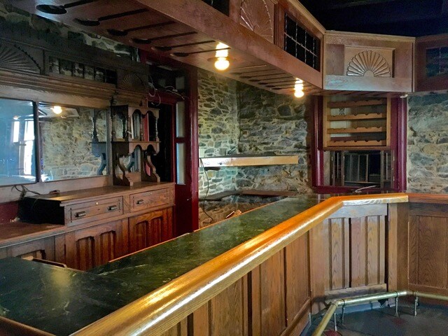
Restaurantbuilding
Lancaster
X
Pennsylvania
42071C0159F
12
2024
0.58 AC
2025
Lancaster County
010202
Philadelphia
5,881 SF
DEMOGRAPHICS near 2415 W Main St
1 Mile
3 Mile
5 Mile
2024 Total Population
2,320
10,246
46,553
2029 Population
2,322
10,292
46,886
Pop Growth 2024-2029
+ 0.09%
+ 0.45%
+ 0.72%
Average Age
41
41
41
2024 Total Households
839
3,754
17,969
HH Growth 2024-2029
+ 0.12%
+ 0.51%
+ 0.75%
Median Household Inc
$73,571
$78,078
$72,848
Avg Household Size
2.70
2.70
2.50
2024 Avg HH Vehicles
2.00
2.00
2.00
Median Home Value
$255,394
$269,360
$250,867
Median Year Built
1983
1984
1981
Nearby Places
Map Layers
Map Styles
 Street
 Aerial
- Restaurants
- Banks
- Shops
- Fitness
- Groceries
PUBLIC TRANSPORTATION
AIRPORT
Harrisburg International
DRIVE
WALK
Distance
Harrisburg International
48 min
35.7 mi
Freight Ports
Port of Wilmington, RI
DRIVE
WALK
Distance
Port of Wilmington, RI
98 min
66.4 mi
SALE & LEASE HISTORY
LISTING DATE
SALE/LEASE

Sep 23, 2016
For Sale
Nearby Properties
Address
Land Use
TOTAL SIZE
Lot Size
Zoning
Address
Land Use
TOTAL SIZE
Lot Size
Zoning
203,091 SF
37.05 AC
Address
Land Use
TOTAL SIZE
Lot Size
Zoning
102,392 SF
21.77 AC
Address
Land Use
TOTAL SIZE
Lot Size
Zoning
392 SF
1,710.80 AC
FR
Address
Land Use
TOTAL SIZE
Lot Size
Zoning
72,478 SF
11.83 AC
Address
Land Use
TOTAL SIZE
Lot Size
Zoning
145,069 SF
16.30 AC
LI
Address
Land Use
TOTAL SIZE
Lot Size
Zoning
86,947 SF
6.30 AC
A
Address
Land Use
TOTAL SIZE
Lot Size
Zoning
86,842 SF
12 AC
R2
Address
Land Use
TOTAL SIZE
Lot Size
Zoning
55,334 SF
5.70 AC
Address
Land Use
TOTAL SIZE
Lot Size
Zoning
81,780 SF
10.24 AC
Address
Land Use
TOTAL SIZE
Lot Size
Zoning
79,968 SF
7.41 AC
Address
Land Use
TOTAL SIZE
Lot Size
Zoning
76,047 SF
60.10 AC
AT
Address
Land Use
TOTAL SIZE
Lot Size
Zoning
23,424 SF
13.60 AC
NC
Address
Land Use
TOTAL SIZE
Lot Size
Zoning
71,689 SF
6.10 AC
LI
Address
Land Use
TOTAL SIZE
Lot Size
Zoning
58,104 SF
5.06 AC
Address
Land Use
TOTAL SIZE
Lot Size
Zoning
29,519 SF
9.17 AC
A
Address
Land Use
TOTAL SIZE
Lot Size
Zoning
5,727 SF
79.90 AC
AG
Address
Land Use
TOTAL SIZE
Lot Size
Zoning
47,136 SF
7.62 AC
LI
Address
Land Use
TOTAL SIZE
Lot Size
Zoning
12,762 SF
77.96 AC
AT
Address
Land Use
TOTAL SIZE
Lot Size
Zoning
4,956 SF
115.40 AC
A
Address
Land Use
TOTAL SIZE
Lot Size
Zoning
4,894 SF
109.80 AC
AG
Address
Land Use
TOTAL SIZE
Lot Size
Zoning
13,249 SF
18.53 AC
LI
Address
Land Use
TOTAL SIZE
Lot Size
Zoning
18,509 SF
5.59 AC
Address
Land Use
TOTAL SIZE
Lot Size
Zoning
4,478 SF
190.60 AC
A
Address
Land Use
TOTAL SIZE
Lot Size
Zoning
38,758 SF
43.13 AC
HC
Address
Land Use
TOTAL SIZE
Lot Size
Zoning
49,008 SF
25.30 AC
A
Address
Land Use
TOTAL SIZE
Lot Size
Zoning
18,970 SF
4.72 AC
HC
Address
Land Use
TOTAL SIZE
Lot Size
Zoning
6,346 SF
55.50 AC
A
Address
Land Use
TOTAL SIZE
Lot Size
Zoning
17,400 SF
6.70 AC
R
Address
Land Use
TOTAL SIZE
Lot Size
Zoning
8,837 SF
65.90 AC
Address
Land Use
TOTAL SIZE
Lot Size
Zoning
7,884 SF
107.56 AC
AG
The World's #1 Commercial Real Estate Marketplace
Connect with us
© 2025 CoStar Group
The information above has been obtained from sources believed reliable. While we do not doubt its accuracy we have not verified it and make no guarantee, warranty or representation about it. It is your responsibility to independently confirm its accuracy and completeness. Any projections, opinions, assumptions, or estimates used are for example only and do not represent the current or future performance of the property. The value of this transaction to you depends on tax and other factors which should be evaluated by your tax, financial, and legal advisors. You and your advisors should conduct a careful, independent investigation of the property to determine to your satisfaction the suitability of the property for your needs.