Property Record
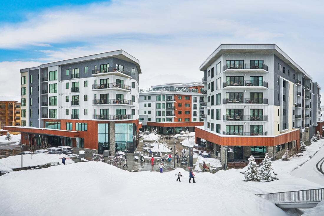
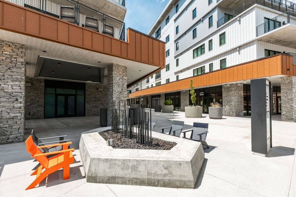
2417 W High Mountain Rd, Park City, UT 84098

Current Lease Availabilities
Hospitality LEASE
$35.00 - $250.00 SF/YR
395 - 1,903 SF
NEARBY LISTINGS FOR SALE OR LEASE
-
-
View all Park City listings for lease on LoopNet.com
Property Detail
2417 W High Mountain Rd
Summit Park, UT
Rc17 Residences And Commercial Condomini
RC17-CP
REMAINING DESC WRITTEN FOR ASSESSMENT PURPOSES: BEG 1887.02 FT W FROM THE SE COR OF SEC 36 T1SR3E SLBM SD PT BEING THE NE COR OF VACATED LOT 16 PARK CITY WEST PLAT NO 2 & RUN TH N 60* W 30 FT M/L TO THE CENTER LINE OF VACATED JEANNIE DR; TH S 30* W A
Commercialbuilding
Summit
X
Utah
49035C0375G
16,5,
2023
0.53 AC
2023
Park City
22,935 SF
Salt Lake City
DEMOGRAPHICS near 2417 W High Mountain Rd
1 Mile
3 Mile
5 Mile
2024 Total Population
1,726
9,719
24,543
2029 Population
1,965
10,494
25,932
Pop Growth 2024-2029
+ 13.85%
+ 7.97%
+ 5.66%
Average Age
41
42
41
2024 Total Households
732
3,946
9,629
HH Growth 2024-2029
+ 13.25%
+ 7.30%
+ 4.98%
Median Household Inc
$94,402
$164,360
$141,698
Avg Household Size
2.20
2.40
2.50
2024 Avg HH Vehicles
2.00
2.00
2.00
Median Home Value
$1,067,695
$1,041,176
$963,322
Median Year Built
2005
1998
1995
Nearby Places
- Restaurants
- Banks
- Shops
- Fitness
- Groceries
PUBLIC TRANSPORTATION
AIRPORT
Salt Lake City International
DRIVE
WALK
Distance
Salt Lake City International
42 min
33.7 mi
Freight Ports
Port of Stockton
DRIVE
WALK
Distance
Port of Stockton
742 min
724.1 mi
Nearby Properties
Address
Land Use
TOTAL SIZE
Lot Size
Zoning
Address
Land Use
TOTAL SIZE
Lot Size
Zoning
Address
Land Use
TOTAL SIZE
Lot Size
Zoning
259,734 SF
2.56 AC
Address
Land Use
TOTAL SIZE
Lot Size
Zoning
132,330 SF
4.47 AC
Address
Land Use
TOTAL SIZE
Lot Size
Zoning
74,233 SF
6.89 AC
Address
Land Use
TOTAL SIZE
Lot Size
Zoning
73,997 SF
4.20 AC
Address
Land Use
TOTAL SIZE
Lot Size
Zoning
119,206 SF
2.70 AC
Address
Land Use
TOTAL SIZE
Lot Size
Zoning
70,603 SF
5.86 AC
Address
Land Use
TOTAL SIZE
Lot Size
Zoning
90,911 SF
1.88 AC
Address
Land Use
TOTAL SIZE
Lot Size
Zoning
55,447 SF
1.88 AC
Address
Land Use
TOTAL SIZE
Lot Size
Zoning
54,133 SF
1.97 AC
Address
Land Use
TOTAL SIZE
Lot Size
Zoning
36,038 SF
0.83 AC
Address
Land Use
TOTAL SIZE
Lot Size
Zoning
0.55 AC
Address
Land Use
TOTAL SIZE
Lot Size
Zoning
47,044 SF
7.38 AC
Address
Land Use
TOTAL SIZE
Lot Size
Zoning
49,257 SF
1.67 AC
Address
Land Use
TOTAL SIZE
Lot Size
Zoning
110,109 SF
7.05 AC
Address
Land Use
TOTAL SIZE
Lot Size
Zoning
50,913 SF
5.03 AC
Address
Land Use
TOTAL SIZE
Lot Size
Zoning
11,940 SF
5.73 AC
Address
Land Use
TOTAL SIZE
Lot Size
Zoning
49,530 SF
2.43 AC
Address
Land Use
TOTAL SIZE
Lot Size
Zoning
115,767 SF
9.82 AC
Address
Land Use
TOTAL SIZE
Lot Size
Zoning
Address
Land Use
TOTAL SIZE
Lot Size
Zoning
8,001 SF
106.94 AC
Address
Land Use
TOTAL SIZE
Lot Size
Zoning
39,080 SF
3.28 AC
Address
Land Use
TOTAL SIZE
Lot Size
Zoning
34,119 SF
1.39 AC
Address
Land Use
TOTAL SIZE
Lot Size
Zoning
16,391 SF
5.23 AC
Address
Land Use
TOTAL SIZE
Lot Size
Zoning
39,601 SF
2.20 AC
Address
Land Use
TOTAL SIZE
Lot Size
Zoning
51,933 SF
1.19 AC
Address
Land Use
TOTAL SIZE
Lot Size
Zoning
27,508 SF
0.96 AC
Address
Land Use
TOTAL SIZE
Lot Size
Zoning
The World's #1 Commercial Real Estate Marketplace
Connect with us
© 2025 CoStar Group
The information above has been obtained from sources believed reliable. While we do not doubt its accuracy we have not verified it and make no guarantee, warranty or representation about it. It is your responsibility to independently confirm its accuracy and completeness. Any projections, opinions, assumptions, or estimates used are for example only and do not represent the current or future performance of the property. The value of this transaction to you depends on tax and other factors which should be evaluated by your tax, financial, and legal advisors. You and your advisors should conduct a careful, independent investigation of the property to determine to your satisfaction the suitability of the property for your needs.