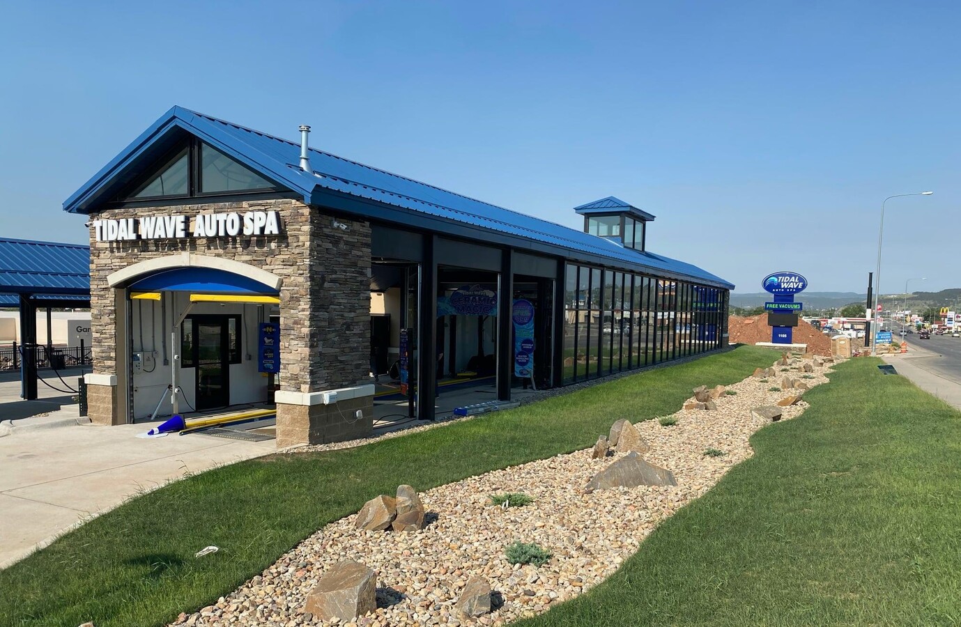
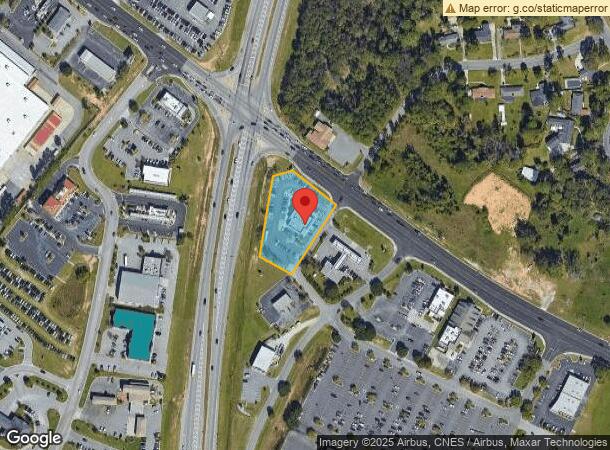
Property Record
24187 Us Highway 80 E, Statesboro, GA 30461
NEARBY LISTINGS FOR SALE OR LEASE
Property Detail
24187 Us Highway 80 E
Statesboro, GA
Mary Foreman
MS84000100-003
LOT A/1.169 AC
Commercialnec
Bulloch
X
Georgia
13031C0217D
a
2024
1.17 AC
2024
Georgia South Area
110500
Other Market Areas
3,836 SF
DEMOGRAPHICS near 24187 Us Highway 80 E
1 Mile
3 Mile
5 Mile
2024 Total Population
2,832
35,956
51,530
2029 Population
3,126
38,943
56,228
Pop Growth 2024-2029
+ 10.38%
+ 8.31%
+ 9.12%
Average Age
38
32
33
2024 Total Households
1,232
13,512
19,094
HH Growth 2024-2029
+ 10.96%
+ 9.13%
+ 9.91%
Median Household Inc
$60,173
$42,866
$51,443
Avg Household Size
2.20
2.30
2.40
2024 Avg HH Vehicles
2.00
2.00
2.00
Median Home Value
$174,589
$168,708
$195,688
Median Year Built
1983
1989
1992
Nearby Places
- Restaurants
- Banks
- Shops
- Fitness
- Groceries
SALE & LEASE HISTORY
LISTING DATE
SALE/LEASE

Feb 15, 2023
For Sale
Nearby Properties
Address
Land Use
TOTAL SIZE
Lot Size
Zoning
Address
Land Use
TOTAL SIZE
Lot Size
Zoning
612.82 AC
EXPT
Address
Land Use
TOTAL SIZE
Lot Size
Zoning
250,037 SF
30.67 AC
O
Address
Land Use
TOTAL SIZE
Lot Size
Zoning
9,870 SF
46.47 AC
CR/R4
Address
Land Use
TOTAL SIZE
Lot Size
Zoning
10,228 SF
24.06 AC
R4
Address
Land Use
TOTAL SIZE
Lot Size
Zoning
7,470 SF
39.71 AC
CR
Address
Land Use
TOTAL SIZE
Lot Size
Zoning
7,063 SF
22.96 AC
R4
Address
Land Use
TOTAL SIZE
Lot Size
Zoning
11,490 SF
10.01 AC
R4
Address
Land Use
TOTAL SIZE
Lot Size
Zoning
5.54 AC
EXPT
Address
Land Use
TOTAL SIZE
Lot Size
Zoning
146,137 SF
17.78 AC
CR
Address
Land Use
TOTAL SIZE
Lot Size
Zoning
8,824 SF
29.25 AC
PUD/R4
Address
Land Use
TOTAL SIZE
Lot Size
Zoning
41.09 AC
R3/R15
Address
Land Use
TOTAL SIZE
Lot Size
Zoning
55 AC
EXPT
Address
Land Use
TOTAL SIZE
Lot Size
Zoning
3,659 SF
38.60 AC
R40
Address
Land Use
TOTAL SIZE
Lot Size
Zoning
37,918 SF
9.93 AC
R4
Address
Land Use
TOTAL SIZE
Lot Size
Zoning
3,951 SF
20.19 AC
CR
Address
Land Use
TOTAL SIZE
Lot Size
Zoning
950 SF
12.73 AC
PUD/R4
Address
Land Use
TOTAL SIZE
Lot Size
Zoning
118,696 SF
18.26 AC
LI
Address
Land Use
TOTAL SIZE
Lot Size
Zoning
4,622 SF
17 AC
R4/CR
Address
Land Use
TOTAL SIZE
Lot Size
Zoning
22,392 SF
13.97 AC
R4
Address
Land Use
TOTAL SIZE
Lot Size
Zoning
102,529 SF
18.07 AC
CR
Address
Land Use
TOTAL SIZE
Lot Size
Zoning
3,552 SF
16.42 AC
PUD/R4/CR
Address
Land Use
TOTAL SIZE
Lot Size
Zoning
4,450 SF
26.60 AC
R4
Address
Land Use
TOTAL SIZE
Lot Size
Zoning
190,382 SF
23.53 AC
CR
Address
Land Use
TOTAL SIZE
Lot Size
Zoning
153.74 AC
R40
Address
Land Use
TOTAL SIZE
Lot Size
Zoning
60,537 SF
8.76 AC
CR
Address
Land Use
TOTAL SIZE
Lot Size
Zoning
8,394 SF
14.34 AC
R4/CR
Address
Land Use
TOTAL SIZE
Lot Size
Zoning
4,969 SF
13.52 AC
PUD/R4
Address
Land Use
TOTAL SIZE
Lot Size
Zoning
1,893 SF
10.73 AC
R4
Address
Land Use
TOTAL SIZE
Lot Size
Zoning
21.05 AC
PUD/R4
Address
Land Use
TOTAL SIZE
Lot Size
Zoning
76,118 SF
12.31 AC
CR
The World's #1 Commercial Real Estate Marketplace
Connect with us
© 2025 CoStar Group
The information above has been obtained from sources believed reliable. While we do not doubt its accuracy we have not verified it and make no guarantee, warranty or representation about it. It is your responsibility to independently confirm its accuracy and completeness. Any projections, opinions, assumptions, or estimates used are for example only and do not represent the current or future performance of the property. The value of this transaction to you depends on tax and other factors which should be evaluated by your tax, financial, and legal advisors. You and your advisors should conduct a careful, independent investigation of the property to determine to your satisfaction the suitability of the property for your needs.