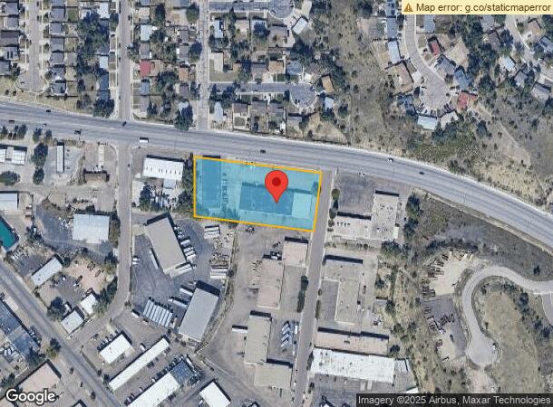
Property Record
2408 Hancock Expy, Colorado Springs, CO 80910


Current Lease Availabilities
NEARBY LISTINGS FOR SALE OR LEASE
Property Detail
2408 Hancock Expy
Colorado Springs
Sproul Rail Industrial Park Fil No 5
Colorado Springs, CO
LOT 3 BLK 1 SPROUL RAIL INDUSTRIAL PARK FIL NO 5 COLO SPGS
64342-07-001
El Paso
Warehouse
Colorado
2023
3
2024
1.86 AC
004501
Southeast
29,280 SF
DEMOGRAPHICS near 2408 Hancock Expy
1 Mile
3 Mile
5 Mile
2024 Total Population
10,629
114,397
231,531
2029 Population
11,101
120,066
242,090
Pop Growth 2024-2029
+ 4.44%
+ 4.96%
+ 4.56%
Average Age
35
35
36
2024 Total Households
4,004
44,667
89,785
HH Growth 2024-2029
+ 4.50%
+ 5.31%
+ 4.91%
Median Household Inc
$55,922
$55,507
$60,189
Avg Household Size
2.50
2.40
2.40
2024 Avg HH Vehicles
2.00
2.00
2.00
Median Home Value
$265,287
$283,814
$330,118
Median Year Built
1982
1983
1977
Nearby Places
- Restaurants
- Banks
- Shops
- Fitness
- Groceries
PUBLIC TRANSPORTATION
AIRPORT
City of Colorado Springs Municipal
DRIVE
WALK
Distance
City of Colorado Springs Municipal
16 min
7.5 mi
Freight Ports
Tulsa Port Of Catoosa
DRIVE
WALK
Distance
Tulsa Port Of Catoosa
742 min
694.0 mi
Nearby Properties
Address
Land Use
TOTAL SIZE
Lot Size
Zoning
Address
Land Use
TOTAL SIZE
Lot Size
Zoning
309,046 SF
28.95 AC
PF SS
Address
Land Use
TOTAL SIZE
Lot Size
Zoning
152,977 SF
39.50 AC
PBC/CR PBC
Address
Land Use
TOTAL SIZE
Lot Size
Zoning
226,448 SF
16.80 AC
OC/CR
Address
Land Use
TOTAL SIZE
Lot Size
Zoning
233,194 SF
30 AC
R1-6 SS AO
Address
Land Use
TOTAL SIZE
Lot Size
Zoning
24,445 SF
Address
Land Use
TOTAL SIZE
Lot Size
Zoning
166,182 SF
26.35 AC
PIP1/CR
Address
Land Use
TOTAL SIZE
Lot Size
Zoning
200,642 SF
6.65 AC
PBC HR AO
Address
Land Use
TOTAL SIZE
Lot Size
Zoning
704,240 SF
41.99 AC
PIP2/CR UV
Address
Land Use
TOTAL SIZE
Lot Size
Zoning
261,184 SF
17.39 AC
PBC CU
Address
Land Use
TOTAL SIZE
Lot Size
Zoning
100,020 SF
9.03 AC
Address
Land Use
TOTAL SIZE
Lot Size
Zoning
168,835 SF
33 AC
PF SS
Address
Land Use
TOTAL SIZE
Lot Size
Zoning
215,377 SF
11.24 AC
R5/CR
Address
Land Use
TOTAL SIZE
Lot Size
Zoning
109,739 SF
18.61 AC
PIP2/CR CU
Address
Land Use
TOTAL SIZE
Lot Size
Zoning
60,730 SF
4.26 AC
PIP2
Address
Land Use
TOTAL SIZE
Lot Size
Zoning
124,597 SF
10.89 AC
PIP2/CR AO
Address
Land Use
TOTAL SIZE
Lot Size
Zoning
162,945 SF
20.05 AC
PIP2/CR CU
Address
Land Use
TOTAL SIZE
Lot Size
Zoning
135,296 SF
11.67 AC
PIP2/CR UV
Address
Land Use
TOTAL SIZE
Lot Size
Zoning
131,040 SF
8.50 AC
PIP2/CR AO
Address
Land Use
TOTAL SIZE
Lot Size
Zoning
148,414 SF
24.09 AC
C5 UV
Address
Land Use
TOTAL SIZE
Lot Size
Zoning
109,200 SF
6.13 AC
PIP2/CR AO
Address
Land Use
TOTAL SIZE
Lot Size
Zoning
23,535 SF
15.91 AC
PIP2/CR AO
Address
Land Use
TOTAL SIZE
Lot Size
Zoning
123,644 SF
74.14 AC
PF M2 SS
Address
Land Use
TOTAL SIZE
Lot Size
Zoning
65,400 SF
13.65 AC
PF CU
Address
Land Use
TOTAL SIZE
Lot Size
Zoning
71,438 SF
9.81 AC
R5/CR
Address
Land Use
TOTAL SIZE
Lot Size
Zoning
68,075 SF
Address
Land Use
TOTAL SIZE
Lot Size
Zoning
70,466 SF
4.26 AC
OC AO
Address
Land Use
TOTAL SIZE
Lot Size
Zoning
131,040 SF
9.68 AC
PIP2 AO
Address
Land Use
TOTAL SIZE
Lot Size
Zoning
98,638 SF
7.22 AC
PBC AO
Address
Land Use
TOTAL SIZE
Lot Size
Zoning
204,535 SF
12.53 AC
PUD
Address
Land Use
TOTAL SIZE
Lot Size
Zoning
201,512 SF
19.73 AC
C6
The World's #1 Commercial Real Estate Marketplace
Connect with us
© 2025 CoStar Group
The information above has been obtained from sources believed reliable. While we do not doubt its accuracy we have not verified it and make no guarantee, warranty or representation about it. It is your responsibility to independently confirm its accuracy and completeness. Any projections, opinions, assumptions, or estimates used are for example only and do not represent the current or future performance of the property. The value of this transaction to you depends on tax and other factors which should be evaluated by your tax, financial, and legal advisors. You and your advisors should conduct a careful, independent investigation of the property to determine to your satisfaction the suitability of the property for your needs.