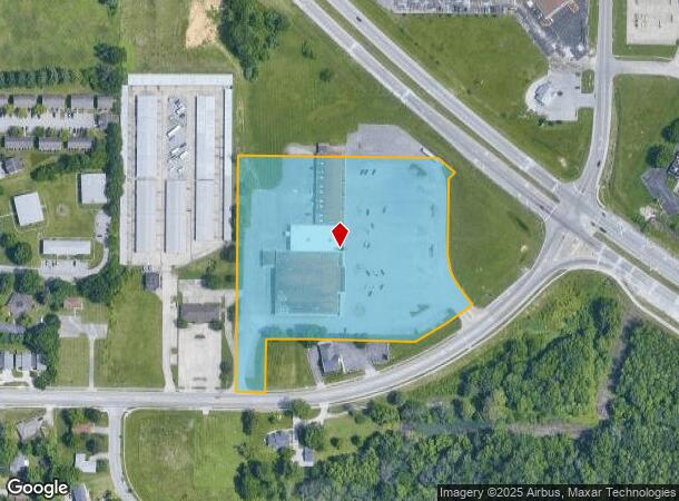
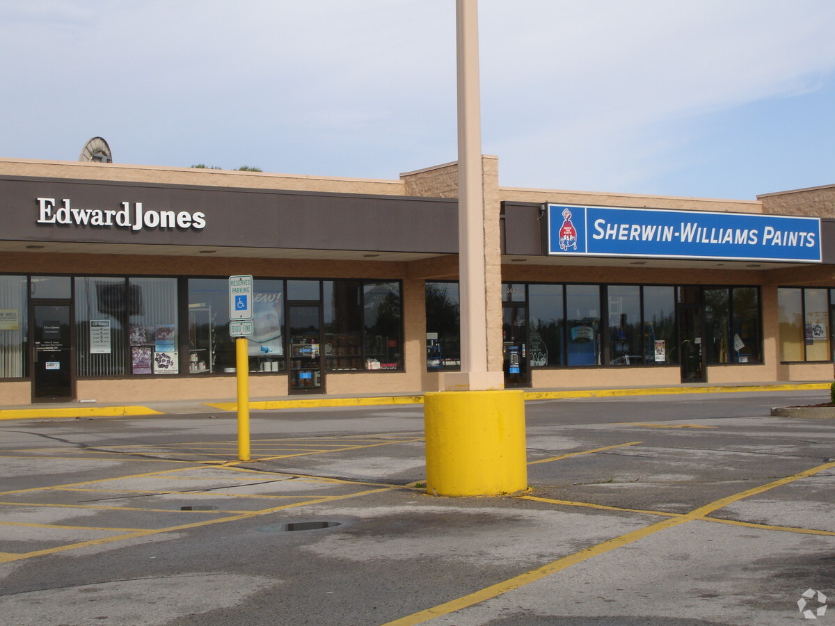
Property Record
2421 W Main St, Carbondale, IL 62901

NEARBY LISTINGS FOR SALE OR LEASE
Property Detail
2421 W Main St
Carbondale-Marion, IL
Westpark Plaza
15-18-476-017
FROM 15-18-476-006 & 007 LOT 1 - WESTPARK PLAZA 18-9-1 PC 2 SL 158 2010/11055
Commercialnec
Jackson
X
Illinois
17199C0150D
1
2023
7.21 AC
2023
Marion/I-64 & South
0110001073
Other Market Areas
DEMOGRAPHICS near 2421 W Main St
1 Mile
3 Mile
5 Mile
2024 Total Population
3,803
22,412
29,943
2029 Population
3,752
22,395
29,833
Pop Growth 2024-2029
(1.34%)
(0.08%)
(0.37%)
Average Age
45
35
36
2024 Total Households
1,748
9,922
13,340
HH Growth 2024-2029
(1.49%)
0.00%
(0.37%)
Median Household Inc
$75,682
$29,027
$32,263
Avg Household Size
2.00
1.90
2.00
2024 Avg HH Vehicles
2.00
1.00
1.00
Median Home Value
$167,286
$141,904
$142,303
Median Year Built
1977
1978
1978
Nearby Places
- Restaurants
- Banks
- Shops
- Fitness
- Groceries
PUBLIC TRANSPORTATION
COMMUTER RAIL
Carbondale (City of New Orleans - Amtrak, Illini - Amtrak, Saluki - Amtrak)
DRIVE
WALK
Distance
Carbondale (City of New Orleans - Amtrak, Illini - Amtrak, Saluki - Amtrak)
5 min
2.2 mi
Freight Ports
Tulsa Port of Inola
DRIVE
WALK
Distance
Tulsa Port of Inola
550 min
469.2 mi
SALE & LEASE HISTORY
LISTING DATE
SALE/LEASE

Feb 23, 2018
For Lease
Nearby Properties
Address
Land Use
TOTAL SIZE
Lot Size
Zoning
Address
Land Use
TOTAL SIZE
Lot Size
Zoning
Address
Land Use
TOTAL SIZE
Lot Size
Zoning
27.03 AC
Address
Land Use
TOTAL SIZE
Lot Size
Zoning
16.78 AC
Address
Land Use
TOTAL SIZE
Lot Size
Zoning
3.76 AC
Address
Land Use
TOTAL SIZE
Lot Size
Zoning
Address
Land Use
TOTAL SIZE
Lot Size
Zoning
Address
Land Use
TOTAL SIZE
Lot Size
Zoning
2.50 AC
Address
Land Use
TOTAL SIZE
Lot Size
Zoning
Address
Land Use
TOTAL SIZE
Lot Size
Zoning
Address
Land Use
TOTAL SIZE
Lot Size
Zoning
1.21 AC
Address
Land Use
TOTAL SIZE
Lot Size
Zoning
7.50 AC
Address
Land Use
TOTAL SIZE
Lot Size
Zoning
0.85 AC
Address
Land Use
TOTAL SIZE
Lot Size
Zoning
1.89 AC
Address
Land Use
TOTAL SIZE
Lot Size
Zoning
2.46 AC
Address
Land Use
TOTAL SIZE
Lot Size
Zoning
Address
Land Use
TOTAL SIZE
Lot Size
Zoning
4.66 AC
Address
Land Use
TOTAL SIZE
Lot Size
Zoning
4.25 AC
Address
Land Use
TOTAL SIZE
Lot Size
Zoning
0.35 AC
Address
Land Use
TOTAL SIZE
Lot Size
Zoning
3.03 AC
Address
Land Use
TOTAL SIZE
Lot Size
Zoning
9.68 AC
Address
Land Use
TOTAL SIZE
Lot Size
Zoning
Address
Land Use
TOTAL SIZE
Lot Size
Zoning
2.03 AC
Address
Land Use
TOTAL SIZE
Lot Size
Zoning
Address
Land Use
TOTAL SIZE
Lot Size
Zoning
0.71 AC
Address
Land Use
TOTAL SIZE
Lot Size
Zoning
0.88 AC
The World's #1 Commercial Real Estate Marketplace
Connect with us
© 2025 CoStar Group
The information above has been obtained from sources believed reliable. While we do not doubt its accuracy we have not verified it and make no guarantee, warranty or representation about it. It is your responsibility to independently confirm its accuracy and completeness. Any projections, opinions, assumptions, or estimates used are for example only and do not represent the current or future performance of the property. The value of this transaction to you depends on tax and other factors which should be evaluated by your tax, financial, and legal advisors. You and your advisors should conduct a careful, independent investigation of the property to determine to your satisfaction the suitability of the property for your needs.