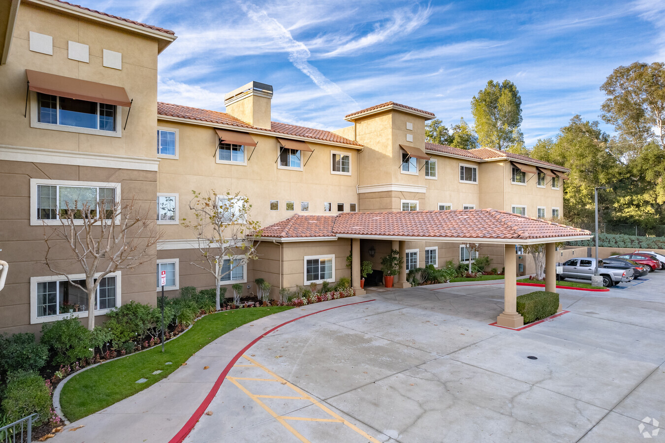
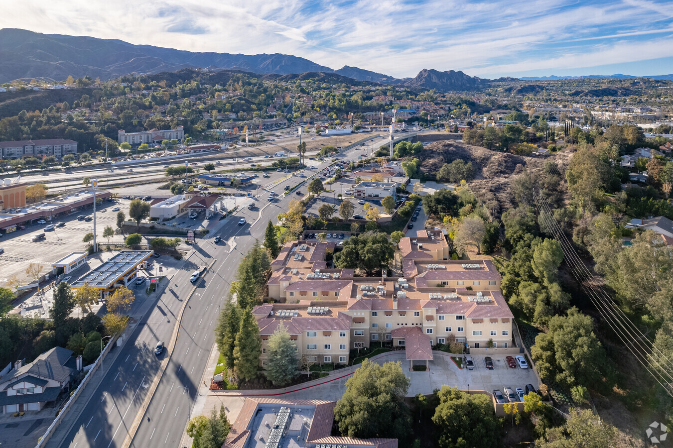
Property Record
24431 Lyons Ave, Newhall, CA 91321

NEARBY LISTINGS FOR SALE OR LEASE
-
-
View all Newhall listings for sale on LoopNet.com
Property Detail
24431 Lyons Ave
Los Angeles-Long Beach-Glendale, CA
St John
2851-014-005
LOT COM AT INTERSECTION OF N LINE OF LOT 2 IN SEC 4 T 3N R 16W WITH NE LINE OF GOLDEN STATE FRWY (PER OR 7363-128) TH SE ON SD NE LINE 58.15 FT TH S 78 04 E 302.4 FT TH N 11 56 E 50 FT TH S LOT/SEC 4 BLK/DIV/TWN 3N REG/RNG16
Hospitalprivate
Los Angeles
X
California
06037C0818G
2
2024
1.35 AC
2024
Santa Clarita Valley
920334
Los Angeles
52,633 SF
DEMOGRAPHICS near 24431 Lyons Ave
1 Mile
3 Mile
5 Mile
2024 Total Population
15,219
71,422
109,299
2029 Population
14,794
69,028
105,678
Pop Growth 2024-2029
(2.79%)
(3.35%)
(3.31%)
Average Age
41
40
40
2024 Total Households
5,476
24,675
37,906
HH Growth 2024-2029
(3.07%)
(3.64%)
(3.59%)
Median Household Inc
$110,547
$110,788
$110,900
Avg Household Size
2.60
2.80
2.80
2024 Avg HH Vehicles
2.00
2.00
2.00
Median Home Value
$727,538
$772,597
$744,869
Median Year Built
1978
1986
1988
Nearby Places
- Restaurants
- Banks
- Shops
- Fitness
- Groceries
PUBLIC TRANSPORTATION
COMMUTER RAIL
Newhall (Antelope Valley Line - Southern California Regional Rail Authority (Metrolink))
DRIVE
WALK
Distance
Newhall (Antelope Valley Line - Southern California Regional Rail Authority (Metrolink))
6 min
2.5 mi
Santa Clarita (Antelope Valley Line - Southern California Regional Rail Authority (Metrolink))
DRIVE
WALK
Distance
Santa Clarita (Antelope Valley Line - Southern California Regional Rail Authority (Metrolink))
10 min
6.1 mi
AIRPORT
Bob Hope
DRIVE
WALK
Distance
Bob Hope
24 min
18.9 mi
Freight Ports
The Port of Hueneme
DRIVE
WALK
Distance
The Port of Hueneme
74 min
53.2 mi
Nearby Properties
Address
Land Use
TOTAL SIZE
Lot Size
Zoning
Address
Land Use
TOTAL SIZE
Lot Size
Zoning
491,654 SF
17.56 AC
SCPI
Address
Land Use
TOTAL SIZE
Lot Size
Zoning
479,178 SF
14.17 AC
SCCR
Address
Land Use
TOTAL SIZE
Lot Size
Zoning
173,298 SF
12.42 AC
LCA25*
Address
Land Use
TOTAL SIZE
Lot Size
Zoning
200,717 SF
7.62 AC
SCCR
Address
Land Use
TOTAL SIZE
Lot Size
Zoning
197,558 SF
3.08 AC
SCBP
Address
Land Use
TOTAL SIZE
Lot Size
Zoning
495,604 SF
38.40 AC
SCI
Address
Land Use
TOTAL SIZE
Lot Size
Zoning
291,344 SF
15.32 AC
LCA2
Address
Land Use
TOTAL SIZE
Lot Size
Zoning
1,014,267 SF
59.94 AC
SCPI
Address
Land Use
TOTAL SIZE
Lot Size
Zoning
225,723 SF
11.36 AC
Address
Land Use
TOTAL SIZE
Lot Size
Zoning
245,053 SF
19.81 AC
LCA25*
Address
Land Use
TOTAL SIZE
Lot Size
Zoning
139,196 SF
8.79 AC
SCUR5
Address
Land Use
TOTAL SIZE
Lot Size
Zoning
325,406 SF
4.11 AC
SCBP
Address
Land Use
TOTAL SIZE
Lot Size
Zoning
161,103 SF
4.68 AC
SCUR4
Address
Land Use
TOTAL SIZE
Lot Size
Zoning
180,450 SF
5.08 AC
SCCR
Address
Land Use
TOTAL SIZE
Lot Size
Zoning
143,163 SF
10.48 AC
SCUR3
Address
Land Use
TOTAL SIZE
Lot Size
Zoning
402,480 SF
13.58 AC
SCCN
Address
Land Use
TOTAL SIZE
Lot Size
Zoning
137,361 SF
7.38 AC
SCUR3
Address
Land Use
TOTAL SIZE
Lot Size
Zoning
118,380 SF
4.52 AC
LCA2
Address
Land Use
TOTAL SIZE
Lot Size
Zoning
83,698 SF
8.94 AC
SCPI
Address
Land Use
TOTAL SIZE
Lot Size
Zoning
174,562 SF
4.01 AC
SCCR
Address
Land Use
TOTAL SIZE
Lot Size
Zoning
212,783 SF
11.44 AC
SCBP
Address
Land Use
TOTAL SIZE
Lot Size
Zoning
132,668 SF
0.90 AC
SCCR
Address
Land Use
TOTAL SIZE
Lot Size
Zoning
271,399 SF
7.49 AC
LCA25*
Address
Land Use
TOTAL SIZE
Lot Size
Zoning
131,425 SF
0.82 AC
SCCR
Address
Land Use
TOTAL SIZE
Lot Size
Zoning
93,450 SF
4.83 AC
LCA2
Address
Land Use
TOTAL SIZE
Lot Size
Zoning
86,201 SF
3.68 AC
SCUR4
Address
Land Use
TOTAL SIZE
Lot Size
Zoning
320,405 SF
8.03 AC
SCCR
Address
Land Use
TOTAL SIZE
Lot Size
Zoning
138,025 SF
14.50 AC
LCA2
Address
Land Use
TOTAL SIZE
Lot Size
Zoning
245,606 SF
11.66 AC
SCUR4
Address
Land Use
TOTAL SIZE
Lot Size
Zoning
78,596 SF
4.62 AC
SCCR
The World's #1 Commercial Real Estate Marketplace
Connect with us
© 2025 CoStar Group
The information above has been obtained from sources believed reliable. While we do not doubt its accuracy we have not verified it and make no guarantee, warranty or representation about it. It is your responsibility to independently confirm its accuracy and completeness. Any projections, opinions, assumptions, or estimates used are for example only and do not represent the current or future performance of the property. The value of this transaction to you depends on tax and other factors which should be evaluated by your tax, financial, and legal advisors. You and your advisors should conduct a careful, independent investigation of the property to determine to your satisfaction the suitability of the property for your needs.