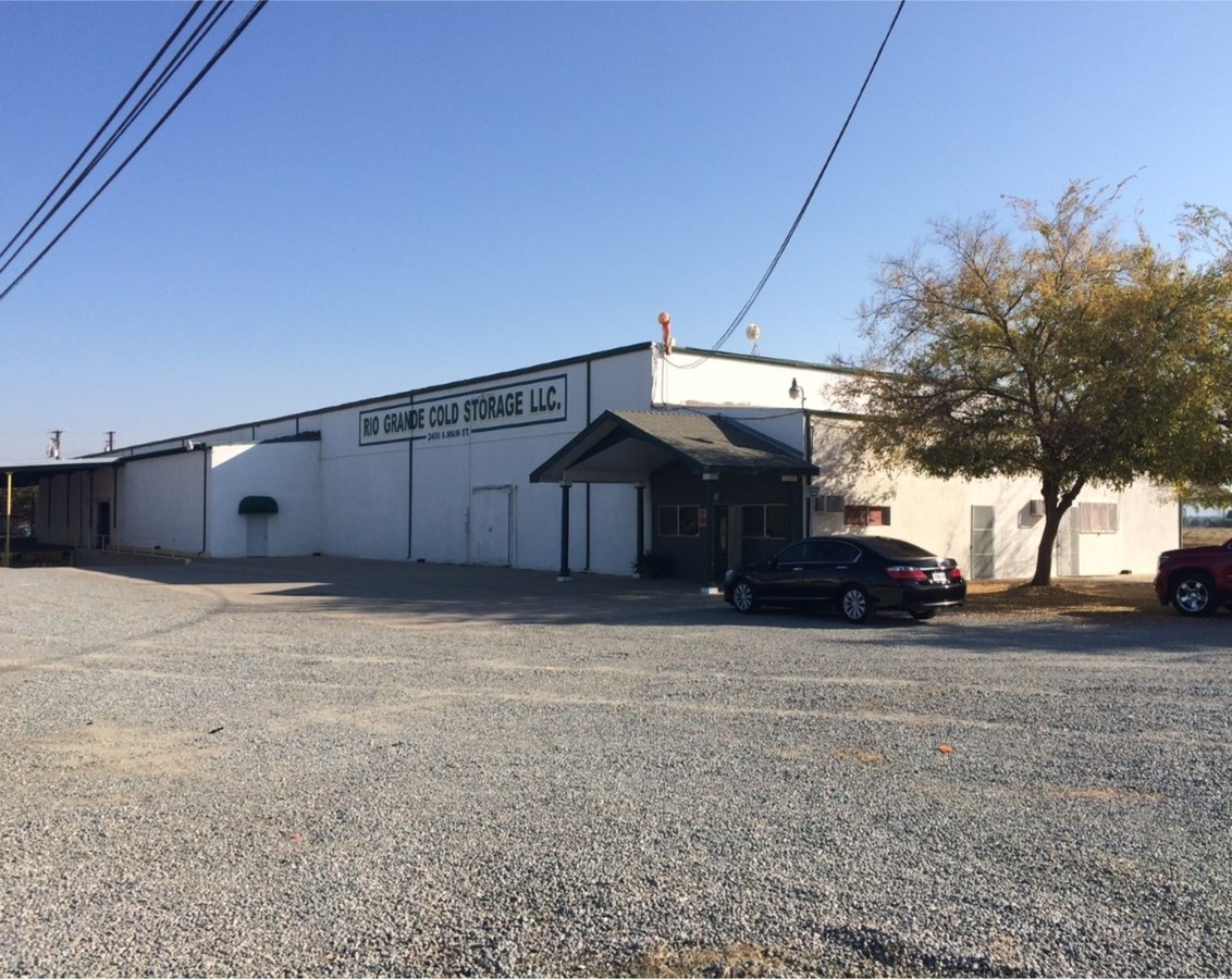
Property Record
2450 S Main St, Porterville, CA 93257

NEARBY LISTINGS FOR SALE OR LEASE
Property Detail
2450 S Main St
Visalia-Porterville, CA
Campo Verde Colony
303-060-036-000
POR N/2 SEC 14-22-27
Packing
Tulare
X
California
06107C1645E
69
2024
6.98 AC
2024
SW Outlying Tulare County
003402
Visalia/Porterville
21,360 SF
DEMOGRAPHICS near 2450 S Main St
1 Mile
3 Mile
5 Mile
2024 Total Population
289
17,919
71,282
2029 Population
283
18,390
73,304
Pop Growth 2024-2029
(2.08%)
+ 2.63%
+ 2.84%
Average Age
40
34
34
2024 Total Households
102
4,934
20,402
HH Growth 2024-2029
(1.96%)
+ 2.53%
+ 2.82%
Median Household Inc
$53,000
$47,236
$47,854
Avg Household Size
2.80
3.50
3.40
2024 Avg HH Vehicles
2.00
2.00
2.00
Median Home Value
$283,333
$232,420
$240,185
Median Year Built
1978
1982
1979
Nearby Places
- Restaurants
- Banks
- Shops
- Fitness
- Groceries
SALE & LEASE HISTORY
LISTING DATE
SALE/LEASE

Nov 16, 2016
For Sale
Nearby Properties
Address
Land Use
TOTAL SIZE
Lot Size
Zoning
Address
Land Use
TOTAL SIZE
Lot Size
Zoning
727,643 SF
43.05 AC
M-1
Address
Land Use
TOTAL SIZE
Lot Size
Zoning
379,008 SF
36.46 AC
M-1
Address
Land Use
TOTAL SIZE
Lot Size
Zoning
139,487 SF
11.54 AC
CR
Address
Land Use
TOTAL SIZE
Lot Size
Zoning
Address
Land Use
TOTAL SIZE
Lot Size
Zoning
95,450 SF
11.61 AC
CR
Address
Land Use
TOTAL SIZE
Lot Size
Zoning
125,074 SF
5.96 AC
Address
Land Use
TOTAL SIZE
Lot Size
Zoning
54,129 SF
3.44 AC
C-3
Address
Land Use
TOTAL SIZE
Lot Size
Zoning
64,271 SF
1.90 AC
R4D
Address
Land Use
TOTAL SIZE
Lot Size
Zoning
37,951 SF
1.62 AC
Address
Land Use
TOTAL SIZE
Lot Size
Zoning
9,013 SF
1.49 AC
PD
Address
Land Use
TOTAL SIZE
Lot Size
Zoning
88,731 SF
32.80 AC
M-1
Address
Land Use
TOTAL SIZE
Lot Size
Zoning
10,191 SF
1.03 AC
PD
Address
Land Use
TOTAL SIZE
Lot Size
Zoning
144,964 SF
13.12 AC
Address
Land Use
TOTAL SIZE
Lot Size
Zoning
25,837 SF
1.11 AC
PO
Address
Land Use
TOTAL SIZE
Lot Size
Zoning
Address
Land Use
TOTAL SIZE
Lot Size
Zoning
9,960 SF
1.21 AC
AE10
Address
Land Use
TOTAL SIZE
Lot Size
Zoning
40,880 SF
12.02 AC
M-2
Address
Land Use
TOTAL SIZE
Lot Size
Zoning
6,000 SF
0.84 AC
C-2
Address
Land Use
TOTAL SIZE
Lot Size
Zoning
11,130 SF
20.33 AC
M-1
Address
Land Use
TOTAL SIZE
Lot Size
Zoning
9,560 SF
3.10 AC
AE10
Address
Land Use
TOTAL SIZE
Lot Size
Zoning
82,620 SF
16.80 AC
A-D
Address
Land Use
TOTAL SIZE
Lot Size
Zoning
16 AC
AE-20
Address
Land Use
TOTAL SIZE
Lot Size
Zoning
4.45 AC
Address
Land Use
TOTAL SIZE
Lot Size
Zoning
Address
Land Use
TOTAL SIZE
Lot Size
Zoning
1.26 AC
Address
Land Use
TOTAL SIZE
Lot Size
Zoning
1.55 AC
Address
Land Use
TOTAL SIZE
Lot Size
Zoning
51,730 SF
4.91 AC
AE10
The World's #1 Commercial Real Estate Marketplace
Connect with us
© 2025 CoStar Group
The information above has been obtained from sources believed reliable. While we do not doubt its accuracy we have not verified it and make no guarantee, warranty or representation about it. It is your responsibility to independently confirm its accuracy and completeness. Any projections, opinions, assumptions, or estimates used are for example only and do not represent the current or future performance of the property. The value of this transaction to you depends on tax and other factors which should be evaluated by your tax, financial, and legal advisors. You and your advisors should conduct a careful, independent investigation of the property to determine to your satisfaction the suitability of the property for your needs.