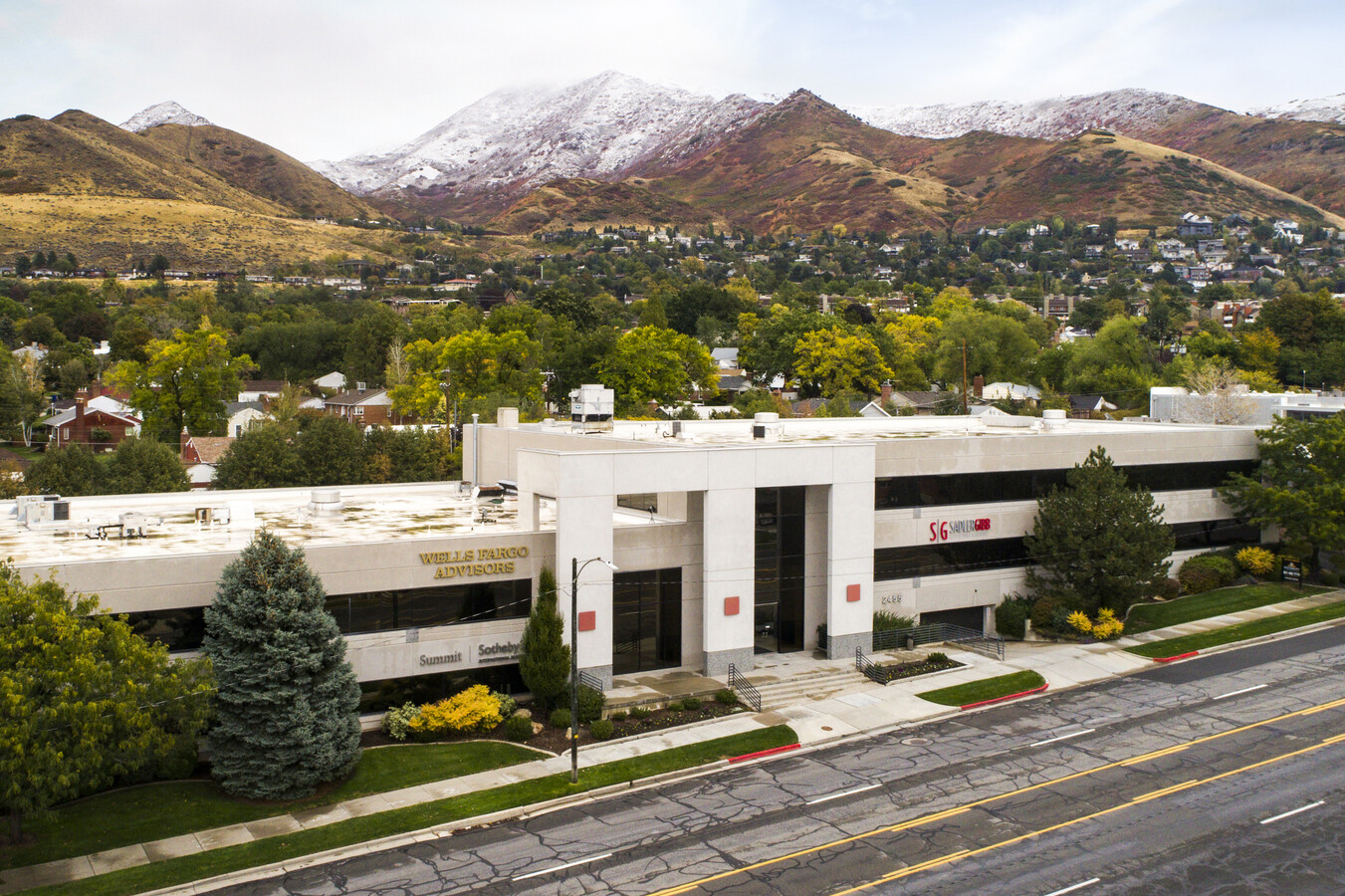
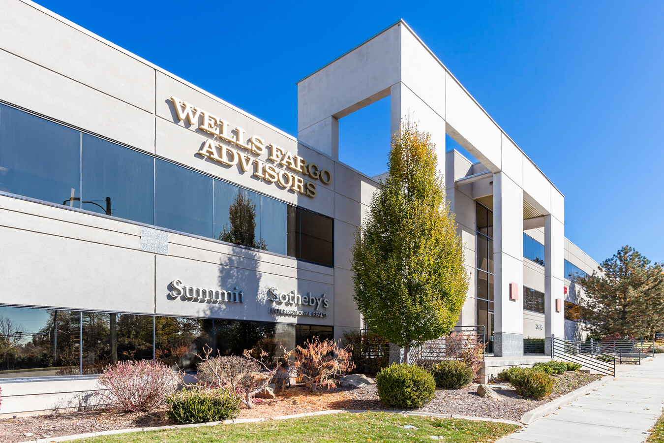
Property Record
2455 E Parleys Way, Salt Lake City, UT 84109

Current Lease Availabilities
NEARBY LISTINGS FOR SALE OR LEASE
Property Detail
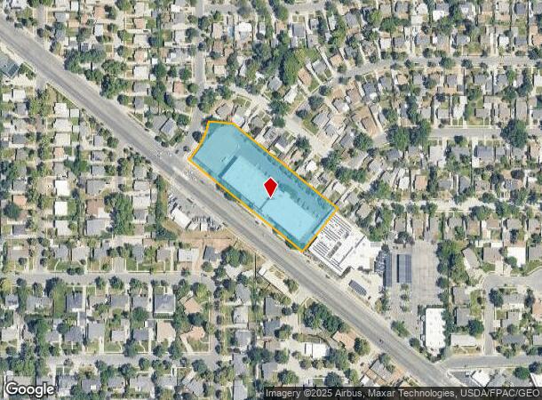
2455 E Parleys Way
Salt Lake City, UT
Parleys Corporate Center Subdivision
16-22-276-039-0000
LOT 1, PARLEYS CORPORATE CENTER SUBDIVISION.
Officebuilding
Salt Lake
X
Utah
49035C0302H
1
2023
2.11 AC
2023
Foothill Corridor
104300
Salt Lake City
85,095 SF
DEMOGRAPHICS near 2455 E Parleys Way
1 Mile
3 Mile
5 Mile
2024 Total Population
13,365
99,462
246,794
2029 Population
13,607
100,072
250,013
Pop Growth 2024-2029
+ 1.81%
+ 0.61%
+ 1.30%
Average Age
39
38
38
2024 Total Households
5,306
39,570
106,164
HH Growth 2024-2029
+ 1.94%
+ 0.65%
+ 1.50%
Median Household Inc
$104,467
$95,130
$71,419
Avg Household Size
2.40
2.40
2.20
2024 Avg HH Vehicles
2.00
2.00
2.00
Median Home Value
$726,190
$646,317
$591,655
Median Year Built
1958
1957
1967
Nearby Places
- Restaurants
- Banks
- Shops
- Fitness
- Groceries
PUBLIC TRANSPORTATION
AIRPORT
Salt Lake City International
DRIVE
WALK
Distance
Salt Lake City International
20 min
14.6 mi
Freight Ports
Port of Stockton
DRIVE
WALK
Distance
Port of Stockton
720 min
705.0 mi
Nearby Properties
Address
Land Use
TOTAL SIZE
Lot Size
Zoning
Address
Land Use
TOTAL SIZE
Lot Size
Zoning
629,582 SF
80.77 AC
I
Address
Land Use
TOTAL SIZE
Lot Size
Zoning
457,024 SF
127 AC
RP
Address
Land Use
TOTAL SIZE
Lot Size
Zoning
296,978 SF
27.30 AC
I
Address
Land Use
TOTAL SIZE
Lot Size
Zoning
234,508 SF
113.27 AC
RP
Address
Land Use
TOTAL SIZE
Lot Size
Zoning
440,898 SF
0.01 AC
RP
Address
Land Use
TOTAL SIZE
Lot Size
Zoning
207,140 SF
23.06 AC
P
Address
Land Use
TOTAL SIZE
Lot Size
Zoning
308,431 SF
38 AC
I
Address
Land Use
TOTAL SIZE
Lot Size
Zoning
16,933 SF
34.68 AC
1205
Address
Land Use
TOTAL SIZE
Lot Size
Zoning
497,018 SF
13.11 AC
1205
Address
Land Use
TOTAL SIZE
Lot Size
Zoning
166,938 SF
51.07 AC
I
Address
Land Use
TOTAL SIZE
Lot Size
Zoning
183,600 SF
10.70 AC
RMF-35
Address
Land Use
TOTAL SIZE
Lot Size
Zoning
728,665 SF
0.01 AC
RP
Address
Land Use
TOTAL SIZE
Lot Size
Zoning
426,600 SF
1.61 AC
CSHBD1
Address
Land Use
TOTAL SIZE
Lot Size
Zoning
115,169 SF
119.06 AC
RP
Address
Land Use
TOTAL SIZE
Lot Size
Zoning
232,984 SF
52.19 AC
RP
Address
Land Use
TOTAL SIZE
Lot Size
Zoning
296,854 SF
10.97 AC
1205
Address
Land Use
TOTAL SIZE
Lot Size
Zoning
903,167 SF
1.90 AC
CSHBD1
Address
Land Use
TOTAL SIZE
Lot Size
Zoning
297,476 SF
1.74 AC
Address
Land Use
TOTAL SIZE
Lot Size
Zoning
369,717 SF
2.50 AC
RO
Address
Land Use
TOTAL SIZE
Lot Size
Zoning
323,689 SF
29.21 AC
1205
Address
Land Use
TOTAL SIZE
Lot Size
Zoning
152,579 SF
25.45 AC
I
Address
Land Use
TOTAL SIZE
Lot Size
Zoning
8,042 SF
64.58 AC
RP
Address
Land Use
TOTAL SIZE
Lot Size
Zoning
568,776 SF
0.01 AC
RP
Address
Land Use
TOTAL SIZE
Lot Size
Zoning
107,416 SF
5.46 AC
C-SHBD
Address
Land Use
TOTAL SIZE
Lot Size
Zoning
115,106 SF
12.87 AC
I
Address
Land Use
TOTAL SIZE
Lot Size
Zoning
263,894 SF
49.02 AC
I
Address
Land Use
TOTAL SIZE
Lot Size
Zoning
269,946 SF
25.87 AC
1108
Address
Land Use
TOTAL SIZE
Lot Size
Zoning
386,512 SF
9.66 AC
C-SHDB
Address
Land Use
TOTAL SIZE
Lot Size
Zoning
266,380 SF
2.09 AC
CSHBD1
Address
Land Use
TOTAL SIZE
Lot Size
Zoning
649,879 SF
10.17 AC
CS
The World's #1 Commercial Real Estate Marketplace
Connect with us
© 2025 CoStar Group
The information above has been obtained from sources believed reliable. While we do not doubt its accuracy we have not verified it and make no guarantee, warranty or representation about it. It is your responsibility to independently confirm its accuracy and completeness. Any projections, opinions, assumptions, or estimates used are for example only and do not represent the current or future performance of the property. The value of this transaction to you depends on tax and other factors which should be evaluated by your tax, financial, and legal advisors. You and your advisors should conduct a careful, independent investigation of the property to determine to your satisfaction the suitability of the property for your needs.