Property Record
2464 Kalakaua Ave, Honolulu, HI 96815

NEARBY LISTINGS FOR SALE OR LEASE
Property Detail
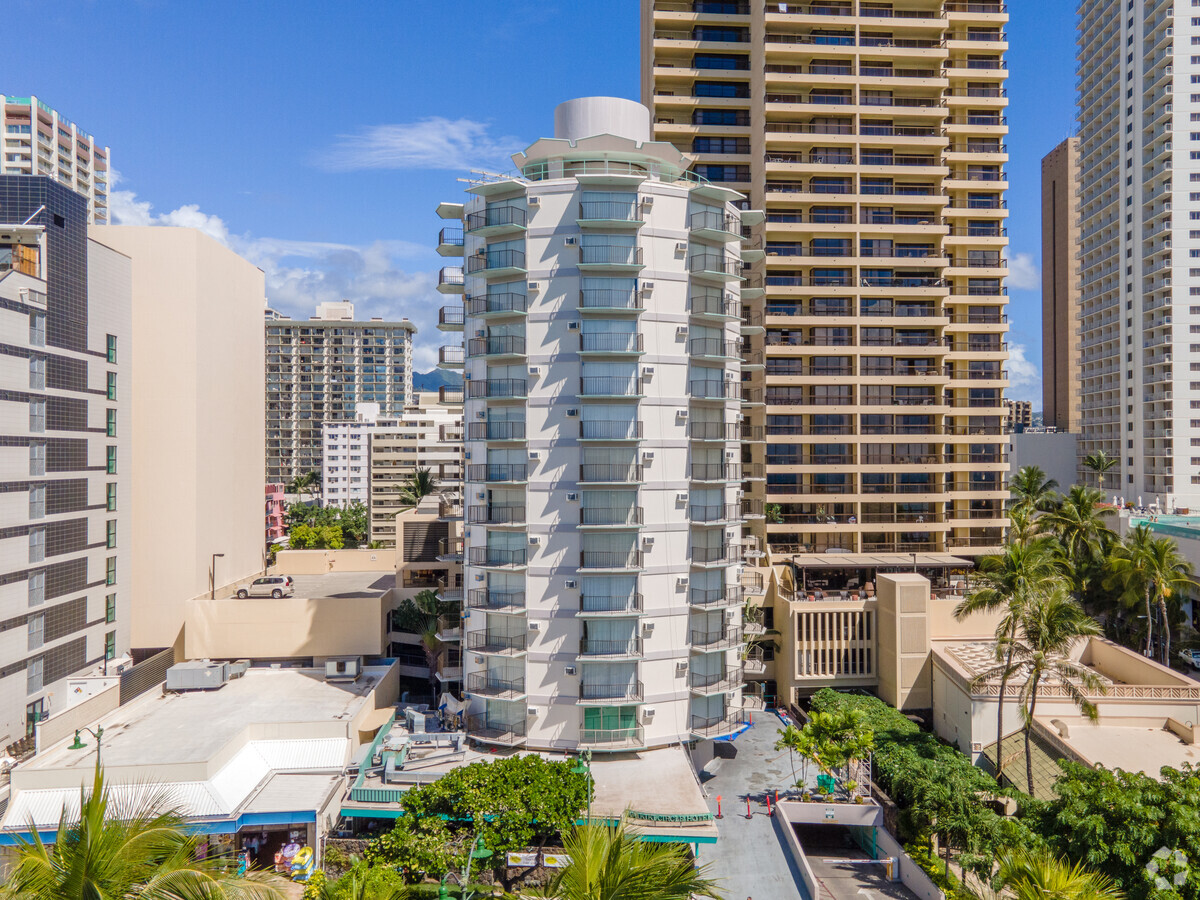
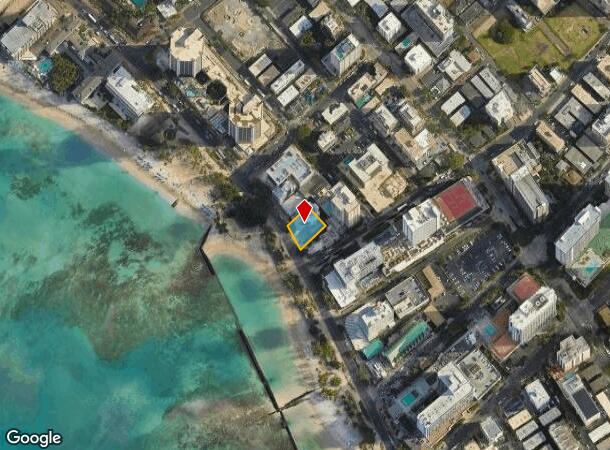
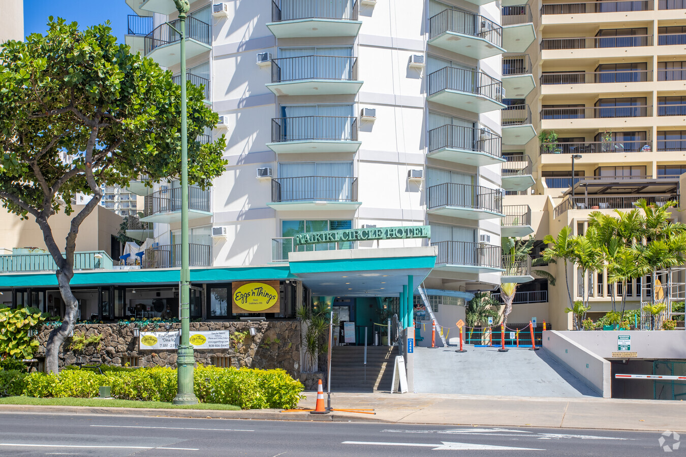
2464 Kalakaua Ave
Urban Honolulu, HI
Waikiki Circle Hotel
1-2-6-023-002-0000
LOT A POR RP 4493 LCAW 104 11,534 SF SUBJ/ESMT SEWER
Resorthotel
Honolulu
X
Hawaii
15003C0368G
a
2024
0.26 AC
2024
Waikiki
001801
Hawaii
7,865 SF
DEMOGRAPHICS near 2464 Kalakaua Ave
1 Mile
3 Mile
5 Mile
2024 Total Population
44,958
211,705
300,015
2029 Population
46,093
211,890
297,895
Pop Growth 2024-2029
+ 2.52%
+ 0.09%
(0.71%)
Average Age
45
45
45
2024 Total Households
22,773
95,505
127,462
HH Growth 2024-2029
+ 2.53%
(0.08%)
(0.81%)
Median Household Inc
$64,122
$73,123
$74,867
Avg Household Size
1.90
2.10
2.20
2024 Avg HH Vehicles
1.00
1.00
1.00
Median Home Value
$547,067
$770,930
$813,047
Median Year Built
1973
1973
1973
Nearby Places
- Restaurants
- Banks
- Shops
- Fitness
- Groceries
PUBLIC TRANSPORTATION
AIRPORT
Daniel K Inouye International
DRIVE
WALK
Distance
Daniel K Inouye International
20 min
10.0 mi
Freight Ports
Honolulu Harbor, Oahu
DRIVE
WALK
Distance
Honolulu Harbor, Oahu
22 min
8.8 mi
Nearby Properties
Address
Land Use
TOTAL SIZE
Lot Size
Zoning
Address
Land Use
TOTAL SIZE
Lot Size
Zoning
7,944,402 SF
34.93 AC
U/33/30
Address
Land Use
TOTAL SIZE
Lot Size
Zoning
491,116 SF
9.06 AC
U/X6/20
Address
Land Use
TOTAL SIZE
Lot Size
Zoning
119.90 AC
U/X7/60
Address
Land Use
TOTAL SIZE
Lot Size
Zoning
264,870 SF
3.47 AC
U/X6/20
Address
Land Use
TOTAL SIZE
Lot Size
Zoning
13,088 SF
75.21 AC
U/62/90
Address
Land Use
TOTAL SIZE
Lot Size
Zoning
193,478 SF
10.34 AC
U/X6/20
Address
Land Use
TOTAL SIZE
Lot Size
Zoning
1,100,000 SF
9.65 AC
U/33/30
Address
Land Use
TOTAL SIZE
Lot Size
Zoning
292,691 SF
1.09 AC
U/X6/20
Address
Land Use
TOTAL SIZE
Lot Size
Zoning
164,234 SF
2.56 AC
U/X6/20
Address
Land Use
TOTAL SIZE
Lot Size
Zoning
495,002 SF
2.42 AC
U/X6/20
Address
Land Use
TOTAL SIZE
Lot Size
Zoning
471,798 SF
6.31 AC
U/X5/30
Address
Land Use
TOTAL SIZE
Lot Size
Zoning
130,002 SF
2.50 AC
U/X6/20
Address
Land Use
TOTAL SIZE
Lot Size
Zoning
45.65 AC
U/KA/70
Address
Land Use
TOTAL SIZE
Lot Size
Zoning
42.67 AC
U/62/90
Address
Land Use
TOTAL SIZE
Lot Size
Zoning
1,339,500 SF
7.27 AC
U/33/30
Address
Land Use
TOTAL SIZE
Lot Size
Zoning
107,721 SF
2.76 AC
U/X6/20
Address
Land Use
TOTAL SIZE
Lot Size
Zoning
103,284 SF
1.84 AC
U/X6/20
Address
Land Use
TOTAL SIZE
Lot Size
Zoning
242,241 SF
2.40 AC
U/X6/20
Address
Land Use
TOTAL SIZE
Lot Size
Zoning
172,305 SF
2.54 AC
U/X6/70
Address
Land Use
TOTAL SIZE
Lot Size
Zoning
64,300 SF
0.77 AC
U/X6/20
Address
Land Use
TOTAL SIZE
Lot Size
Zoning
104,386 SF
1.04 AC
U/X6/20
Address
Land Use
TOTAL SIZE
Lot Size
Zoning
144,855 SF
1.74 AC
U/X6/20
Address
Land Use
TOTAL SIZE
Lot Size
Zoning
139,740 SF
2.82 AC
U/X6/20
Address
Land Use
TOTAL SIZE
Lot Size
Zoning
142,306 SF
3.02 AC
U/X6/20
Address
Land Use
TOTAL SIZE
Lot Size
Zoning
92,885 SF
1.18 AC
U/X6/20
Address
Land Use
TOTAL SIZE
Lot Size
Zoning
79,613 SF
1.33 AC
U/X6/20
Address
Land Use
TOTAL SIZE
Lot Size
Zoning
240,702 SF
2.60 AC
U/X6/20
Address
Land Use
TOTAL SIZE
Lot Size
Zoning
446,464 SF
9.90 AC
U/KA/30
Address
Land Use
TOTAL SIZE
Lot Size
Zoning
22.36 AC
U/X7/70
Address
Land Use
TOTAL SIZE
Lot Size
Zoning
66,180 SF
1.61 AC
U/X6/20
The World's #1 Commercial Real Estate Marketplace
Connect with us
© 2025 CoStar Group
The information above has been obtained from sources believed reliable. While we do not doubt its accuracy we have not verified it and make no guarantee, warranty or representation about it. It is your responsibility to independently confirm its accuracy and completeness. Any projections, opinions, assumptions, or estimates used are for example only and do not represent the current or future performance of the property. The value of this transaction to you depends on tax and other factors which should be evaluated by your tax, financial, and legal advisors. You and your advisors should conduct a careful, independent investigation of the property to determine to your satisfaction the suitability of the property for your needs.