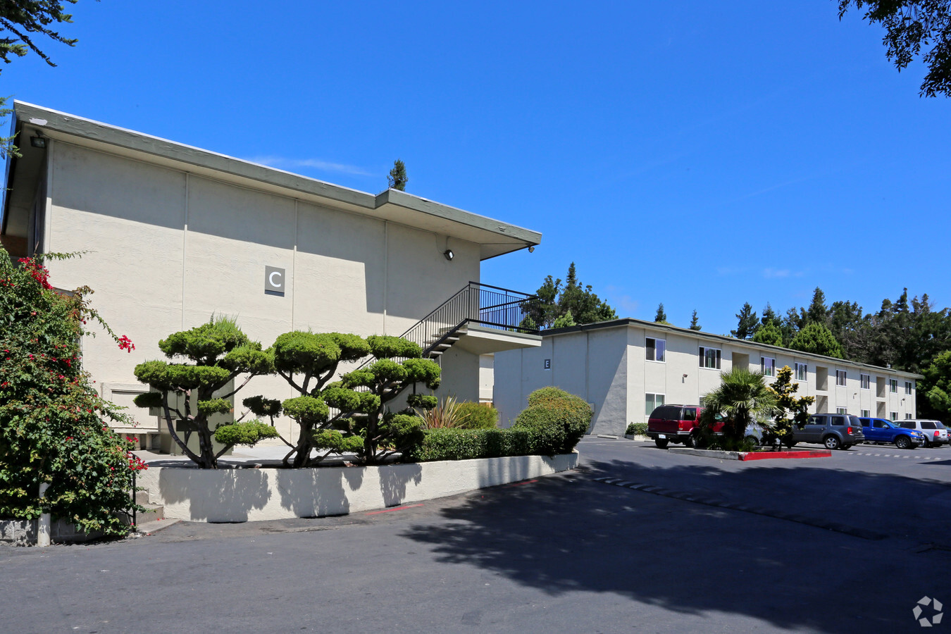
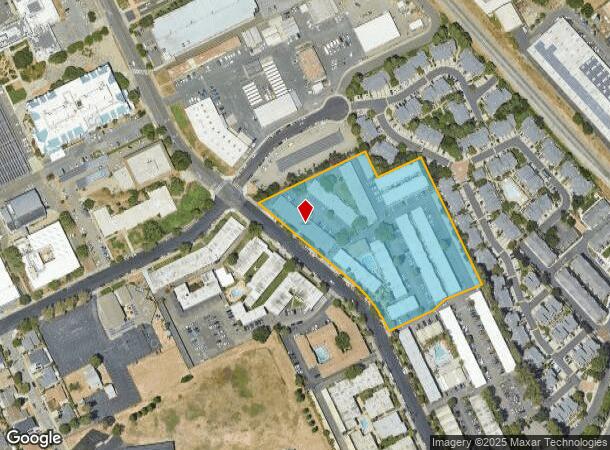
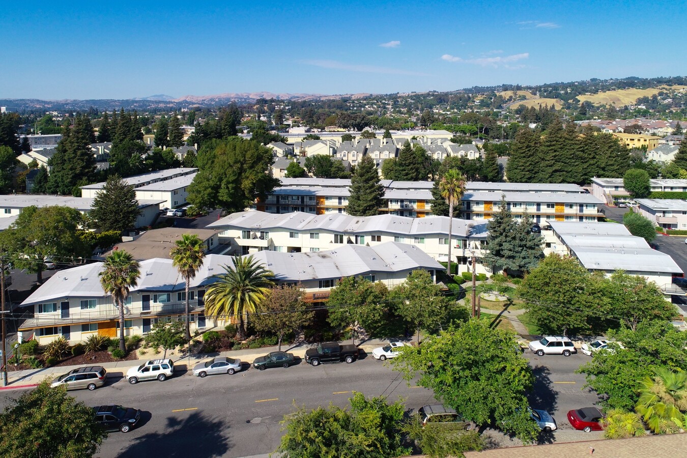
Property Record
24650 Amador St, Hayward, CA 94544
NEARBY LISTINGS FOR SALE OR LEASE
Property Detail
24650 Amador St
Oakland-Hayward-Berkeley, CA
Parcel Map 2406
443-0050-009-00
LOT: 0000A BLK: PM: 0101 PAGE: 0005
Multifamilydwelling
Alameda
X
California
06001C0289G
a
2024
4.72 AC
2024
Santa Clara
436800
East Bay/Oakland
116,750 SF
DEMOGRAPHICS near 24650 Amador St
1 Mile
3 Mile
5 Mile
2024 Total Population
36,265
210,395
353,303
2029 Population
35,052
203,550
341,489
Pop Growth 2024-2029
(3.34%)
(3.25%)
(3.34%)
Average Age
38
39
40
2024 Total Households
11,058
66,140
112,530
HH Growth 2024-2029
(3.59%)
(3.42%)
(3.53%)
Median Household Inc
$97,297
$92,484
$98,676
Avg Household Size
3.10
3.00
3.00
2024 Avg HH Vehicles
2.00
2.00
2.00
Median Home Value
$726,449
$722,328
$773,233
Median Year Built
1970
1968
1968
Nearby Places
- Restaurants
- Banks
- Shops
- Fitness
- Groceries
PUBLIC TRANSPORTATION
COMMUTER RAIL
Hayward (Capitol Corridor - Capitol Corridor Joint Powers Authority)
DRIVE
WALK
Distance
Hayward (Capitol Corridor - Capitol Corridor Joint Powers Authority)
4 min
1.5 mi
Hayward Amtrak (Capitol Corridor - Amtrak)
DRIVE
WALK
Distance
Hayward Amtrak (Capitol Corridor - Amtrak)
4 min
1.5 mi
AIRPORT
Metro Oakland International
DRIVE
WALK
Distance
Metro Oakland International
15 min
10.3 mi
San Francisco International
DRIVE
WALK
Distance
San Francisco International
29 min
21.9 mi
Norman Y Mineta San Jose International
DRIVE
WALK
Distance
Norman Y Mineta San Jose International
33 min
26.4 mi
Freight Ports
Port of Redwood City
DRIVE
WALK
Distance
Port of Redwood City
29 min
22.3 mi
Nearby Properties
Address
Land Use
TOTAL SIZE
Lot Size
Zoning
Address
Land Use
TOTAL SIZE
Lot Size
Zoning
710,091 SF
50.34 AC
Address
Land Use
TOTAL SIZE
Lot Size
Zoning
367,398 SF
21.94 AC
Address
Land Use
TOTAL SIZE
Lot Size
Zoning
4.90 AC
Address
Land Use
TOTAL SIZE
Lot Size
Zoning
500,913 SF
22.59 AC
Address
Land Use
TOTAL SIZE
Lot Size
Zoning
240,556 SF
11.63 AC
Address
Land Use
TOTAL SIZE
Lot Size
Zoning
2.48 AC
Address
Land Use
TOTAL SIZE
Lot Size
Zoning
200,451 SF
11.22 AC
Address
Land Use
TOTAL SIZE
Lot Size
Zoning
6.57 AC
Address
Land Use
TOTAL SIZE
Lot Size
Zoning
6.57 AC
Address
Land Use
TOTAL SIZE
Lot Size
Zoning
236,976 SF
18.36 AC
Address
Land Use
TOTAL SIZE
Lot Size
Zoning
173,948 SF
6.10 AC
Address
Land Use
TOTAL SIZE
Lot Size
Zoning
175,325 SF
2.91 AC
Address
Land Use
TOTAL SIZE
Lot Size
Zoning
470,929 SF
31.62 AC
Address
Land Use
TOTAL SIZE
Lot Size
Zoning
150,856 SF
5.99 AC
Address
Land Use
TOTAL SIZE
Lot Size
Zoning
10.64 AC
Address
Land Use
TOTAL SIZE
Lot Size
Zoning
300,507 SF
15.52 AC
Address
Land Use
TOTAL SIZE
Lot Size
Zoning
160,987 SF
7.20 AC
Address
Land Use
TOTAL SIZE
Lot Size
Zoning
393,894 SF
11.65 AC
Address
Land Use
TOTAL SIZE
Lot Size
Zoning
230,186 SF
15.89 AC
Address
Land Use
TOTAL SIZE
Lot Size
Zoning
187,926 SF
1.19 AC
Address
Land Use
TOTAL SIZE
Lot Size
Zoning
310,072 SF
14.96 AC
Address
Land Use
TOTAL SIZE
Lot Size
Zoning
242,861 SF
17.57 AC
Address
Land Use
TOTAL SIZE
Lot Size
Zoning
228,736 SF
5.95 AC
Address
Land Use
TOTAL SIZE
Lot Size
Zoning
169,371 SF
4.63 AC
Address
Land Use
TOTAL SIZE
Lot Size
Zoning
1.81 AC
Address
Land Use
TOTAL SIZE
Lot Size
Zoning
139,144 SF
18.44 AC
Address
Land Use
TOTAL SIZE
Lot Size
Zoning
10.69 AC
Address
Land Use
TOTAL SIZE
Lot Size
Zoning
154,113 SF
14.10 AC
Address
Land Use
TOTAL SIZE
Lot Size
Zoning
146,944 SF
4.21 AC
The World's #1 Commercial Real Estate Marketplace
Connect with us
© 2025 CoStar Group
The information above has been obtained from sources believed reliable. While we do not doubt its accuracy we have not verified it and make no guarantee, warranty or representation about it. It is your responsibility to independently confirm its accuracy and completeness. Any projections, opinions, assumptions, or estimates used are for example only and do not represent the current or future performance of the property. The value of this transaction to you depends on tax and other factors which should be evaluated by your tax, financial, and legal advisors. You and your advisors should conduct a careful, independent investigation of the property to determine to your satisfaction the suitability of the property for your needs.