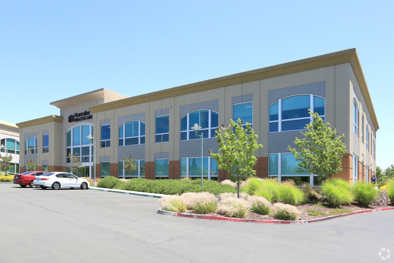
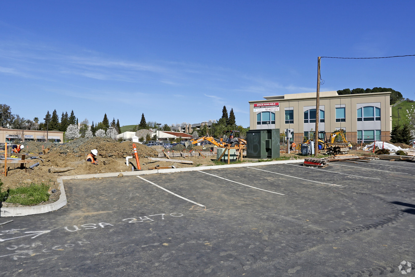
Property Record
2470 Hilborn Rd, Fairfield, CA 94534

NEARBY LISTINGS FOR SALE OR LEASE
Property Detail
2470 Hilborn Rd
0156-490-020
BK-BG 48-07 LOT C1
Medicalbuilding
Solano
X
California
06095C0268E
c1
2023
0.35 AC
2023
Fairfield/Suisun City
252312
North Bay/Santa Rosa
30,138 SF
Vallejo-Fairfield, CA
DEMOGRAPHICS near 2470 Hilborn Rd
1 Mile
3 Mile
5 Mile
2024 Total Population
17,925
99,008
124,201
2029 Population
17,691
97,800
122,814
Pop Growth 2024-2029
(1.31%)
(1.22%)
(1.12%)
Average Age
39
39
39
2024 Total Households
6,301
33,001
40,879
HH Growth 2024-2029
(1.44%)
(1.27%)
(1.19%)
Median Household Inc
$86,063
$83,620
$88,727
Avg Household Size
2.80
2.90
3.00
2024 Avg HH Vehicles
2.00
2.00
2.00
Median Home Value
$487,364
$486,716
$495,686
Median Year Built
1978
1979
1982
Nearby Places
- Restaurants
- Banks
- Shops
- Fitness
- Groceries
PUBLIC TRANSPORTATION
COMMUTER RAIL
Suisun-Fairfield (Capitol Corridor - Capitol Corridor Joint Powers Authority)
DRIVE
WALK
Distance
Suisun-Fairfield (Capitol Corridor - Capitol Corridor Joint Powers Authority)
9 min
4.4 mi
Fairfield-Vacaville (Capitol Corridor - Amtrak)
DRIVE
WALK
Distance
Fairfield-Vacaville (Capitol Corridor - Amtrak)
11 min
5.9 mi
Freight Ports
Port of Richmond
DRIVE
WALK
Distance
Port of Richmond
49 min
36.6 mi
Nearby Properties
Address
Land Use
TOTAL SIZE
Lot Size
Zoning
Address
Land Use
TOTAL SIZE
Lot Size
Zoning
Address
Land Use
TOTAL SIZE
Lot Size
Zoning
317,493 SF
21.54 AC
Address
Land Use
TOTAL SIZE
Lot Size
Zoning
67.79 AC
Address
Land Use
TOTAL SIZE
Lot Size
Zoning
172,856 SF
10.11 AC
Address
Land Use
TOTAL SIZE
Lot Size
Zoning
170,958 SF
14.65 AC
Address
Land Use
TOTAL SIZE
Lot Size
Zoning
Address
Land Use
TOTAL SIZE
Lot Size
Zoning
527,279 SF
33.29 AC
Address
Land Use
TOTAL SIZE
Lot Size
Zoning
300,897 SF
14.63 AC
Address
Land Use
TOTAL SIZE
Lot Size
Zoning
204,928 SF
8.87 AC
MR
Address
Land Use
TOTAL SIZE
Lot Size
Zoning
22.49 AC
Address
Land Use
TOTAL SIZE
Lot Size
Zoning
8.80 AC
Address
Land Use
TOTAL SIZE
Lot Size
Zoning
260,356 SF
25.40 AC
Address
Land Use
TOTAL SIZE
Lot Size
Zoning
151,537 SF
8.66 AC
Address
Land Use
TOTAL SIZE
Lot Size
Zoning
Address
Land Use
TOTAL SIZE
Lot Size
Zoning
76,195 SF
8.43 AC
Address
Land Use
TOTAL SIZE
Lot Size
Zoning
113,320 SF
6.63 AC
Address
Land Use
TOTAL SIZE
Lot Size
Zoning
90,416 SF
6.03 AC
MULTIRE
Address
Land Use
TOTAL SIZE
Lot Size
Zoning
144,466 SF
8.07 AC
MULTI-RES
Address
Land Use
TOTAL SIZE
Lot Size
Zoning
72,718 SF
4.58 AC
Address
Land Use
TOTAL SIZE
Lot Size
Zoning
185,292 SF
10.18 AC
Address
Land Use
TOTAL SIZE
Lot Size
Zoning
102,528 SF
4.87 AC
Address
Land Use
TOTAL SIZE
Lot Size
Zoning
53,960 SF
8.22 AC
Address
Land Use
TOTAL SIZE
Lot Size
Zoning
6,156 SF
0.36 AC
Address
Land Use
TOTAL SIZE
Lot Size
Zoning
59,427 SF
2.90 AC
Address
Land Use
TOTAL SIZE
Lot Size
Zoning
95,800 SF
8.95 AC
Address
Land Use
TOTAL SIZE
Lot Size
Zoning
111,717 SF
11.05 AC
COMML
Address
Land Use
TOTAL SIZE
Lot Size
Zoning
0.68 AC
Address
Land Use
TOTAL SIZE
Lot Size
Zoning
7,680 SF
0.05 AC
Address
Land Use
TOTAL SIZE
Lot Size
Zoning
0.25 AC
Address
Land Use
TOTAL SIZE
Lot Size
Zoning
0.10 AC
The World's #1 Commercial Real Estate Marketplace
Connect with us
© 2025 CoStar Group
The information above has been obtained from sources believed reliable. While we do not doubt its accuracy we have not verified it and make no guarantee, warranty or representation about it. It is your responsibility to independently confirm its accuracy and completeness. Any projections, opinions, assumptions, or estimates used are for example only and do not represent the current or future performance of the property. The value of this transaction to you depends on tax and other factors which should be evaluated by your tax, financial, and legal advisors. You and your advisors should conduct a careful, independent investigation of the property to determine to your satisfaction the suitability of the property for your needs.