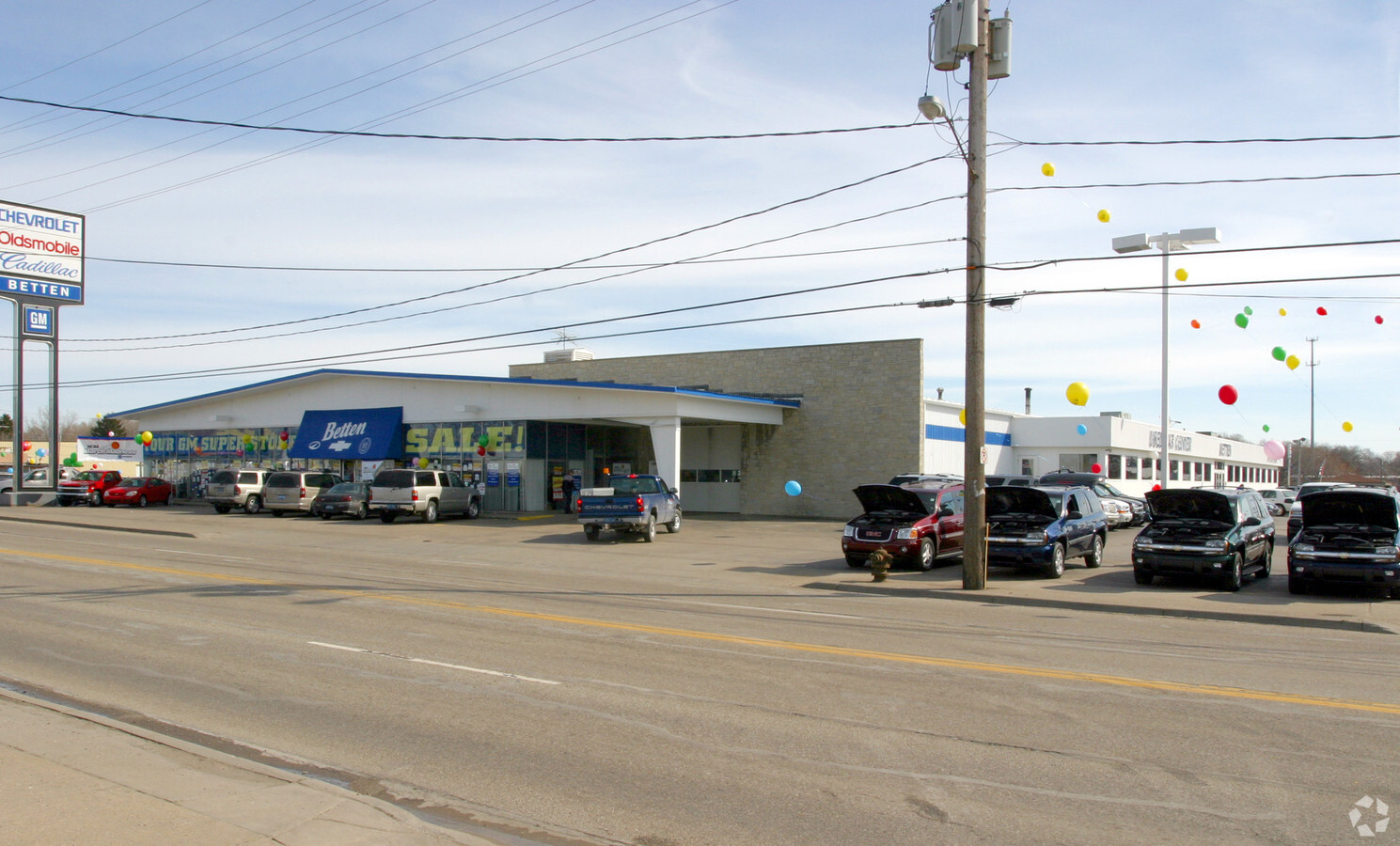
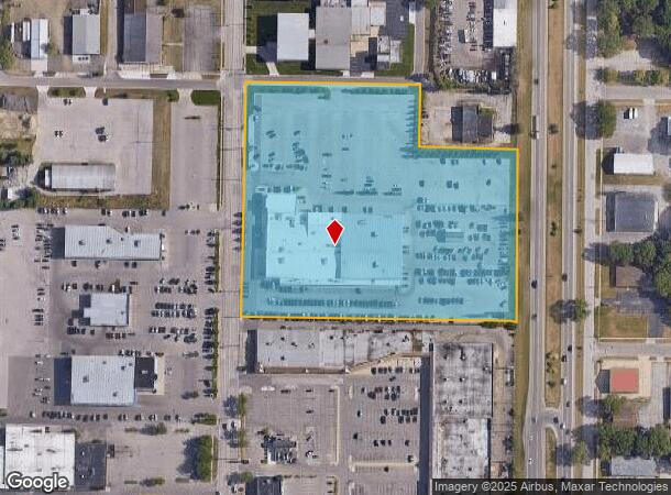
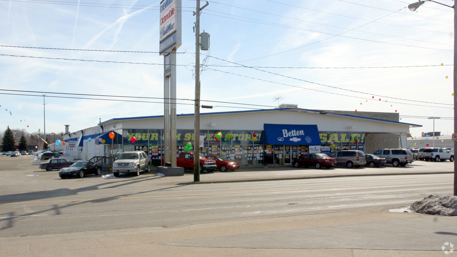
Property Record
2474 Henry St, Muskegon, MI 49441
NEARBY LISTINGS FOR SALE OR LEASE
Property Detail
2474 Henry St
24-131-300-0037-00
CITY OF MUSKEGONSEC 31 T10N R16WS 310 FT OF N 613 FT OF SW FRL 1/4 SW 1/4EXC THAT PT WHICH LIES E OF A LN 100 FT W OF MEASURED RT ANG & PAR TO CONSTRUCTION C/L OF HWY US 16 & US 31SD SEC ALSO INC COM ON LN 33 FT E NW CIR SW FRK 1/4 SW FRL 1/4TH S PAR
Commercialnec
Muskegon
X
Michigan
26121C0259E
8.56 AC
2023
Muskegon Heights
2024
West Michigan
002100
Muskegon, MI
67,896 SF
DEMOGRAPHICS near 2474 Henry St
1 Mile
3 Mile
5 Mile
2024 Total Population
9,214
62,556
96,904
2029 Population
9,314
63,278
97,691
Pop Growth 2024-2029
+ 1.09%
+ 1.15%
+ 0.81%
Average Age
40
39
40
2024 Total Households
3,998
24,191
38,301
HH Growth 2024-2029
+ 0.90%
+ 1.14%
+ 0.80%
Median Household Inc
$49,597
$44,218
$50,291
Avg Household Size
2.20
2.30
2.30
2024 Avg HH Vehicles
1.00
2.00
2.00
Median Home Value
$105,907
$118,450
$143,339
Median Year Built
1953
1953
1959
Nearby Places
- Restaurants
- Banks
- Shops
- Fitness
- Groceries
Nearby Properties
Address
Land Use
TOTAL SIZE
Lot Size
Zoning
Address
Land Use
TOTAL SIZE
Lot Size
Zoning
82,643 SF
5.20 AC
MC
Address
Land Use
TOTAL SIZE
Lot Size
Zoning
273,059 SF
30.59 AC
PUD
Address
Land Use
TOTAL SIZE
Lot Size
Zoning
6,900 SF
165.61 AC
GI
Address
Land Use
TOTAL SIZE
Lot Size
Zoning
248,456 SF
19.18 AC
MFR
Address
Land Use
TOTAL SIZE
Lot Size
Zoning
41,382 SF
6.20 AC
PUD
Address
Land Use
TOTAL SIZE
Lot Size
Zoning
184,130 SF
3.16 AC
FBC-MS
Address
Land Use
TOTAL SIZE
Lot Size
Zoning
116,657 SF
1.60 AC
FBC-UR
Address
Land Use
TOTAL SIZE
Lot Size
Zoning
388,172 SF
21.50 AC
GI
Address
Land Use
TOTAL SIZE
Lot Size
Zoning
203,874 SF
18.55 AC
C-SE
Address
Land Use
TOTAL SIZE
Lot Size
Zoning
194,708 SF
15.59 AC
C-2
Address
Land Use
TOTAL SIZE
Lot Size
Zoning
142,000 SF
1.60 AC
FBC-DT
Address
Land Use
TOTAL SIZE
Lot Size
Zoning
19,171 SF
6.55 AC
MC
Address
Land Use
TOTAL SIZE
Lot Size
Zoning
193,750 SF
23.22 AC
GI
Address
Land Use
TOTAL SIZE
Lot Size
Zoning
2,044 SF
4.10 AC
RT
Address
Land Use
TOTAL SIZE
Lot Size
Zoning
85,577 SF
8.72 AC
PUD
Address
Land Use
TOTAL SIZE
Lot Size
Zoning
33,750 SF
R - 1
Address
Land Use
TOTAL SIZE
Lot Size
Zoning
122.75 AC
R-2
Address
Land Use
TOTAL SIZE
Lot Size
Zoning
73,313 SF
4.94 AC
FBC-MSW
Address
Land Use
TOTAL SIZE
Lot Size
Zoning
124,416 SF
7.41 AC
MFR
Address
Land Use
TOTAL SIZE
Lot Size
Zoning
79,321 SF
B-3
Address
Land Use
TOTAL SIZE
Lot Size
Zoning
125,478 SF
7.90 AC
WM
Address
Land Use
TOTAL SIZE
Lot Size
Zoning
60,658 SF
4.42 AC
RM-2
Address
Land Use
TOTAL SIZE
Lot Size
Zoning
179,172 SF
20.72 AC
I-2
Address
Land Use
TOTAL SIZE
Lot Size
Zoning
171,361 SF
12.26 AC
AR-8
Address
Land Use
TOTAL SIZE
Lot Size
Zoning
325,640 SF
49 AC
WM
Address
Land Use
TOTAL SIZE
Lot Size
Zoning
6.82 AC
PUD
Address
Land Use
TOTAL SIZE
Lot Size
Zoning
42,888 SF
2.10 AC
R - 1
Address
Land Use
TOTAL SIZE
Lot Size
Zoning
399,872 SF
16.99 AC
I-2
Address
Land Use
TOTAL SIZE
Lot Size
Zoning
32,811 SF
5.87 AC
B-4
Address
Land Use
TOTAL SIZE
Lot Size
Zoning
212,648 SF
9.20 AC
"B-2, PUD"
The World's #1 Commercial Real Estate Marketplace
Connect with us
© 2025 CoStar Group
The information above has been obtained from sources believed reliable. While we do not doubt its accuracy we have not verified it and make no guarantee, warranty or representation about it. It is your responsibility to independently confirm its accuracy and completeness. Any projections, opinions, assumptions, or estimates used are for example only and do not represent the current or future performance of the property. The value of this transaction to you depends on tax and other factors which should be evaluated by your tax, financial, and legal advisors. You and your advisors should conduct a careful, independent investigation of the property to determine to your satisfaction the suitability of the property for your needs.