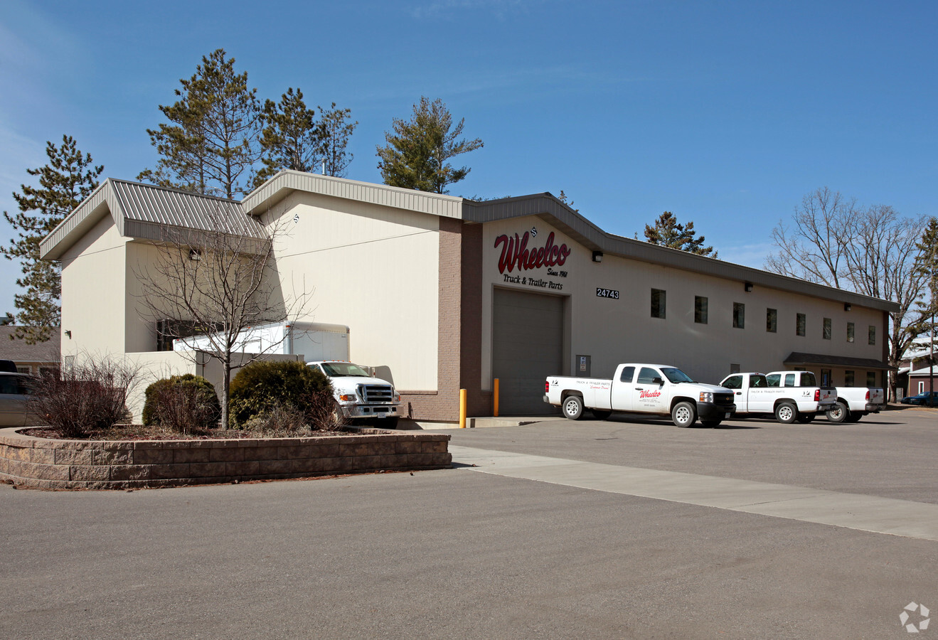
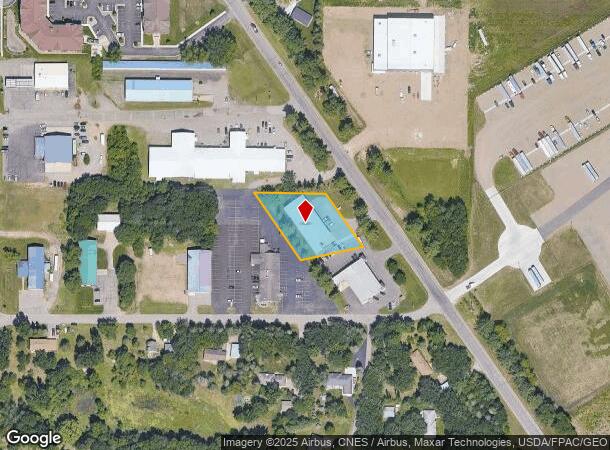
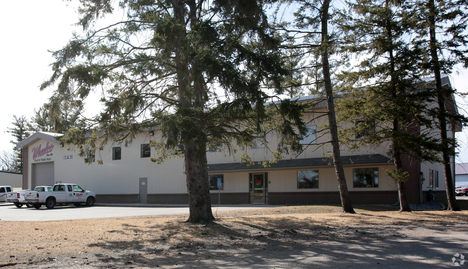
Property Record
24743 County Road 75, Saint Augusta, MN 56301
NEARBY LISTINGS FOR SALE OR LEASE
Property Detail
24743 County Road 75
81.43151.0690
.81 A. FR. .81 A. OF NE4NW4 W OF HGY OLD # 29.17815.000 SECTION 12 TOWNSHIP 123 RANGE 028 SECTION 12 TOWNSHIP 123 RANGE 028
Storebuilding
Stearns
X
Minnesota
27145C0860E
1.62 AC
2024
Stearns County
2024
Minneapolis/St Paul
011400
St. Cloud, MN
9,120 SF
DEMOGRAPHICS near 24743 County Road 75
1 Mile
3 Mile
5 Mile
2024 Total Population
1,414
9,009
39,784
2029 Population
1,458
9,416
41,771
Pop Growth 2024-2029
+ 3.11%
+ 4.52%
+ 4.99%
Average Age
36
39
35
2024 Total Households
606
3,551
14,427
HH Growth 2024-2029
+ 3.30%
+ 4.51%
+ 5.21%
Median Household Inc
$62,922
$81,333
$59,463
Avg Household Size
2.30
2.40
2.50
2024 Avg HH Vehicles
2.00
2.00
2.00
Median Home Value
$241,221
$273,281
$246,750
Median Year Built
2000
1997
1987
Nearby Places
- Restaurants
- Banks
- Shops
- Fitness
- Groceries
PUBLIC TRANSPORTATION
COMMUTER RAIL
St. Cloud Amtrak Station (Empire Builder - Amtrak)
DRIVE
WALK
Distance
St. Cloud Amtrak Station (Empire Builder - Amtrak)
13 min
6.8 mi
Freight Ports
Port Milwaukee
DRIVE
WALK
Distance
Port Milwaukee
440 min
398.6 mi
SALE & LEASE HISTORY
LISTING DATE
SALE/LEASE

Sep 14, 2022
For Lease
Jun 15, 2021
For Sale
Nearby Properties
Address
Land Use
TOTAL SIZE
Lot Size
Zoning
Address
Land Use
TOTAL SIZE
Lot Size
Zoning
278,850 SF
41.66 AC
Address
Land Use
TOTAL SIZE
Lot Size
Zoning
41.05 AC
Address
Land Use
TOTAL SIZE
Lot Size
Zoning
Address
Land Use
TOTAL SIZE
Lot Size
Zoning
55,736 SF
4.60 AC
I1
Address
Land Use
TOTAL SIZE
Lot Size
Zoning
43,250 SF
23.88 AC
Address
Land Use
TOTAL SIZE
Lot Size
Zoning
74,354 SF
8.71 AC
I3
Address
Land Use
TOTAL SIZE
Lot Size
Zoning
55,641 SF
26.60 AC
Address
Land Use
TOTAL SIZE
Lot Size
Zoning
87,813 SF
3.73 AC
PUD14
Address
Land Use
TOTAL SIZE
Lot Size
Zoning
57,111 SF
5.69 AC
I3
Address
Land Use
TOTAL SIZE
Lot Size
Zoning
67,210 SF
4.55 AC
PUD34
Address
Land Use
TOTAL SIZE
Lot Size
Zoning
2.02 AC
Address
Land Use
TOTAL SIZE
Lot Size
Zoning
66,568 SF
2.81 AC
PUD34
Address
Land Use
TOTAL SIZE
Lot Size
Zoning
69,034 SF
3.65 AC
PUD34
Address
Land Use
TOTAL SIZE
Lot Size
Zoning
79,625 SF
2.19 AC
PUD14
Address
Land Use
TOTAL SIZE
Lot Size
Zoning
73,150 SF
3.01 AC
R5
Address
Land Use
TOTAL SIZE
Lot Size
Zoning
71,544 SF
2.29 AC
R5
Address
Land Use
TOTAL SIZE
Lot Size
Zoning
70,677 SF
2.68 AC
R5
Address
Land Use
TOTAL SIZE
Lot Size
Zoning
Address
Land Use
TOTAL SIZE
Lot Size
Zoning
71,487 SF
8.20 AC
R5
Address
Land Use
TOTAL SIZE
Lot Size
Zoning
Address
Land Use
TOTAL SIZE
Lot Size
Zoning
26,561 SF
40 AC
Address
Land Use
TOTAL SIZE
Lot Size
Zoning
22,136 SF
5.66 AC
I1
Address
Land Use
TOTAL SIZE
Lot Size
Zoning
18,310 SF
25.85 AC
Address
Land Use
TOTAL SIZE
Lot Size
Zoning
39,268 SF
2.65 AC
R5
Address
Land Use
TOTAL SIZE
Lot Size
Zoning
39,268 SF
2.48 AC
R5
Address
Land Use
TOTAL SIZE
Lot Size
Zoning
40,631 SF
1.22 AC
PUD14
Address
Land Use
TOTAL SIZE
Lot Size
Zoning
12.15 AC
Address
Land Use
TOTAL SIZE
Lot Size
Zoning
29,773 SF
11.78 AC
Address
Land Use
TOTAL SIZE
Lot Size
Zoning
19.92 AC
Address
Land Use
TOTAL SIZE
Lot Size
Zoning
59.66 AC
The World's #1 Commercial Real Estate Marketplace
Connect with us
© 2025 CoStar Group
The information above has been obtained from sources believed reliable. While we do not doubt its accuracy we have not verified it and make no guarantee, warranty or representation about it. It is your responsibility to independently confirm its accuracy and completeness. Any projections, opinions, assumptions, or estimates used are for example only and do not represent the current or future performance of the property. The value of this transaction to you depends on tax and other factors which should be evaluated by your tax, financial, and legal advisors. You and your advisors should conduct a careful, independent investigation of the property to determine to your satisfaction the suitability of the property for your needs.