Property Record
2480 Sand Hill Rd, Menlo Park, CA 94025


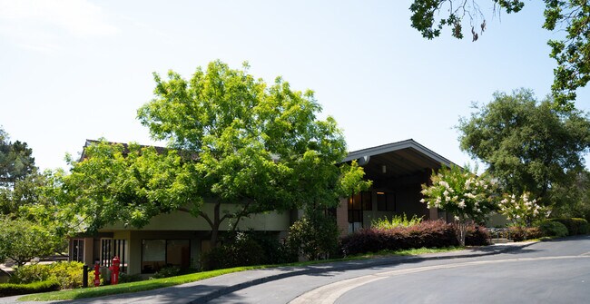

Property Detail
2480 Sand Hill Rd
074-270-260
LOT 2 SAGA LANE SUB RSM 63/39 40 & ADJ PTN ABND SAGA LN
Officebuilding
San Mateo
EAC01C
California
B and X Area of moderate flood hazard, usually the area between the limits of the 100-year and 500-year floods.
2
2024
4.40 AC
2025
Menlo Park
613000
San Francisco
33,982 SF
San Francisco-San Mateo-Redwood City, CA
NEARBY LISTINGS FOR SALE OR LEASE
DEMOGRAPHICS near 2480 Sand Hill Rd
1 mile
3 mile
5 mile
2025 Total Population
8,924
74,244
259,809
2030 Population
9,149
76,129
264,399
Pop Growth 2025-2030
+ 2.52%
+ 2.54%
+ 1.77%
Average Age
44
39
40
2025 Total Households
3,395
25,307
89,386
HH Growth 2025-2030
+ 2.44%
+ 2.75%
+ 1.96%
Median Household Inc
$241,429
$181,602
$169,354
Avg Household Size
2.60
2.40
2.60
2025 Avg HH Vehicles
2.00
2.00
2.00
Median Home Value
$1,143,109
$1,140,062
$1,130,267
Median Year Built
1968
1971
1965
Nearby Places
Map Layers
Map Styles
 Street
 Aerial
Layers
 Traffic
 Biking
Places
Listings with unknown addresses are not visible on the map
- Restaurants
- Banks
- Shops
- Fitness
- Groceries
PUBLIC TRANSPORTATION
COMMUTER RAIL
Palo Alto Caltrain Station Southbound (Express - Caltrain (Caltrain), Limited - Caltrain (Caltrain), Local Weekday - Caltrain (Caltrain), Local Weekend - Caltrain (Caltrain))
Drive
Walk
Distance
Palo Alto Caltrain Station Southbound (Express - Caltrain (Caltrain), Limited - Caltrain (Caltrain), Local Weekday - Caltrain (Caltrain), Local Weekend - Caltrain (Caltrain))
9 min
3.6 mi
Menlo Park Caltrain Station Southbound (Limited - Caltrain (Caltrain), Local Weekday - Caltrain (Caltrain), Local Weekend - Caltrain (Caltrain))
Drive
Walk
Distance
Menlo Park Caltrain Station Southbound (Limited - Caltrain (Caltrain), Local Weekday - Caltrain (Caltrain), Local Weekend - Caltrain (Caltrain))
9 min
3.7 mi
AIRPORT
Norman Y Mineta San Jose International
Drive
Walk
Distance
Norman Y Mineta San Jose International
32 min
18.3 mi
San Francisco International
Drive
Walk
Distance
San Francisco International
31 min
21.5 mi
Metro Oakland International
Drive
Walk
Distance
Metro Oakland International
50 min
39.1 mi
Freight Ports
Port of Redwood City
Drive
Walk
Distance
Port of Redwood City
18 min
8.2 mi
SALE & LEASE HISTORY
LISTING DATE
SALE/LEASE

Feb 13, 2018
For Lease
Aug 23, 2021
For Lease
Aug 16, 2019
For Lease
Aug 06, 2020
For Lease
Nearby Properties
Address
Land Use
TOTAL SIZE
Lot Size
Zoning
Address
Land Use
TOTAL SIZE
Lot Size
Zoning
1,395,540 SF
51.72 AC
C3
Address
Land Use
TOTAL SIZE
Lot Size
Zoning
Address
Land Use
TOTAL SIZE
Lot Size
Zoning
918,926 SF
17.54 AC
PC442
Address
Land Use
TOTAL SIZE
Lot Size
Zoning
182,606 SF
16.48 AC
EAC01C
Address
Land Use
TOTAL SIZE
Lot Size
Zoning
Address
Land Use
TOTAL SIZE
Lot Size
Zoning
118,168 SF
10.92 AC
EA0C1C
Address
Land Use
TOTAL SIZE
Lot Size
Zoning
169,391 SF
13.30 AC
EAC01C
Address
Land Use
TOTAL SIZE
Lot Size
Zoning
328,024 SF
10.64 AC
Address
Land Use
TOTAL SIZE
Lot Size
Zoning
61.20 AC
R10000
Address
Land Use
TOTAL SIZE
Lot Size
Zoning
16.43 AC
Address
Land Use
TOTAL SIZE
Lot Size
Zoning
140,948 SF
7.79 AC
EAC01C
Address
Land Use
TOTAL SIZE
Lot Size
Zoning
0.15 AC
A1
Address
Land Use
TOTAL SIZE
Lot Size
Zoning
0.41 AC
A
Address
Land Use
TOTAL SIZE
Lot Size
Zoning
0.40 AC
A
Address
Land Use
TOTAL SIZE
Lot Size
Zoning
0.41 AC
A
Address
Land Use
TOTAL SIZE
Lot Size
Zoning
0.05 AC
ZN PF
Address
Land Use
TOTAL SIZE
Lot Size
Zoning
442,796 SF
18.45 AC
C10000
Address
Land Use
TOTAL SIZE
Lot Size
Zoning
0.19 AC
A1
Address
Land Use
TOTAL SIZE
Lot Size
Zoning
1.45 AC
A1
Address
Land Use
TOTAL SIZE
Lot Size
Zoning
0.41 AC
A
Address
Land Use
TOTAL SIZE
Lot Size
Zoning
0.05 AC
ZN PF
Address
Land Use
TOTAL SIZE
Lot Size
Zoning
0.05 AC
ZN PF
Address
Land Use
TOTAL SIZE
Lot Size
Zoning
200 SF
4.96 AC
Address
Land Use
TOTAL SIZE
Lot Size
Zoning
0.36 AC
A1
Address
Land Use
TOTAL SIZE
Lot Size
Zoning
16.90 AC
A1
Address
Land Use
TOTAL SIZE
Lot Size
Zoning
0.31 AC
A1
Address
Land Use
TOTAL SIZE
Lot Size
Zoning
1.71 AC
C40000
Address
Land Use
TOTAL SIZE
Lot Size
Zoning
0.01 AC
A1
Address
Land Use
TOTAL SIZE
Lot Size
Zoning
19.35 AC
A1
Address
Land Use
TOTAL SIZE
Lot Size
Zoning
24.67 AC
A1
The World's #1 Commercial Real Estate Marketplace
Connect with us
© 2026 CoStar Group
The information above has been obtained from sources believed reliable. While we do not doubt its accuracy we have not verified it and make no guarantee, warranty or representation about it. It is your responsibility to independently confirm its accuracy and completeness. Any projections, opinions, assumptions, or estimates used are for example only and do not represent the current or future performance of the property. The value of this transaction to you depends on tax and other factors which should be evaluated by your tax, financial, and legal advisors. You and your advisors should conduct a careful, independent investigation of the property to determine to your satisfaction the suitability of the property for your needs.