Property Record
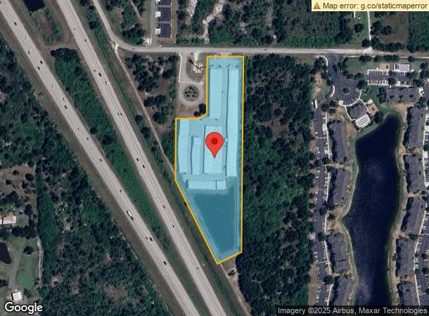
2485 Luther Rd, Punta Gorda, FL 33983

NEARBY LISTINGS FOR SALE OR LEASE
Property Detail
2485 Luther Rd
402317476002
17-40-23 P1-50 5.561 AC. M/L COMM AT SE CORNER OF SECTION 17 THENCE W 996.60 FT N 70.51 FT TO NE ROW I-75 TH CONT N 286.80 FT TO POB TH CONT N 965.12 FT TO S ROW OF LUTHER RD TH W ALNG S ROW LINE 179.27 FT TH W 283 FT SW 43.04 FT W 118.31 FT S 311.57
Publicstorage
Charlotte
X
Florida
12015C0232G
5.59 AC
2023
Charlotte County
2023
Southwest Florida
020101
Punta Gorda, FL
84,500 SF
DEMOGRAPHICS near 2485 Luther Rd
1 Mile
3 Mile
5 Mile
2024 Total Population
3,852
32,833
79,446
2029 Population
4,650
39,452
94,892
Pop Growth 2024-2029
+ 20.72%
+ 20.16%
+ 19.44%
Average Age
51
52
50
2024 Total Households
1,736
15,175
35,936
HH Growth 2024-2029
+ 21.08%
+ 20.57%
+ 19.81%
Median Household Inc
$39,757
$61,244
$51,555
Avg Household Size
2.10
2.10
2.10
2024 Avg HH Vehicles
2.00
2.00
2.00
Median Home Value
$254,118
$235,094
$223,420
Median Year Built
1996
1992
1986
Nearby Places
- Restaurants
- Banks
- Shops
- Fitness
- Groceries
PUBLIC TRANSPORTATION
AIRPORT
Punta Gorda
DRIVE
WALK
Distance
Punta Gorda
20 min
10.4 mi
Freight Ports
Port Manatee
DRIVE
WALK
Distance
Port Manatee
83 min
67.8 mi
SALE & LEASE HISTORY
LISTING DATE
SALE/LEASE

Feb 24, 2017
For Sale
Nearby Properties
Address
Land Use
TOTAL SIZE
Lot Size
Zoning
Address
Land Use
TOTAL SIZE
Lot Size
Zoning
204,731 SF
16.10 AC
PD
Address
Land Use
TOTAL SIZE
Lot Size
Zoning
229,973 SF
21.33 AC
PD
Address
Land Use
TOTAL SIZE
Lot Size
Zoning
789,392 SF
31.39 AC
RMF15
Address
Land Use
TOTAL SIZE
Lot Size
Zoning
202,009 SF
20.89 AC
PD
Address
Land Use
TOTAL SIZE
Lot Size
Zoning
121,585 SF
696.03 AC
RE1
Address
Land Use
TOTAL SIZE
Lot Size
Zoning
139,109 SF
23.44 AC
CG
Address
Land Use
TOTAL SIZE
Lot Size
Zoning
217,784 SF
38.63 AC
PD
Address
Land Use
TOTAL SIZE
Lot Size
Zoning
50,970 SF
9.74 AC
RSF3.5
Address
Land Use
TOTAL SIZE
Lot Size
Zoning
249,777 SF
47.99 AC
RMF10
Address
Land Use
TOTAL SIZE
Lot Size
Zoning
254.31 AC
PD
Address
Land Use
TOTAL SIZE
Lot Size
Zoning
128,594 SF
25.95 AC
PD
Address
Land Use
TOTAL SIZE
Lot Size
Zoning
82,865 SF
19.74 AC
RMF12
Address
Land Use
TOTAL SIZE
Lot Size
Zoning
95,547 SF
14.06 AC
PD
Address
Land Use
TOTAL SIZE
Lot Size
Zoning
83,180 SF
9.31 AC
PD
Address
Land Use
TOTAL SIZE
Lot Size
Zoning
35,951 SF
24.22 AC
PD
Address
Land Use
TOTAL SIZE
Lot Size
Zoning
116,186 SF
20.02 AC
RMF10
Address
Land Use
TOTAL SIZE
Lot Size
Zoning
75,960 SF
5.14 AC
PD
Address
Land Use
TOTAL SIZE
Lot Size
Zoning
21.61 AC
PD
Address
Land Use
TOTAL SIZE
Lot Size
Zoning
23,798 SF
1.70 AC
PD
Address
Land Use
TOTAL SIZE
Lot Size
Zoning
81,226 SF
11.55 AC
OMI
Address
Land Use
TOTAL SIZE
Lot Size
Zoning
125.54 AC
PD
Address
Land Use
TOTAL SIZE
Lot Size
Zoning
96.71 AC
PD
Address
Land Use
TOTAL SIZE
Lot Size
Zoning
13,642 SF
2.55 AC
PD
Address
Land Use
TOTAL SIZE
Lot Size
Zoning
34,983 SF
18.79 AC
RE1
Address
Land Use
TOTAL SIZE
Lot Size
Zoning
66,050 SF
7.74 AC
CG
Address
Land Use
TOTAL SIZE
Lot Size
Zoning
86,773 SF
5.07 AC
IG
Address
Land Use
TOTAL SIZE
Lot Size
Zoning
81,167 SF
5.63 AC
CG
Address
Land Use
TOTAL SIZE
Lot Size
Zoning
98,552 SF
11.42 AC
CG
Address
Land Use
TOTAL SIZE
Lot Size
Zoning
27,082 SF
2.05 AC
PD
Address
Land Use
TOTAL SIZE
Lot Size
Zoning
30,912 SF
7.68 AC
PD
The World's #1 Commercial Real Estate Marketplace
Connect with us
© 2025 CoStar Group
The information above has been obtained from sources believed reliable. While we do not doubt its accuracy we have not verified it and make no guarantee, warranty or representation about it. It is your responsibility to independently confirm its accuracy and completeness. Any projections, opinions, assumptions, or estimates used are for example only and do not represent the current or future performance of the property. The value of this transaction to you depends on tax and other factors which should be evaluated by your tax, financial, and legal advisors. You and your advisors should conduct a careful, independent investigation of the property to determine to your satisfaction the suitability of the property for your needs.