Property Record
249 Peachtree St, Toccoa, GA 30577
NEARBY LISTINGS FOR SALE OR LEASE
Property Detail
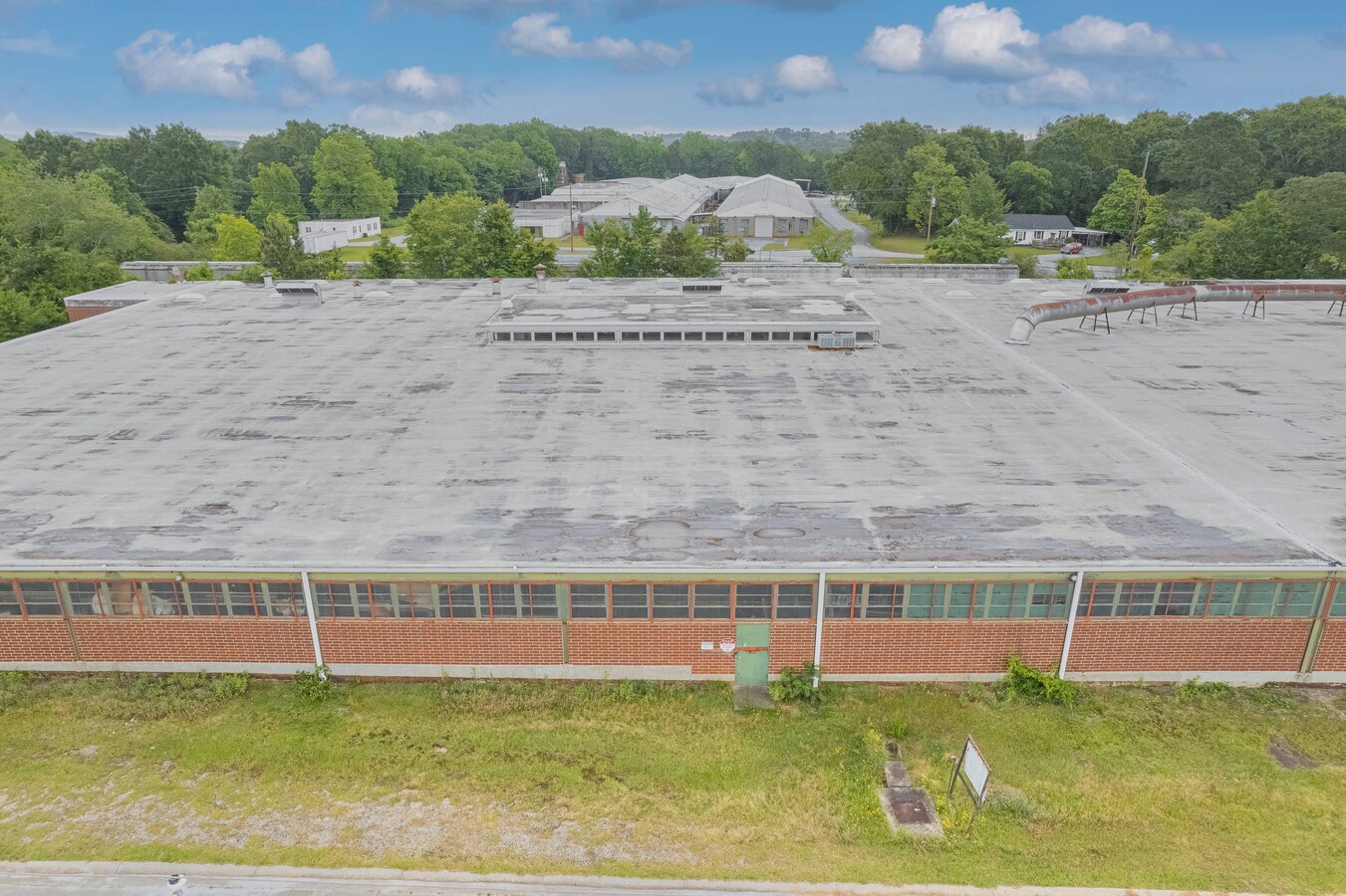
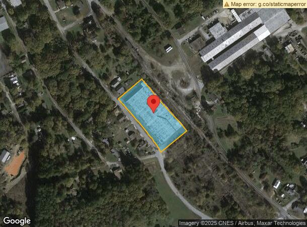
249 Peachtree St
Toccoa, GA
Stowe & Scott
T12-180
LOTS 7-24 STOWE & SCOTT S/D
Manufacturinglight
Stephens
X
Georgia
13257C0104D
7-24
2024
2.20 AC
2024
Georgia Northeast
970302
Other Market Areas
66,080 SF
DEMOGRAPHICS near 249 Peachtree St
1 Mile
3 Mile
5 Mile
2024 Total Population
2,886
12,551
16,983
2029 Population
2,997
12,794
17,315
Pop Growth 2024-2029
+ 3.85%
+ 1.94%
+ 1.95%
Average Age
42
41
42
2024 Total Households
1,155
5,083
6,794
HH Growth 2024-2029
+ 3.81%
+ 1.99%
+ 1.97%
Median Household Inc
$44,898
$48,330
$51,823
Avg Household Size
2.40
2.40
2.40
2024 Avg HH Vehicles
2.00
2.00
2.00
Median Home Value
$96,974
$145,643
$159,654
Median Year Built
1969
1975
1978
Nearby Places
- Restaurants
- Banks
- Shops
- Fitness
- Groceries
PUBLIC TRANSPORTATION
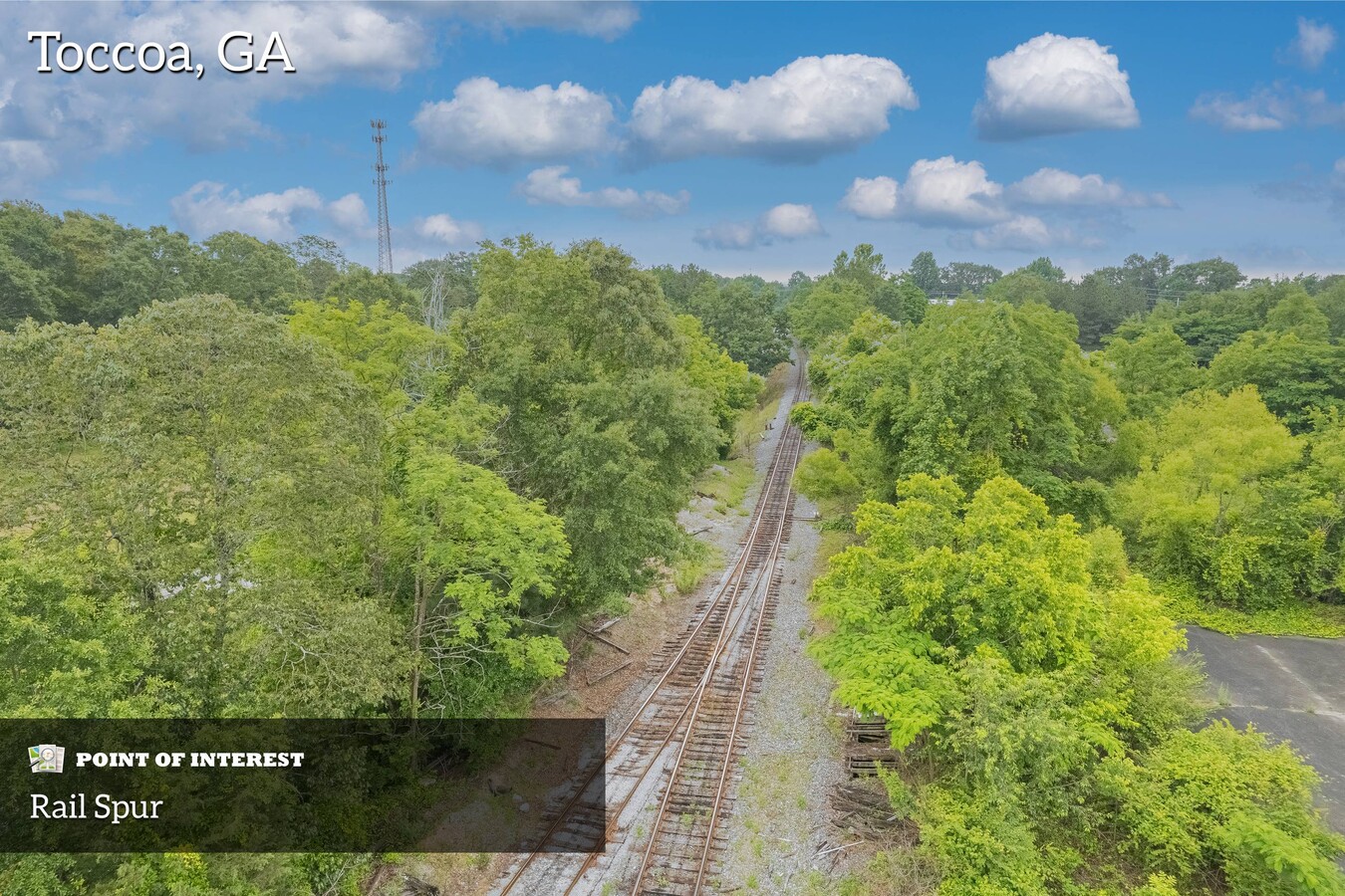
COMMUTER RAIL
Toccoa Amtrak Station (Crescent - Amtrak)
DRIVE
WALK
Distance
Toccoa Amtrak Station (Crescent - Amtrak)
2 min
1.3 mi
Freight Ports
Georgia Ports - Savannah
DRIVE
WALK
Distance
Georgia Ports - Savannah
303 min
248.0 mi
SALE & LEASE HISTORY
LISTING DATE
SALE/LEASE

May 30, 2023
For Sale
Nearby Properties
Address
Land Use
TOTAL SIZE
Lot Size
Zoning
Address
Land Use
TOTAL SIZE
Lot Size
Zoning
3.47 AC
CI
Address
Land Use
TOTAL SIZE
Lot Size
Zoning
218,215 SF
25.17 AC
CG
Address
Land Use
TOTAL SIZE
Lot Size
Zoning
391,121 SF
62.73 AC
CG
Address
Land Use
TOTAL SIZE
Lot Size
Zoning
52,140 SF
115.88 AC
CG
Address
Land Use
TOTAL SIZE
Lot Size
Zoning
161,644 SF
28 AC
R-III
Address
Land Use
TOTAL SIZE
Lot Size
Zoning
6.56 AC
CG
Address
Land Use
TOTAL SIZE
Lot Size
Zoning
5,120 SF
154.08 AC
CG
Address
Land Use
TOTAL SIZE
Lot Size
Zoning
4.24 AC
M-I
Address
Land Use
TOTAL SIZE
Lot Size
Zoning
49,548 SF
14.80 AC
R-II
Address
Land Use
TOTAL SIZE
Lot Size
Zoning
Address
Land Use
TOTAL SIZE
Lot Size
Zoning
68,998 SF
24.53 AC
CG
Address
Land Use
TOTAL SIZE
Lot Size
Zoning
66,517 SF
10.48 AC
R-II
Address
Land Use
TOTAL SIZE
Lot Size
Zoning
13,568 SF
7.50 AC
B-II
Address
Land Use
TOTAL SIZE
Lot Size
Zoning
44,496 SF
0.93 AC
B-III
Address
Land Use
TOTAL SIZE
Lot Size
Zoning
0.58 AC
CI
Address
Land Use
TOTAL SIZE
Lot Size
Zoning
Address
Land Use
TOTAL SIZE
Lot Size
Zoning
110,718 SF
10.14 AC
B-II
Address
Land Use
TOTAL SIZE
Lot Size
Zoning
32,440 SF
81.75 AC
R-IA
Address
Land Use
TOTAL SIZE
Lot Size
Zoning
11,600 SF
199.79 AC
A-I
Address
Land Use
TOTAL SIZE
Lot Size
Zoning
11,914 SF
2.04 AC
B-I
Address
Land Use
TOTAL SIZE
Lot Size
Zoning
Address
Land Use
TOTAL SIZE
Lot Size
Zoning
19,970 SF
0.61 AC
B-III
Address
Land Use
TOTAL SIZE
Lot Size
Zoning
131,717 SF
23.47 AC
CI
Address
Land Use
TOTAL SIZE
Lot Size
Zoning
2,880 SF
7.72 AC
R-III
Address
Land Use
TOTAL SIZE
Lot Size
Zoning
74,957 SF
13.98 AC
B-II
Address
Land Use
TOTAL SIZE
Lot Size
Zoning
27,013 SF
3.25 AC
R-IA
Address
Land Use
TOTAL SIZE
Lot Size
Zoning
20,866 SF
0.62 AC
B-III
Address
Land Use
TOTAL SIZE
Lot Size
Zoning
51,660 SF
2.39 AC
R-IA
Address
Land Use
TOTAL SIZE
Lot Size
Zoning
16,872 SF
2.53 AC
B-II
Address
Land Use
TOTAL SIZE
Lot Size
Zoning
9,068 SF
4.15 AC
R-IA
The World's #1 Commercial Real Estate Marketplace
Connect with us
© 2025 CoStar Group
The information above has been obtained from sources believed reliable. While we do not doubt its accuracy we have not verified it and make no guarantee, warranty or representation about it. It is your responsibility to independently confirm its accuracy and completeness. Any projections, opinions, assumptions, or estimates used are for example only and do not represent the current or future performance of the property. The value of this transaction to you depends on tax and other factors which should be evaluated by your tax, financial, and legal advisors. You and your advisors should conduct a careful, independent investigation of the property to determine to your satisfaction the suitability of the property for your needs.