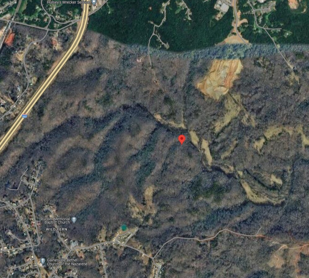
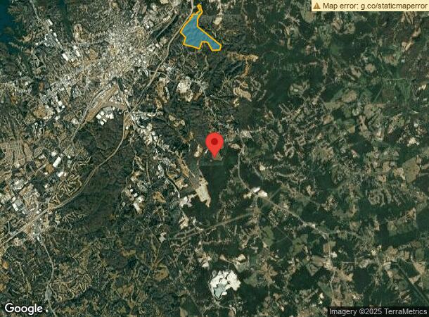
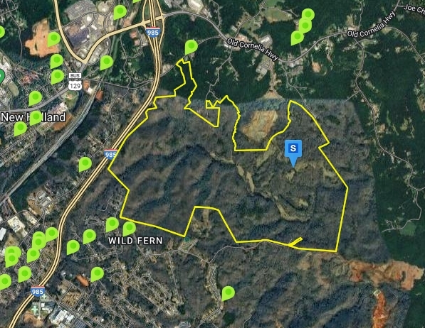
Property Record
2490 Old Cornelia Hwy, Gainesville, GA 30507
NEARBY LISTINGS FOR SALE OR LEASE
Property Detail
2490 Old Cornelia Hwy
Gainesville, GA
Jd Hawkins Estate
15-00033-00-001
TRACT 2 OLD CORNELIA HIGHWAY
Agriculturalland
Hall
A
Georgia
13139C0195H
335.47 AC
2024
Gainesville/Hall County
2024
Atlanta
001202
DEMOGRAPHICS near 2490 Old Cornelia Hwy
1 Mile
3 Mile
5 Mile
2024 Total Population
1,813
28,758
62,131
2029 Population
2,006
31,760
68,562
Pop Growth 2024-2029
+ 10.65%
+ 10.44%
+ 10.35%
Average Age
36
36
36
2024 Total Households
592
9,837
20,692
HH Growth 2024-2029
+ 10.30%
+ 10.38%
+ 10.32%
Median Household Inc
$44,499
$50,443
$52,384
Avg Household Size
2.80
2.70
2.80
2024 Avg HH Vehicles
2.00
2.00
2.00
Median Home Value
$153,801
$203,740
$226,346
Median Year Built
1985
1984
1987
Nearby Places
- Restaurants
- Banks
- Shops
- Fitness
- Groceries
PUBLIC TRANSPORTATION
COMMUTER RAIL
Gainesville Amtrak Station (Crescent - Amtrak)
DRIVE
WALK
Distance
Gainesville Amtrak Station (Crescent - Amtrak)
13 min
4.5 mi
Freight Ports
Georgia Ports - Savannah
DRIVE
WALK
Distance
Georgia Ports - Savannah
324 min
252.0 mi
SALE & LEASE HISTORY
LISTING DATE
SALE/LEASE

Sep 24, 2016
For Sale
Nearby Properties
Address
Land Use
TOTAL SIZE
Lot Size
Zoning
Address
Land Use
TOTAL SIZE
Lot Size
Zoning
578,645 SF
110.18 AC
PUD
Address
Land Use
TOTAL SIZE
Lot Size
Zoning
334,800 SF
56.96 AC
PUD
Address
Land Use
TOTAL SIZE
Lot Size
Zoning
3,284 SF
28.53 AC
PUD
Address
Land Use
TOTAL SIZE
Lot Size
Zoning
54,751 SF
33.38 AC
EX
Address
Land Use
TOTAL SIZE
Lot Size
Zoning
346,875 SF
82.09 AC
H-I
Address
Land Use
TOTAL SIZE
Lot Size
Zoning
258,201 SF
80.83 AC
I-I
Address
Land Use
TOTAL SIZE
Lot Size
Zoning
258,800 SF
52.20 AC
H-I
Address
Land Use
TOTAL SIZE
Lot Size
Zoning
88,042 SF
280.24 AC
PID
Address
Land Use
TOTAL SIZE
Lot Size
Zoning
91,728 SF
15 AC
L-I
Address
Land Use
TOTAL SIZE
Lot Size
Zoning
157,987 SF
34.67 AC
I-I
Address
Land Use
TOTAL SIZE
Lot Size
Zoning
194,850 SF
13.58 AC
I-I
Address
Land Use
TOTAL SIZE
Lot Size
Zoning
18,126 SF
14.65 AC
AR-IV
Address
Land Use
TOTAL SIZE
Lot Size
Zoning
145,064 SF
7.47 AC
I-I
Address
Land Use
TOTAL SIZE
Lot Size
Zoning
67,624 SF
163.46 AC
EX
Address
Land Use
TOTAL SIZE
Lot Size
Zoning
43,170 SF
23.06 AC
PUD
Address
Land Use
TOTAL SIZE
Lot Size
Zoning
135,522 SF
8.57 AC
L-I
Address
Land Use
TOTAL SIZE
Lot Size
Zoning
14,980 SF
136.15 AC
I-I
Address
Land Use
TOTAL SIZE
Lot Size
Zoning
112,840 SF
29.97 AC
I-II
Address
Land Use
TOTAL SIZE
Lot Size
Zoning
78,042 SF
42.75 AC
AR-IV
Address
Land Use
TOTAL SIZE
Lot Size
Zoning
80,952 SF
20.70 AC
H-I
Address
Land Use
TOTAL SIZE
Lot Size
Zoning
230.86 AC
PID
Address
Land Use
TOTAL SIZE
Lot Size
Zoning
192,266 SF
12.38 AC
H-I
Address
Land Use
TOTAL SIZE
Lot Size
Zoning
103,606 SF
4.58 AC
Address
Land Use
TOTAL SIZE
Lot Size
Zoning
67,938 SF
27.43 AC
H-I
Address
Land Use
TOTAL SIZE
Lot Size
Zoning
91,018 SF
4.31 AC
I-II
Address
Land Use
TOTAL SIZE
Lot Size
Zoning
157,987 SF
34.67 AC
Address
Land Use
TOTAL SIZE
Lot Size
Zoning
6.32 AC
R-II
Address
Land Use
TOTAL SIZE
Lot Size
Zoning
90,000 SF
10.66 AC
H-I
Address
Land Use
TOTAL SIZE
Lot Size
Zoning
95,993 SF
0.92 AC
I-II
Address
Land Use
TOTAL SIZE
Lot Size
Zoning
76,756 SF
20.06 AC
H-I
The World's #1 Commercial Real Estate Marketplace
Connect with us
© 2025 CoStar Group
The information above has been obtained from sources believed reliable. While we do not doubt its accuracy we have not verified it and make no guarantee, warranty or representation about it. It is your responsibility to independently confirm its accuracy and completeness. Any projections, opinions, assumptions, or estimates used are for example only and do not represent the current or future performance of the property. The value of this transaction to you depends on tax and other factors which should be evaluated by your tax, financial, and legal advisors. You and your advisors should conduct a careful, independent investigation of the property to determine to your satisfaction the suitability of the property for your needs.