Property Record
250 Henry St, Belleville, MI 48111

NEARBY LISTINGS FOR SALE OR LEASE
-
-
View all Belleville listings for sale on LoopNet.com
Property Detail
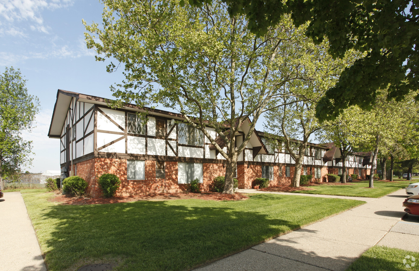
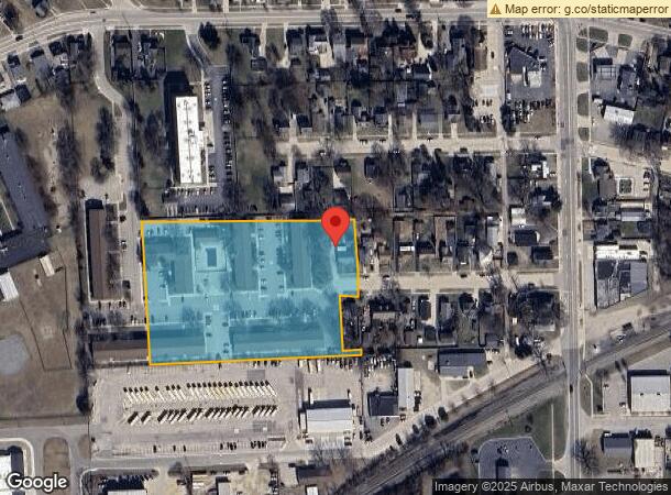
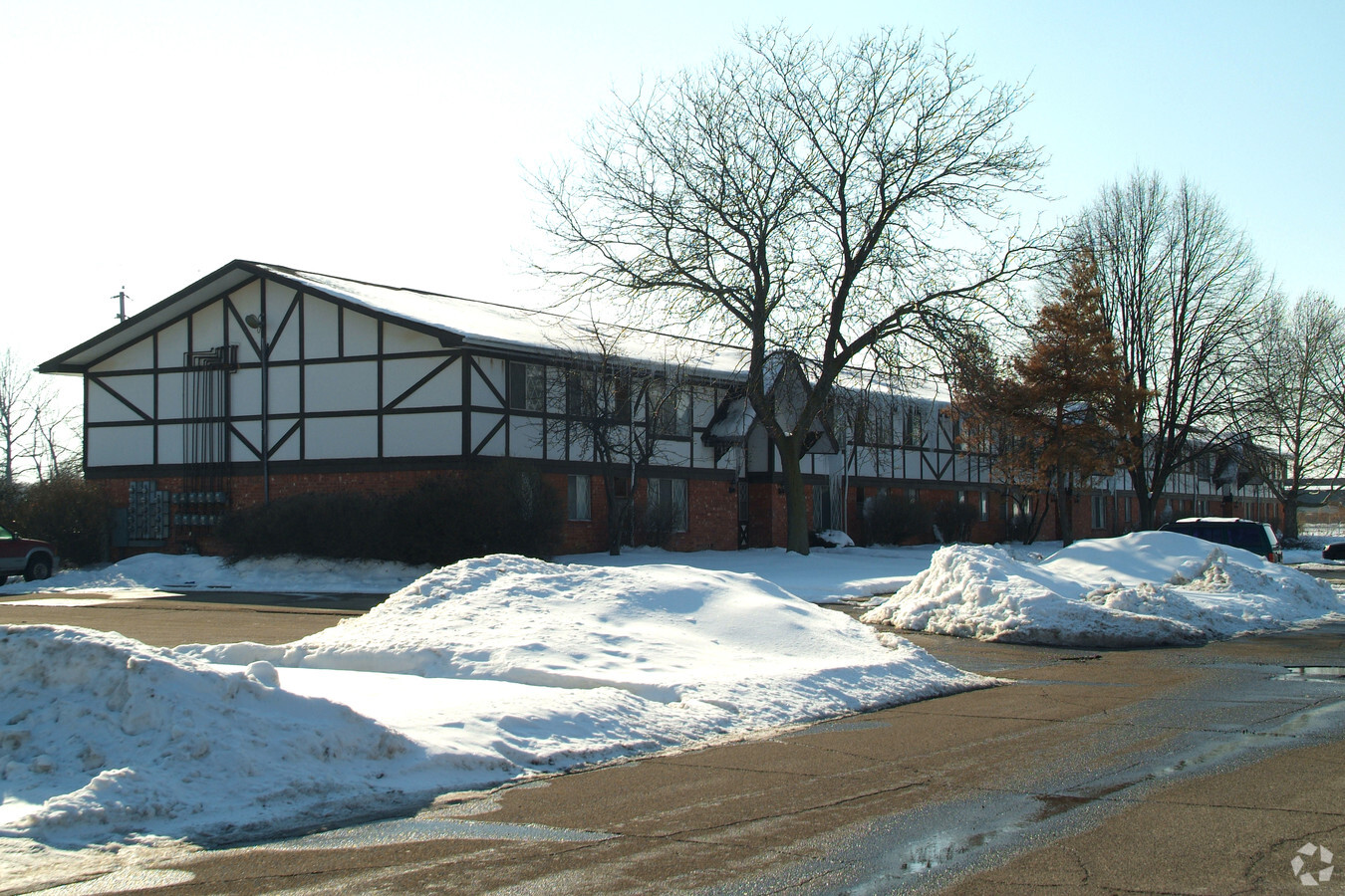
250 Henry St
Detroit-Warren-Dearborn, MI
Assessors Belleville Plat #3
31-109-02-0041-010
28B41A1A3 41A1C4 42A2B PT OF LOT 41 AND 42 ASSORS BELLEVILLE PLAT NO 3 L67 OF PLATS P66 WCR BEG N2DEG 59M 40S W 434.12FT FROM SW COR LOT 42 TH N2DEG 59M 40S W 751.51FT TH N87DEG 00M 20S E 50FT TH N2DEG 59M 40S W 128.51FT TH ELY ON CUR TO RT RAD 408.7
Multifamilydwelling
Wayne
X
Michigan
26163C0353E
41-42
2024
7.37 AC
2024
Outlying Wayne County
587000
Detroit
107,235 SF
DEMOGRAPHICS near 250 Henry St
1 Mile
3 Mile
5 Mile
2024 Total Population
5,646
27,598
62,377
2029 Population
5,445
26,461
60,738
Pop Growth 2024-2029
(3.56%)
(4.12%)
(2.63%)
Average Age
42
41
40
2024 Total Households
2,519
12,155
26,223
HH Growth 2024-2029
(3.49%)
(4.11%)
(2.72%)
Median Household Inc
$55,881
$66,820
$67,828
Avg Household Size
2.20
2.20
2.30
2024 Avg HH Vehicles
2.00
2.00
2.00
Median Home Value
$219,154
$233,132
$210,727
Median Year Built
1979
1978
1978
Nearby Places
- Restaurants
- Banks
- Shops
- Fitness
- Groceries
PUBLIC TRANSPORTATION
AIRPORT
Detroit Metro Wayne County
DRIVE
WALK
Distance
Detroit Metro Wayne County
17 min
9.6 mi
Windsor International
DRIVE
WALK
Distance
Windsor International
58 min
38.3 mi
Freight Ports
Port of Toledo
DRIVE
WALK
Distance
Port of Toledo
67 min
52.6 mi
Nearby Properties
Address
Land Use
TOTAL SIZE
Lot Size
Zoning
Address
Land Use
TOTAL SIZE
Lot Size
Zoning
461,566 SF
50.13 AC
RM MULT
Address
Land Use
TOTAL SIZE
Lot Size
Zoning
357,286 SF
36.79 AC
RM MULT
Address
Land Use
TOTAL SIZE
Lot Size
Zoning
198,549 SF
13.43 AC
RM MULT
Address
Land Use
TOTAL SIZE
Lot Size
Zoning
211,345 SF
18.67 AC
RM MULT
Address
Land Use
TOTAL SIZE
Lot Size
Zoning
135,430 SF
8.33 AC
AP
Address
Land Use
TOTAL SIZE
Lot Size
Zoning
432.42 AC
M2 GEN
Address
Land Use
TOTAL SIZE
Lot Size
Zoning
161,794 SF
17.73 AC
RM MULT
Address
Land Use
TOTAL SIZE
Lot Size
Zoning
132,528 SF
5.91 AC
C2 EXT
Address
Land Use
TOTAL SIZE
Lot Size
Zoning
25,000 SF
7.91 AC
C1GEN
Address
Land Use
TOTAL SIZE
Lot Size
Zoning
Address
Land Use
TOTAL SIZE
Lot Size
Zoning
191,446 SF
22.76 AC
C2EXT
Address
Land Use
TOTAL SIZE
Lot Size
Zoning
154,400 SF
23.96 AC
Address
Land Use
TOTAL SIZE
Lot Size
Zoning
3,177 SF
41.02 AC
Address
Land Use
TOTAL SIZE
Lot Size
Zoning
119,319 SF
10.23 AC
RM MULT
Address
Land Use
TOTAL SIZE
Lot Size
Zoning
49,649 SF
11.32 AC
C2 EXT
Address
Land Use
TOTAL SIZE
Lot Size
Zoning
102,395 SF
11 AC
RM MULT
Address
Land Use
TOTAL SIZE
Lot Size
Zoning
146,977 SF
11.19 AC
RM MULT
Address
Land Use
TOTAL SIZE
Lot Size
Zoning
158,744 SF
10.17 AC
RM MULT
Address
Land Use
TOTAL SIZE
Lot Size
Zoning
89,919 SF
15.38 AC
C2 EXT
Address
Land Use
TOTAL SIZE
Lot Size
Zoning
500 SF
37.70 AC
Address
Land Use
TOTAL SIZE
Lot Size
Zoning
62,633 SF
6.39 AC
Address
Land Use
TOTAL SIZE
Lot Size
Zoning
62,729 SF
20.01 AC
Address
Land Use
TOTAL SIZE
Lot Size
Zoning
95,244 SF
20 AC
II
Address
Land Use
TOTAL SIZE
Lot Size
Zoning
74,937 SF
4.97 AC
RM MULT
Address
Land Use
TOTAL SIZE
Lot Size
Zoning
3,640 SF
60.01 AC
RMH MOB
Address
Land Use
TOTAL SIZE
Lot Size
Zoning
73,239 SF
6.18 AC
RM MULT
Address
Land Use
TOTAL SIZE
Lot Size
Zoning
137,013 SF
7.80 AC
RM MULT
Address
Land Use
TOTAL SIZE
Lot Size
Zoning
73,188 SF
6.32 AC
RM MULT
Address
Land Use
TOTAL SIZE
Lot Size
Zoning
54.32 AC
RMH MOB
Address
Land Use
TOTAL SIZE
Lot Size
Zoning
66,340 SF
6.59 AC
RM MULT
The World's #1 Commercial Real Estate Marketplace
Connect with us
© 2025 CoStar Group
The information above has been obtained from sources believed reliable. While we do not doubt its accuracy we have not verified it and make no guarantee, warranty or representation about it. It is your responsibility to independently confirm its accuracy and completeness. Any projections, opinions, assumptions, or estimates used are for example only and do not represent the current or future performance of the property. The value of this transaction to you depends on tax and other factors which should be evaluated by your tax, financial, and legal advisors. You and your advisors should conduct a careful, independent investigation of the property to determine to your satisfaction the suitability of the property for your needs.