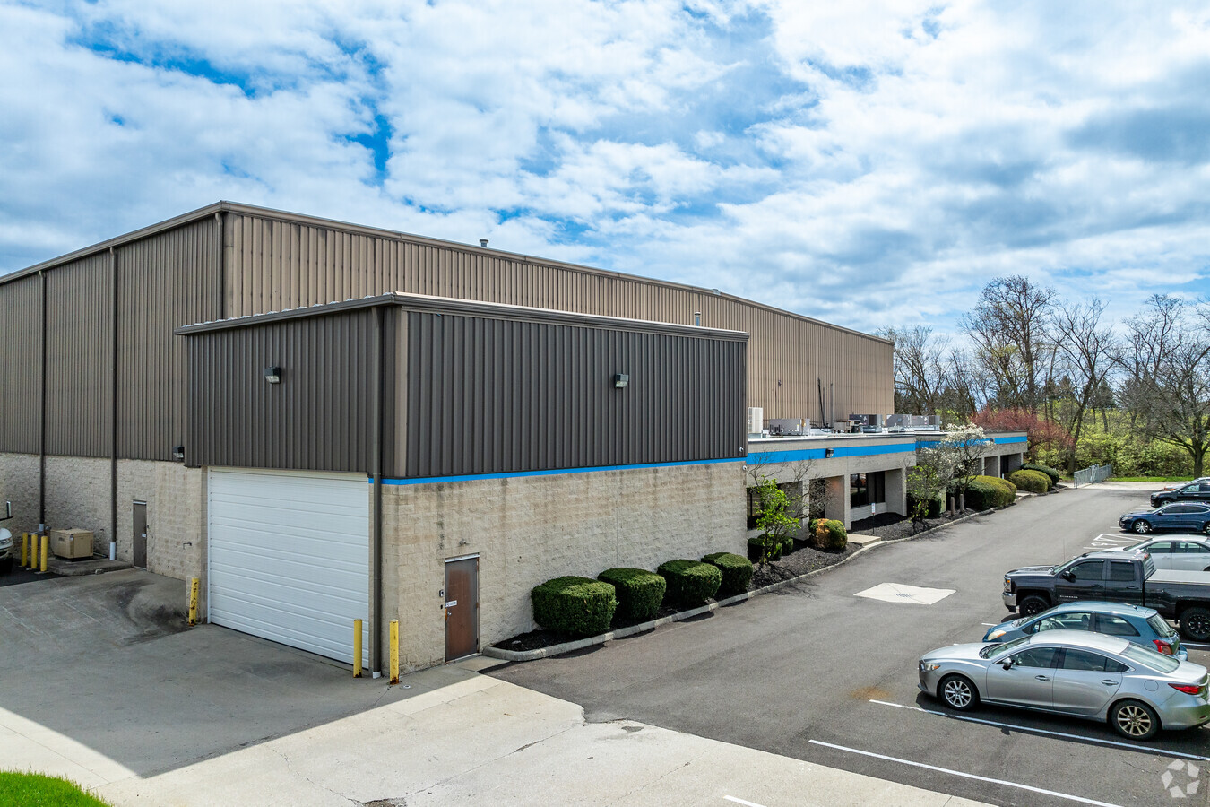
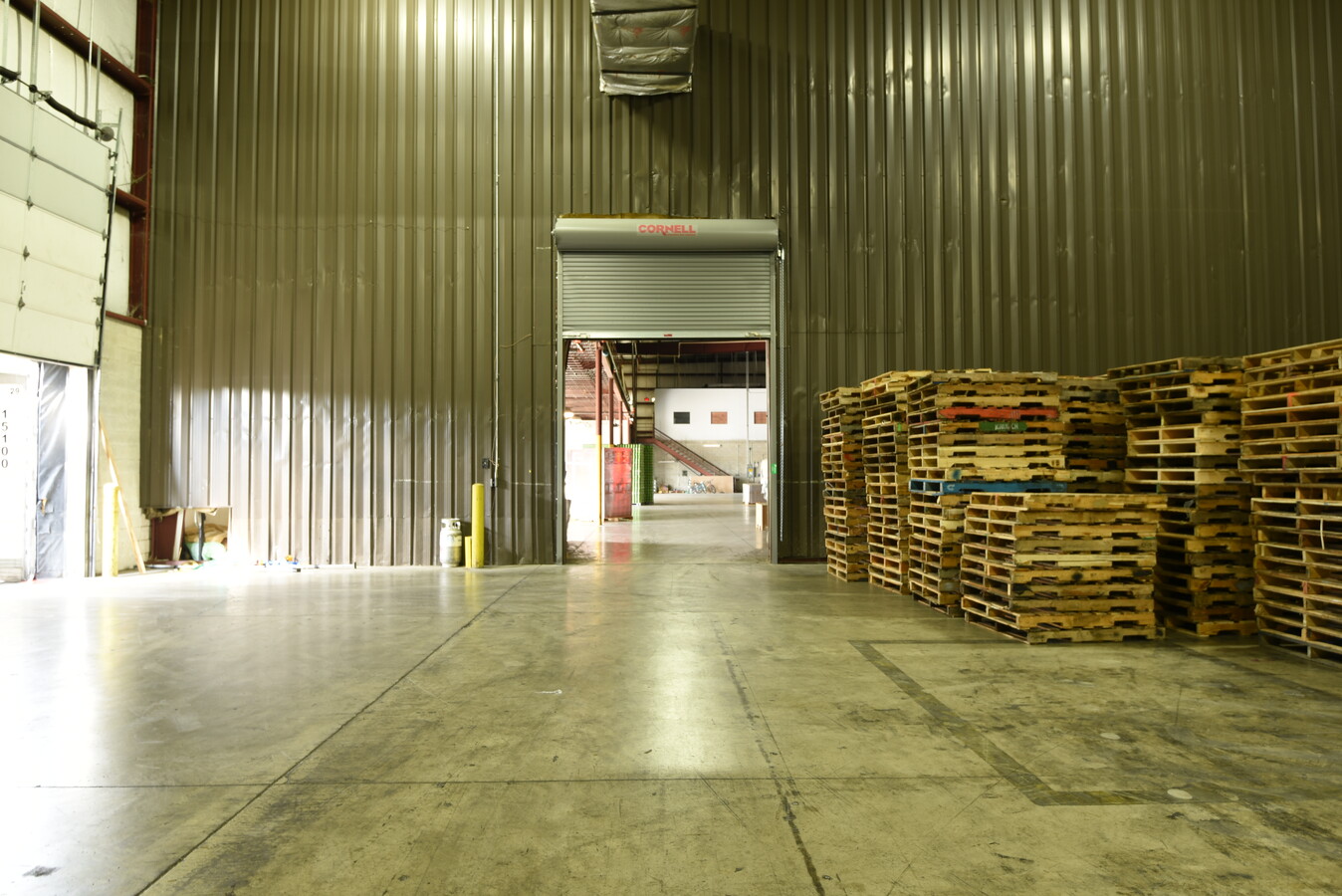
Property Record
2500 Charter St, Columbus, OH 43228


NEARBY LISTINGS FOR SALE OR LEASE
Property Detail
2500 Charter St
Columbus, OH
Westbelt Business Park West
560-189898
2500 CHARTER ST WESTBELT BUS PARK W PT LOT 6=6.015 ACRES
Warehouse
Franklin
X
Ohio
39097C0100D
6 6
2023
6.02 AC
2023
Hilliard
007956
Columbus
61,908 SF
DEMOGRAPHICS near 2500 Charter St
1 Mile
3 Mile
5 Mile
2024 Total Population
7,447
75,534
223,527
2029 Population
7,409
75,236
222,960
Pop Growth 2024-2029
(0.51%)
(0.39%)
(0.25%)
Average Age
34
37
37
2024 Total Households
2,926
31,171
92,482
HH Growth 2024-2029
(0.65%)
(0.32%)
(0.33%)
Median Household Inc
$84,368
$88,791
$79,782
Avg Household Size
2.50
2.40
2.40
2024 Avg HH Vehicles
2.00
2.00
2.00
Median Home Value
$240,165
$264,084
$289,583
Median Year Built
1994
1993
1986
Nearby Places
- Restaurants
- Banks
- Shops
- Fitness
- Groceries
PUBLIC TRANSPORTATION
AIRPORT
John Glenn Columbus International
DRIVE
WALK
Distance
John Glenn Columbus International
24 min
16.5 mi
Rickenbacker International
DRIVE
WALK
Distance
Rickenbacker International
29 min
21.1 mi
Freight Ports
Port of Toledo
DRIVE
WALK
Distance
Port of Toledo
180 min
133.0 mi
SALE & LEASE HISTORY
LISTING DATE
SALE/LEASE

Nov 10, 2023
For Lease
Feb 29, 2024
For Lease
Feb 25, 2021
For Lease
Apr 08, 2021
For Lease
Apr 07, 2021
For Lease
Nearby Properties
Address
Land Use
TOTAL SIZE
Lot Size
Zoning
Address
Land Use
TOTAL SIZE
Lot Size
Zoning
796,160 SF
55.17 AC
Address
Land Use
TOTAL SIZE
Lot Size
Zoning
982,575 SF
70.58 AC
Address
Land Use
TOTAL SIZE
Lot Size
Zoning
1,587,003 SF
27.39 AC
Address
Land Use
TOTAL SIZE
Lot Size
Zoning
961,397 SF
75.09 AC
Address
Land Use
TOTAL SIZE
Lot Size
Zoning
329,215 SF
8.33 AC
Address
Land Use
TOTAL SIZE
Lot Size
Zoning
103,563 SF
29.23 AC
Address
Land Use
TOTAL SIZE
Lot Size
Zoning
91,413 SF
0.14 AC
Address
Land Use
TOTAL SIZE
Lot Size
Zoning
255,902 SF
8.15 AC
Address
Land Use
TOTAL SIZE
Lot Size
Zoning
155,280 SF
9.42 AC
Address
Land Use
TOTAL SIZE
Lot Size
Zoning
195,503 SF
14.13 AC
Address
Land Use
TOTAL SIZE
Lot Size
Zoning
110,344 SF
19.06 AC
Address
Land Use
TOTAL SIZE
Lot Size
Zoning
82,510 SF
15.80 AC
Address
Land Use
TOTAL SIZE
Lot Size
Zoning
566,334 SF
58.62 AC
Address
Land Use
TOTAL SIZE
Lot Size
Zoning
289,806 SF
10.78 AC
Address
Land Use
TOTAL SIZE
Lot Size
Zoning
74,208 SF
29.55 AC
Address
Land Use
TOTAL SIZE
Lot Size
Zoning
286,320 SF
23.51 AC
Address
Land Use
TOTAL SIZE
Lot Size
Zoning
294,948 SF
10.81 AC
Address
Land Use
TOTAL SIZE
Lot Size
Zoning
473,625 SF
8.51 AC
Address
Land Use
TOTAL SIZE
Lot Size
Zoning
121,500 SF
20.91 AC
Address
Land Use
TOTAL SIZE
Lot Size
Zoning
607,308 SF
7.50 AC
Address
Land Use
TOTAL SIZE
Lot Size
Zoning
448,272 SF
39.15 AC
Address
Land Use
TOTAL SIZE
Lot Size
Zoning
208,950 SF
15.15 AC
Address
Land Use
TOTAL SIZE
Lot Size
Zoning
126,656 SF
15.83 AC
Address
Land Use
TOTAL SIZE
Lot Size
Zoning
1,288,632 SF
23.21 AC
Address
Land Use
TOTAL SIZE
Lot Size
Zoning
137,350 SF
11.01 AC
Address
Land Use
TOTAL SIZE
Lot Size
Zoning
201,399 SF
16.67 AC
Address
Land Use
TOTAL SIZE
Lot Size
Zoning
84,002 SF
4.08 AC
Address
Land Use
TOTAL SIZE
Lot Size
Zoning
167,274 SF
7.83 AC
Address
Land Use
TOTAL SIZE
Lot Size
Zoning
639,219 SF
14.75 AC
Address
Land Use
TOTAL SIZE
Lot Size
Zoning
519,006 SF
7.16 AC
The World's #1 Commercial Real Estate Marketplace
Connect with us
© 2025 CoStar Group
The information above has been obtained from sources believed reliable. While we do not doubt its accuracy we have not verified it and make no guarantee, warranty or representation about it. It is your responsibility to independently confirm its accuracy and completeness. Any projections, opinions, assumptions, or estimates used are for example only and do not represent the current or future performance of the property. The value of this transaction to you depends on tax and other factors which should be evaluated by your tax, financial, and legal advisors. You and your advisors should conduct a careful, independent investigation of the property to determine to your satisfaction the suitability of the property for your needs.