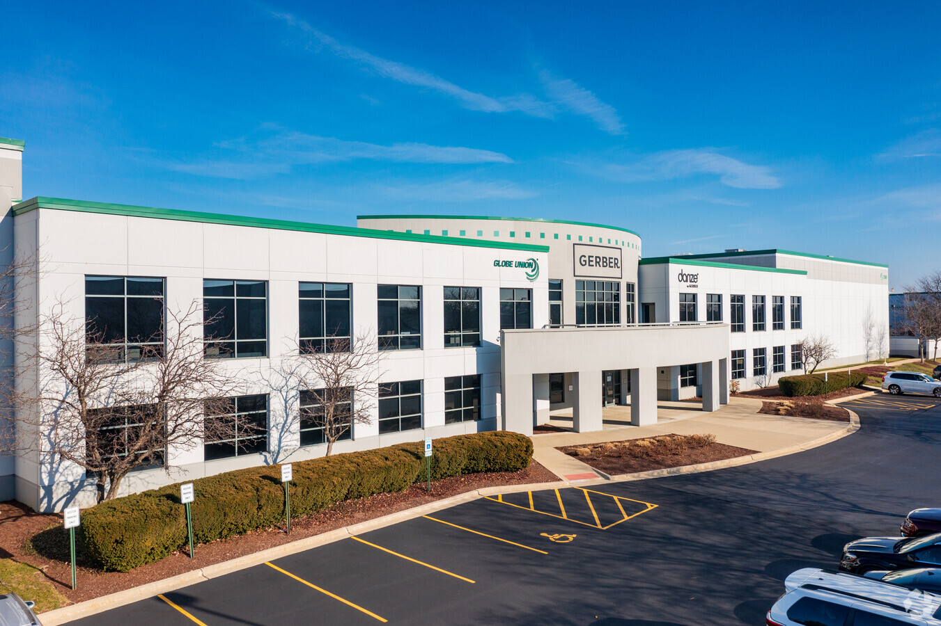
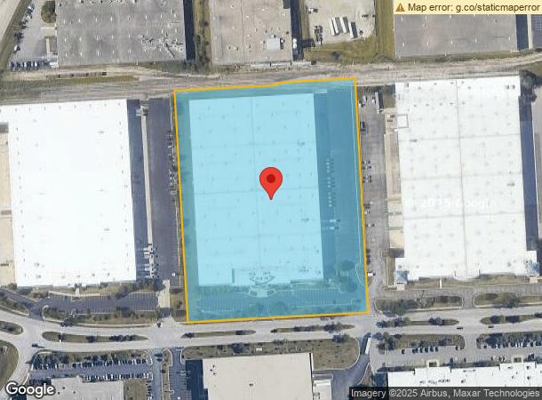
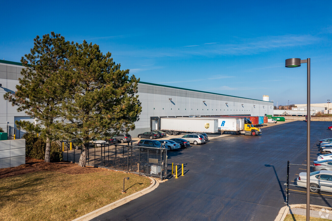
Property Record
2500 Internationale Pky, Woodridge, IL 60517
NEARBY LISTINGS FOR SALE OR LEASE
Property Detail
2500 Internationale Pky
Chicago-Naperville-Elgin, IL-IN-WI
International Centre Unit 4
02-13-326-003
LOT 2 IN INTERNATIONAL CENTRE UNIT 4, BEING A SUB IN THE SW1/4 OF SEC 13, T37N-R10E
Industrialgeneral
Will
X
Illinois
17197C0058G
2
2023
10.49 AC
2023
South I-55 Corridor
8802021035
Chicago
261,076 SF
DEMOGRAPHICS near 2500 Internationale Pky
1 Mile
3 Mile
5 Mile
2024 Total Population
3,162
53,361
153,413
2029 Population
3,133
52,455
151,560
Pop Growth 2024-2029
(0.92%)
(1.70%)
(1.21%)
Average Age
37
39
40
2024 Total Households
922
18,263
53,908
HH Growth 2024-2029
(0.76%)
(1.74%)
(1.32%)
Median Household Inc
$81,224
$84,161
$96,135
Avg Household Size
3.30
2.80
2.80
2024 Avg HH Vehicles
2.00
2.00
2.00
Median Home Value
$219,589
$249,096
$295,653
Median Year Built
1967
1977
1981
Nearby Places
- Restaurants
- Banks
- Shops
- Fitness
- Groceries
PUBLIC TRANSPORTATION
COMMUTER RAIL
Lemont Station (Heritage Corridor Line - Northeast Illinois Regional Commuter Railroad (Metra))
DRIVE
WALK
Distance
Lemont Station (Heritage Corridor Line - Northeast Illinois Regional Commuter Railroad (Metra))
9 min
4.0 mi
Romeoville (Heritage Corridor - Metra)
DRIVE
WALK
Distance
Romeoville (Heritage Corridor - Metra)
12 min
6.1 mi
AIRPORT
Chicago Midway International
DRIVE
WALK
Distance
Chicago Midway International
26 min
18.2 mi
Chicago O'Hare International
DRIVE
WALK
Distance
Chicago O'Hare International
43 min
29.7 mi
Freight Ports
Port Milwaukee
DRIVE
WALK
Distance
Port Milwaukee
124 min
101.4 mi
Nearby Properties
Address
Land Use
TOTAL SIZE
Lot Size
Zoning
Address
Land Use
TOTAL SIZE
Lot Size
Zoning
32.82 AC
Address
Land Use
TOTAL SIZE
Lot Size
Zoning
115.36 AC
Address
Land Use
TOTAL SIZE
Lot Size
Zoning
21,520 SF
32.67 AC
Address
Land Use
TOTAL SIZE
Lot Size
Zoning
1,107,073 SF
35.03 AC
Address
Land Use
TOTAL SIZE
Lot Size
Zoning
759,709 SF
41.75 AC
Address
Land Use
TOTAL SIZE
Lot Size
Zoning
21.30 AC
Address
Land Use
TOTAL SIZE
Lot Size
Zoning
21.12 AC
Address
Land Use
TOTAL SIZE
Lot Size
Zoning
48.48 AC
Address
Land Use
TOTAL SIZE
Lot Size
Zoning
49.91 AC
Address
Land Use
TOTAL SIZE
Lot Size
Zoning
Address
Land Use
TOTAL SIZE
Lot Size
Zoning
334,656 SF
17.72 AC
I
Address
Land Use
TOTAL SIZE
Lot Size
Zoning
353,286 SF
19.84 AC
Address
Land Use
TOTAL SIZE
Lot Size
Zoning
28.89 AC
Address
Land Use
TOTAL SIZE
Lot Size
Zoning
12.52 AC
Address
Land Use
TOTAL SIZE
Lot Size
Zoning
581,000 SF
28.56 AC
Address
Land Use
TOTAL SIZE
Lot Size
Zoning
270,372 SF
12.49 AC
Address
Land Use
TOTAL SIZE
Lot Size
Zoning
557,851 SF
25.47 AC
Address
Land Use
TOTAL SIZE
Lot Size
Zoning
504,722 SF
26.19 AC
Address
Land Use
TOTAL SIZE
Lot Size
Zoning
513,805 SF
23.84 AC
Address
Land Use
TOTAL SIZE
Lot Size
Zoning
165.89 AC
Address
Land Use
TOTAL SIZE
Lot Size
Zoning
506,726 SF
28.54 AC
Address
Land Use
TOTAL SIZE
Lot Size
Zoning
490,436 SF
22.22 AC
Address
Land Use
TOTAL SIZE
Lot Size
Zoning
264,310 SF
12.21 AC
I
Address
Land Use
TOTAL SIZE
Lot Size
Zoning
500,160 SF
25.07 AC
Address
Land Use
TOTAL SIZE
Lot Size
Zoning
600,566 SF
20.17 AC
Address
Land Use
TOTAL SIZE
Lot Size
Zoning
460,350 SF
23.14 AC
Address
Land Use
TOTAL SIZE
Lot Size
Zoning
458,472 SF
33.64 AC
Address
Land Use
TOTAL SIZE
Lot Size
Zoning
11,250 SF
67.19 AC
Address
Land Use
TOTAL SIZE
Lot Size
Zoning
143,024 SF
21.50 AC
Address
Land Use
TOTAL SIZE
Lot Size
Zoning
499,750 SF
26.72 AC
The World's #1 Commercial Real Estate Marketplace
Connect with us
© 2025 CoStar Group
The information above has been obtained from sources believed reliable. While we do not doubt its accuracy we have not verified it and make no guarantee, warranty or representation about it. It is your responsibility to independently confirm its accuracy and completeness. Any projections, opinions, assumptions, or estimates used are for example only and do not represent the current or future performance of the property. The value of this transaction to you depends on tax and other factors which should be evaluated by your tax, financial, and legal advisors. You and your advisors should conduct a careful, independent investigation of the property to determine to your satisfaction the suitability of the property for your needs.