Property Record
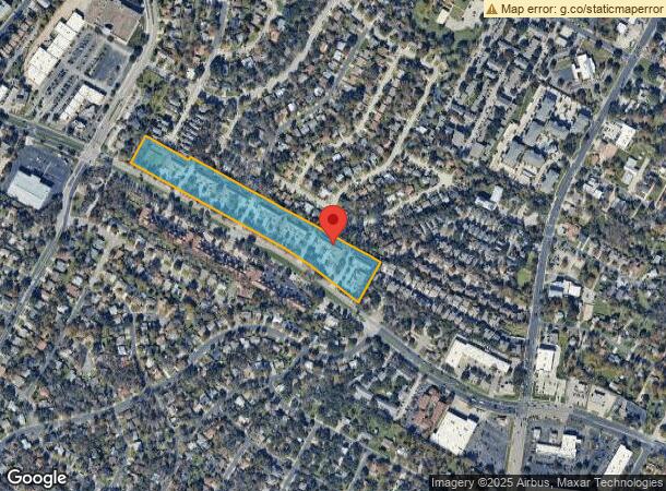
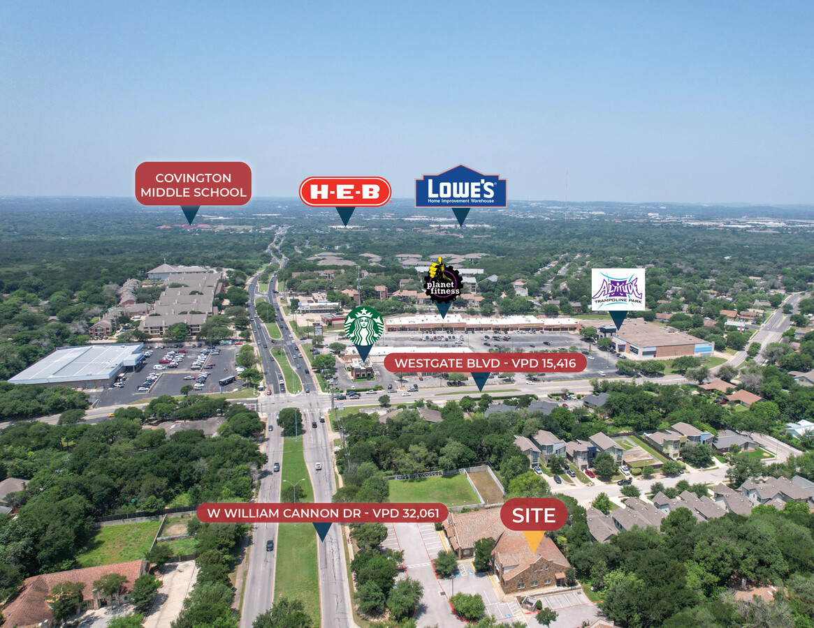
2500 W William Cannon Dr, Austin, TX 78745

This Property Is For Sale
Current Lease Availabilities
NEARBY LISTINGS FOR SALE OR LEASE
Property Detail
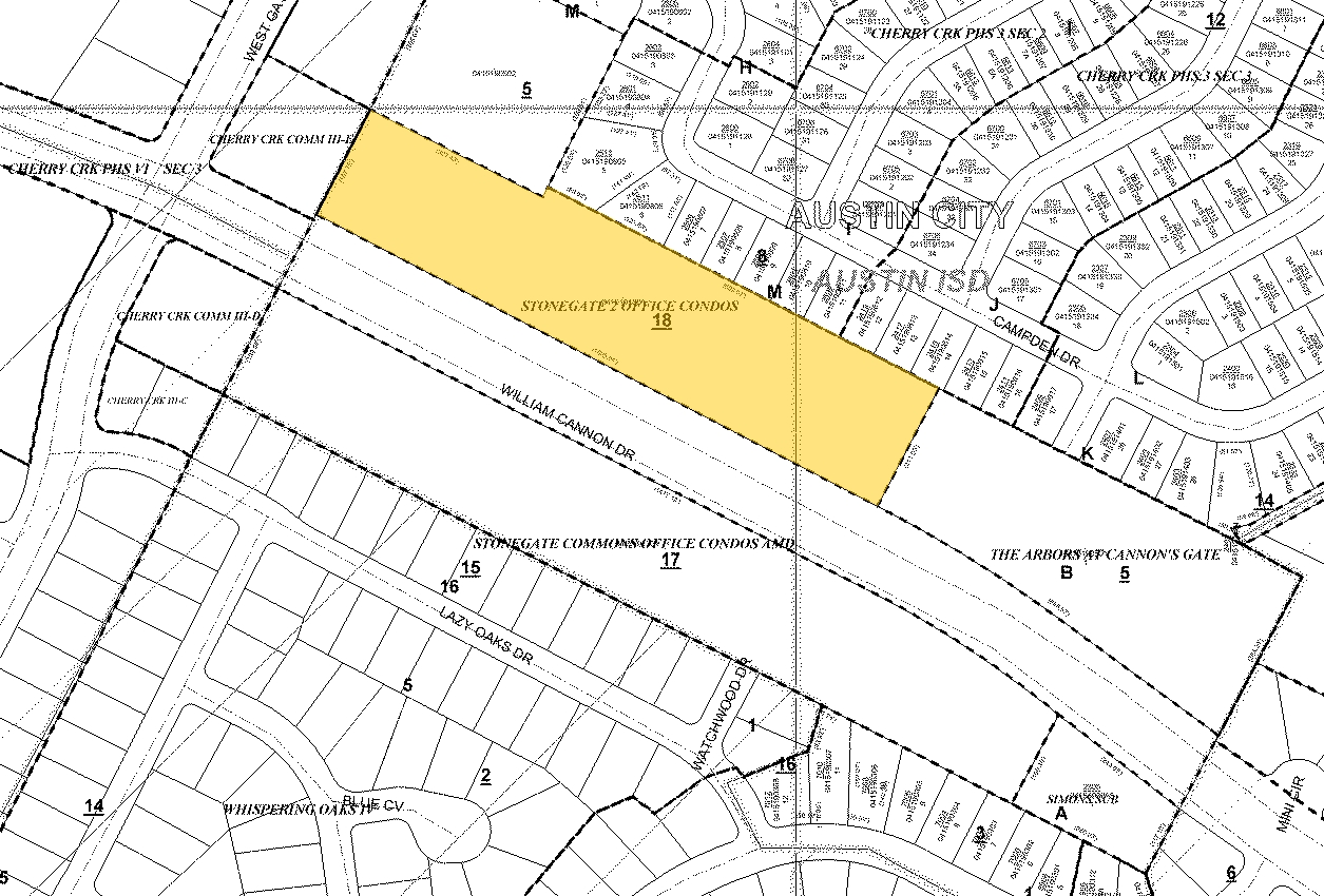
2500 W William Cannon Dr
Austin-Round Rock, TX
Stonegate Two Office Condominiums Amende
759646
UNT 101 BLD 1 STONEGATE TWO OFFICE CONDOMINIUMS PHS 1 AMENDED PLUS 3.0339 % INT IN COM AREA
Commercialcondominium
Travis
X
Texas
48453C0585H
101
2023
0.25 AC
2023
South
030400
Austin
1,591 SF
DEMOGRAPHICS near 2500 W William Cannon Dr
1 Mile
3 Mile
5 Mile
2024 Total Population
13,969
119,790
289,494
2029 Population
15,117
129,435
312,988
Pop Growth 2024-2029
+ 8.22%
+ 8.05%
+ 8.12%
Average Age
40
39
38
2024 Total Households
6,361
54,490
125,359
HH Growth 2024-2029
+ 8.82%
+ 8.79%
+ 8.91%
Median Household Inc
$86,283
$79,467
$85,379
Avg Household Size
2.10
2.10
2.20
2024 Avg HH Vehicles
2.00
2.00
2.00
Median Home Value
$387,113
$394,091
$445,832
Median Year Built
1984
1989
1994
Nearby Places
- Restaurants
- Banks
- Shops
- Fitness
- Groceries
PUBLIC TRANSPORTATION
COMMUTER RAIL
Austin (Texas Eagle - Amtrak)
DRIVE
WALK
Distance
Austin (Texas Eagle - Amtrak)
14 min
9.0 mi
AIRPORT
Austin-Bergstrom International
DRIVE
WALK
Distance
Austin-Bergstrom International
26 min
13.1 mi
Freight Ports
Calhoun Port
DRIVE
WALK
Distance
Calhoun Port
187 min
155.5 mi
Nearby Properties
Address
Land Use
TOTAL SIZE
Lot Size
Zoning
Address
Land Use
TOTAL SIZE
Lot Size
Zoning
881,940 SF
80.11 AC
Address
Land Use
TOTAL SIZE
Lot Size
Zoning
413,880 SF
30.20 AC
Address
Land Use
TOTAL SIZE
Lot Size
Zoning
450,836 SF
29.58 AC
Address
Land Use
TOTAL SIZE
Lot Size
Zoning
398,436 SF
30.81 AC
Address
Land Use
TOTAL SIZE
Lot Size
Zoning
432,404 SF
37.29 AC
Address
Land Use
TOTAL SIZE
Lot Size
Zoning
539,533 SF
26.50 AC
Address
Land Use
TOTAL SIZE
Lot Size
Zoning
342,956 SF
6.15 AC
Address
Land Use
TOTAL SIZE
Lot Size
Zoning
368,349 SF
17.13 AC
Address
Land Use
TOTAL SIZE
Lot Size
Zoning
401,771 SF
59.77 AC
Address
Land Use
TOTAL SIZE
Lot Size
Zoning
324,860 SF
8.36 AC
Address
Land Use
TOTAL SIZE
Lot Size
Zoning
425,720 SF
28.49 AC
Address
Land Use
TOTAL SIZE
Lot Size
Zoning
404,812 SF
31.32 AC
Address
Land Use
TOTAL SIZE
Lot Size
Zoning
399,828 SF
50.10 AC
Address
Land Use
TOTAL SIZE
Lot Size
Zoning
267,224 SF
54.96 AC
Address
Land Use
TOTAL SIZE
Lot Size
Zoning
256,182 SF
3.63 AC
Address
Land Use
TOTAL SIZE
Lot Size
Zoning
287,267 SF
13.28 AC
Address
Land Use
TOTAL SIZE
Lot Size
Zoning
359,144 SF
17.91 AC
Address
Land Use
TOTAL SIZE
Lot Size
Zoning
239,000 SF
2.62 AC
Address
Land Use
TOTAL SIZE
Lot Size
Zoning
315,198 SF
8.88 AC
Address
Land Use
TOTAL SIZE
Lot Size
Zoning
327,886 SF
23.91 AC
Address
Land Use
TOTAL SIZE
Lot Size
Zoning
246,854 SF
19.40 AC
Address
Land Use
TOTAL SIZE
Lot Size
Zoning
255,144 SF
6.62 AC
Address
Land Use
TOTAL SIZE
Lot Size
Zoning
307,584 SF
16.31 AC
Address
Land Use
TOTAL SIZE
Lot Size
Zoning
366,275 SF
44 SF
Address
Land Use
TOTAL SIZE
Lot Size
Zoning
272,824 SF
15.83 AC
Address
Land Use
TOTAL SIZE
Lot Size
Zoning
58.31 AC
Address
Land Use
TOTAL SIZE
Lot Size
Zoning
266,822 SF
23.45 AC
Address
Land Use
TOTAL SIZE
Lot Size
Zoning
198,334 SF
6.10 AC
Address
Land Use
TOTAL SIZE
Lot Size
Zoning
292,257 SF
33.21 AC
Address
Land Use
TOTAL SIZE
Lot Size
Zoning
249,600 SF
14.48 AC
The World's #1 Commercial Real Estate Marketplace
Connect with us
© 2025 CoStar Group
The information above has been obtained from sources believed reliable. While we do not doubt its accuracy we have not verified it and make no guarantee, warranty or representation about it. It is your responsibility to independently confirm its accuracy and completeness. Any projections, opinions, assumptions, or estimates used are for example only and do not represent the current or future performance of the property. The value of this transaction to you depends on tax and other factors which should be evaluated by your tax, financial, and legal advisors. You and your advisors should conduct a careful, independent investigation of the property to determine to your satisfaction the suitability of the property for your needs.