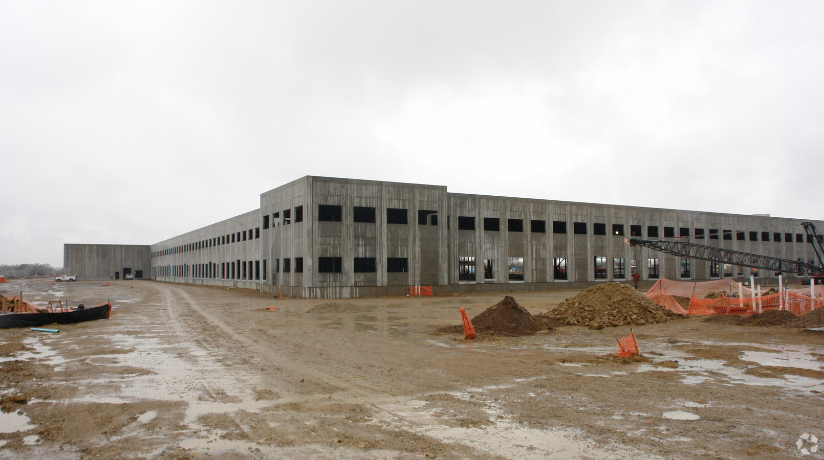
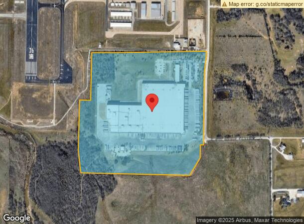
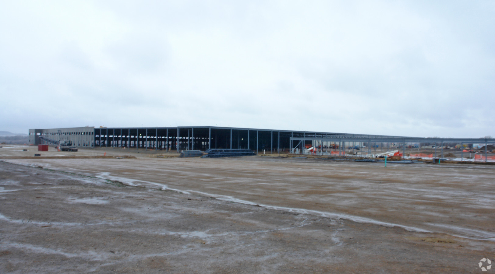
Property Record
2500 Westcourt Rd, Denton, TX 76207
NEARBY LISTINGS FOR SALE OR LEASE
Property Detail
2500 Westcourt Rd
Dallas-Fort Worth-Arlington, TX
Aldi Distribution Center
R583774
ALDI DISTRIBUTION CENTER BLK 1 LOT 1
Commercialnec
Denton
AE
Texas
48121C0355G
1
2024
57.31 AC
2024
Denton
020800
Dallas/Ft Worth
550,569 SF
DEMOGRAPHICS near 2500 Westcourt Rd
1 Mile
3 Mile
5 Mile
2024 Total Population
21
19,493
95,004
2029 Population
27
23,936
115,287
Pop Growth 2024-2029
+ 28.57%
+ 22.79%
+ 21.35%
Average Age
26
32
36
2024 Total Households
9
7,767
38,903
HH Growth 2024-2029
+ 22.22%
+ 24.13%
+ 22.48%
Median Household Inc
$39,999
$41,002
$58,238
Avg Household Size
2.10
2.30
2.20
2024 Avg HH Vehicles
2.00
2.00
2.00
Median Home Value
$0
$239,957
$306,973
Median Year Built
2010
1995
1994
Nearby Places
- Restaurants
- Banks
- Shops
- Fitness
- Groceries
PUBLIC TRANSPORTATION
COMMUTER RAIL
Downtown Denton Transit Center (A-train - Denton County Transportation Authority)
DRIVE
WALK
Distance
Downtown Denton Transit Center (A-train - Denton County Transportation Authority)
16 min
6.4 mi
Medpark Station (A-train - Denton County Transportation Authority)
DRIVE
WALK
Distance
Medpark Station (A-train - Denton County Transportation Authority)
17 min
7.7 mi
AIRPORT
Dallas-Fort Worth International
DRIVE
WALK
Distance
Dallas-Fort Worth International
42 min
30.3 mi
Freight Ports
Port of Shreveport
DRIVE
WALK
Distance
Port of Shreveport
261 min
236.9 mi
Nearby Properties
Address
Land Use
TOTAL SIZE
Lot Size
Zoning
Address
Land Use
TOTAL SIZE
Lot Size
Zoning
515,383 SF
24.39 AC
Address
Land Use
TOTAL SIZE
Lot Size
Zoning
1,121,760 SF
73.87 AC
Address
Land Use
TOTAL SIZE
Lot Size
Zoning
884,646 SF
77.21 AC
Address
Land Use
TOTAL SIZE
Lot Size
Zoning
480,027 SF
4.01 AC
Address
Land Use
TOTAL SIZE
Lot Size
Zoning
343,805 SF
10.95 AC
Address
Land Use
TOTAL SIZE
Lot Size
Zoning
417,554 SF
5.91 AC
Address
Land Use
TOTAL SIZE
Lot Size
Zoning
139.10 AC
Address
Land Use
TOTAL SIZE
Lot Size
Zoning
144,774 SF
Address
Land Use
TOTAL SIZE
Lot Size
Zoning
374,520 SF
23.62 AC
Address
Land Use
TOTAL SIZE
Lot Size
Zoning
611,770 SF
44.56 AC
Address
Land Use
TOTAL SIZE
Lot Size
Zoning
352,862 SF
47.44 AC
Address
Land Use
TOTAL SIZE
Lot Size
Zoning
334,834 SF
11.95 AC
Address
Land Use
TOTAL SIZE
Lot Size
Zoning
316,987 SF
18.22 AC
29G
Address
Land Use
TOTAL SIZE
Lot Size
Zoning
352,950 SF
21.43 AC
Address
Land Use
TOTAL SIZE
Lot Size
Zoning
280,700 SF
45.16 AC
Address
Land Use
TOTAL SIZE
Lot Size
Zoning
48,141 SF
54.26 AC
Address
Land Use
TOTAL SIZE
Lot Size
Zoning
422,240 SF
89.07 AC
Address
Land Use
TOTAL SIZE
Lot Size
Zoning
292,407 SF
7.07 AC
Address
Land Use
TOTAL SIZE
Lot Size
Zoning
766,475 SF
122.71 AC
Address
Land Use
TOTAL SIZE
Lot Size
Zoning
402,802 SF
27.28 AC
Address
Land Use
TOTAL SIZE
Lot Size
Zoning
392,706 SF
30 AC
Address
Land Use
TOTAL SIZE
Lot Size
Zoning
419,220 SF
22.58 AC
Address
Land Use
TOTAL SIZE
Lot Size
Zoning
201,080 SF
10.93 AC
Address
Land Use
TOTAL SIZE
Lot Size
Zoning
311,680 SF
42.74 AC
Address
Land Use
TOTAL SIZE
Lot Size
Zoning
4,800 SF
2.91 AC
Address
Land Use
TOTAL SIZE
Lot Size
Zoning
448,386 SF
19.27 AC
Address
Land Use
TOTAL SIZE
Lot Size
Zoning
436,808 SF
27.55 AC
Address
Land Use
TOTAL SIZE
Lot Size
Zoning
255,510 SF
24.43 AC
Address
Land Use
TOTAL SIZE
Lot Size
Zoning
280,500 SF
21.50 AC
The World's #1 Commercial Real Estate Marketplace
Connect with us
© 2025 CoStar Group
The information above has been obtained from sources believed reliable. While we do not doubt its accuracy we have not verified it and make no guarantee, warranty or representation about it. It is your responsibility to independently confirm its accuracy and completeness. Any projections, opinions, assumptions, or estimates used are for example only and do not represent the current or future performance of the property. The value of this transaction to you depends on tax and other factors which should be evaluated by your tax, financial, and legal advisors. You and your advisors should conduct a careful, independent investigation of the property to determine to your satisfaction the suitability of the property for your needs.