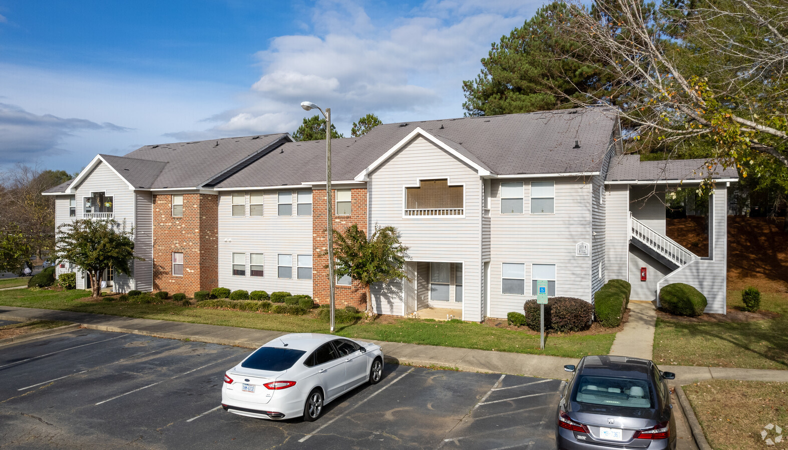
Property Record
2501 Buffalo Church Rd, Sanford, NC 27330
NEARBY LISTINGS FOR SALE OR LEASE
-
-
View all Sanford listings for sale on LoopNet.com
Property Detail
2501 Buffalo Church Rd
9642-04-5210-00
2700- 2844 MALLARD COVE RD 620/941 1318/438
Apartment
Lee
AE
North Carolina
3710964200J
8.26 AC
2024
North Carolina Southeast Area
2024
Other Market Areas
030101
Sanford, NC
14,912 SF
DEMOGRAPHICS near 2501 Buffalo Church Rd
1 Mile
3 Mile
5 Mile
2024 Total Population
3,685
29,097
42,168
2029 Population
3,968
31,680
45,980
Pop Growth 2024-2029
+ 7.68%
+ 8.88%
+ 9.04%
Average Age
38
38
38
2024 Total Households
1,519
11,056
16,107
HH Growth 2024-2029
+ 7.57%
+ 8.82%
+ 9.00%
Median Household Inc
$47,789
$49,750
$53,285
Avg Household Size
2.30
2.50
2.50
2024 Avg HH Vehicles
2.00
2.00
2.00
Median Home Value
$159,966
$162,382
$166,570
Median Year Built
1989
1981
1984
Nearby Places
- Restaurants
- Banks
- Shops
- Fitness
- Groceries
Nearby Properties
Address
Land Use
TOTAL SIZE
Lot Size
Zoning
Address
Land Use
TOTAL SIZE
Lot Size
Zoning
132,378 SF
62.08 AC
OFFICE & I
Address
Land Use
TOTAL SIZE
Lot Size
Zoning
792 SF
72.08 AC
RESIDENTIA
Address
Land Use
TOTAL SIZE
Lot Size
Zoning
5,400 SF
38.98 AC
MF12C
Address
Land Use
TOTAL SIZE
Lot Size
Zoning
11,660 SF
3.98 AC
OFFICE & I
Address
Land Use
TOTAL SIZE
Lot Size
Zoning
154,666 SF
17.32 AC
OFFICE & I
Address
Land Use
TOTAL SIZE
Lot Size
Zoning
100,366 SF
44.51 AC
OFFICE & I
Address
Land Use
TOTAL SIZE
Lot Size
Zoning
1,577 SF
18.13 AC
OFFICE & I
Address
Land Use
TOTAL SIZE
Lot Size
Zoning
75,684 SF
52.71 AC
OFFICE & I
Address
Land Use
TOTAL SIZE
Lot Size
Zoning
75,684 SF
23.45 AC
OFFICE & I
Address
Land Use
TOTAL SIZE
Lot Size
Zoning
2,989 SF
12.85 AC
RESIDENTIA
Address
Land Use
TOTAL SIZE
Lot Size
Zoning
149,148 SF
10.20 AC
RESIDENTIA
Address
Land Use
TOTAL SIZE
Lot Size
Zoning
82,344 SF
16.59 AC
RESIDENTIA
Address
Land Use
TOTAL SIZE
Lot Size
Zoning
6,533 SF
21.95 AC
HIGHWAY CO
Address
Land Use
TOTAL SIZE
Lot Size
Zoning
76,100 SF
2.34 AC
OFFICE & I
Address
Land Use
TOTAL SIZE
Lot Size
Zoning
54,965 SF
10.47 AC
RR
Address
Land Use
TOTAL SIZE
Lot Size
Zoning
27,438 SF
14.44 AC
C2
Address
Land Use
TOTAL SIZE
Lot Size
Zoning
51,352 SF
4.33 AC
OFFICE & I
Address
Land Use
TOTAL SIZE
Lot Size
Zoning
1,200 SF
30.63 AC
RESIDENTIA
Address
Land Use
TOTAL SIZE
Lot Size
Zoning
1,904 SF
101.48 AC
LIGHT INDU
Address
Land Use
TOTAL SIZE
Lot Size
Zoning
1,930 SF
9.28 AC
RESIDENTIA
Address
Land Use
TOTAL SIZE
Lot Size
Zoning
65,598 SF
8.26 AC
C-2
Address
Land Use
TOTAL SIZE
Lot Size
Zoning
23,250 SF
22.80 AC
RESIDENTIA
Address
Land Use
TOTAL SIZE
Lot Size
Zoning
1,440 SF
7.59 AC
OFFICE & I
Address
Land Use
TOTAL SIZE
Lot Size
Zoning
52,276 SF
35.17 AC
LIGHT INDU
Address
Land Use
TOTAL SIZE
Lot Size
Zoning
8,578 SF
4.87 AC
OFFICE & I
Address
Land Use
TOTAL SIZE
Lot Size
Zoning
55,588 SF
7.28 AC
C-2
Address
Land Use
TOTAL SIZE
Lot Size
Zoning
15,720 SF
5.35 AC
OFFICE & I
Address
Land Use
TOTAL SIZE
Lot Size
Zoning
32,624 SF
8.64 AC
RESIDENTIA
Address
Land Use
TOTAL SIZE
Lot Size
Zoning
52,311 SF
20.25 AC
OFFICE & I
The World's #1 Commercial Real Estate Marketplace
Connect with us
© 2025 CoStar Group
The information above has been obtained from sources believed reliable. While we do not doubt its accuracy we have not verified it and make no guarantee, warranty or representation about it. It is your responsibility to independently confirm its accuracy and completeness. Any projections, opinions, assumptions, or estimates used are for example only and do not represent the current or future performance of the property. The value of this transaction to you depends on tax and other factors which should be evaluated by your tax, financial, and legal advisors. You and your advisors should conduct a careful, independent investigation of the property to determine to your satisfaction the suitability of the property for your needs.