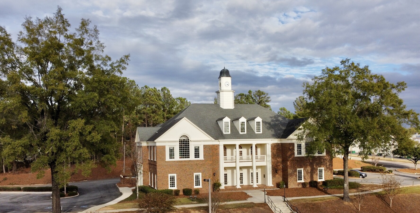
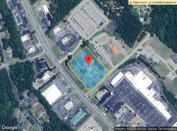
Property Record
2501 N Columbia St, Milledgeville, GA 31061
NEARBY LISTINGS FOR SALE OR LEASE
Property Detail
2501 N Columbia St
M72-007
Comm-Columbia St 3
Financialbuilding
ES HWY 441 N DB275/398-404
X
Baldwin
13009C0135D
Georgia
2023
2.76 AC
2024
Georgia South Area
970302
Other Market Areas
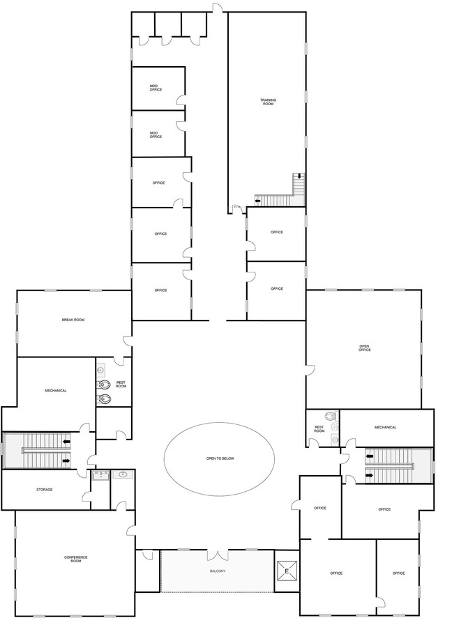
18,810 SF
Milledgeville, GA
DEMOGRAPHICS near 2501 N Columbia St
1 Mile
3 Mile
5 Mile
2024 Total Population
1,859
14,714
28,482
2029 Population
1,798
14,632
28,508
Pop Growth 2024-2029
(3.28%)
(0.56%)
+ 0.09%
Average Age
43
37
39
2024 Total Households
775
6,131
11,396
HH Growth 2024-2029
(3.48%)
(0.65%)
+ 0.06%
Median Household Inc
$71,854
$41,392
$44,906
Avg Household Size
2.40
2.20
2.30
2024 Avg HH Vehicles
2.00
2.00
2.00
Median Home Value
$209,917
$205,414
$186,389
Median Year Built
1982
1982
1982
Nearby Places
- Restaurants
- Banks
- Shops
- Fitness
- Groceries
SALE & LEASE HISTORY
LISTING DATE
SALE/LEASE

Nov 16, 2022
For Sale
Nearby Properties
Address
Land Use
TOTAL SIZE
Lot Size
Zoning
Address
Land Use
TOTAL SIZE
Lot Size
Zoning
19.20 AC
RESIDENTIA
Address
Land Use
TOTAL SIZE
Lot Size
Zoning
29.65 AC
RESIDENTIA
Address
Land Use
TOTAL SIZE
Lot Size
Zoning
59,500 SF
44 AC
RESIDENTIA
Address
Land Use
TOTAL SIZE
Lot Size
Zoning
430,556 SF
32.09 AC
RESIDENTIA
Address
Land Use
TOTAL SIZE
Lot Size
Zoning
74,448 SF
49 AC
RESIDENTIA
Address
Land Use
TOTAL SIZE
Lot Size
Zoning
107,725 SF
18.56 AC
COMMERCIAL
Address
Land Use
TOTAL SIZE
Lot Size
Zoning
25,807 SF
10.05 AC
UNZONED RU
Address
Land Use
TOTAL SIZE
Lot Size
Zoning
2.50 AC
RESIDENTIA
Address
Land Use
TOTAL SIZE
Lot Size
Zoning
75,000 SF
40.26 AC
RESIDENTIA
Address
Land Use
TOTAL SIZE
Lot Size
Zoning
49,412 SF
0.26 AC
RESIDENTIA
Address
Land Use
TOTAL SIZE
Lot Size
Zoning
313,804 SF
17.50 AC
RESIDENTIA
Address
Land Use
TOTAL SIZE
Lot Size
Zoning
99,553 SF
8.94 AC
COMMERCIAL
Address
Land Use
TOTAL SIZE
Lot Size
Zoning
30.05 AC
RESIDENTIA
Address
Land Use
TOTAL SIZE
Lot Size
Zoning
866,082 SF
6.61 AC
RESIDENTIA
Address
Land Use
TOTAL SIZE
Lot Size
Zoning
40,800 SF
0.14 AC
RESIDENTIA
Address
Land Use
TOTAL SIZE
Lot Size
Zoning
12.30 AC
RESIDENTIA
Address
Land Use
TOTAL SIZE
Lot Size
Zoning
66,430 SF
14.93 AC
COMMERCIAL
Address
Land Use
TOTAL SIZE
Lot Size
Zoning
9,648 SF
25.98 AC
RESIDENTIA
Address
Land Use
TOTAL SIZE
Lot Size
Zoning
228,844 SF
3.20 AC
RESIDENTIA
Address
Land Use
TOTAL SIZE
Lot Size
Zoning
554,286 SF
24.17 AC
RESIDENTIA
Address
Land Use
TOTAL SIZE
Lot Size
Zoning
6,318 SF
27.92 AC
RESIDENTIA
Address
Land Use
TOTAL SIZE
Lot Size
Zoning
170 SF
2.96 AC
RESIDENTIA
Address
Land Use
TOTAL SIZE
Lot Size
Zoning
76,800 SF
0.86 AC
UNZONED UR
Address
Land Use
TOTAL SIZE
Lot Size
Zoning
46,858 SF
2.64 AC
RESIDENTIA
Address
Land Use
TOTAL SIZE
Lot Size
Zoning
50,580 SF
7.61 AC
COMMERCIAL
Address
Land Use
TOTAL SIZE
Lot Size
Zoning
34,953 SF
2.17 AC
RESIDENTIA
Address
Land Use
TOTAL SIZE
Lot Size
Zoning
76,582 SF
3.17 AC
RESIDENTIA
Address
Land Use
TOTAL SIZE
Lot Size
Zoning
37,296 SF
13.50 AC
RESIDENTIA
Address
Land Use
TOTAL SIZE
Lot Size
Zoning
17,980 SF
2.30 AC
COMMERCIAL
Address
Land Use
TOTAL SIZE
Lot Size
Zoning
160,604 SF
8.29 AC
RESIDENTIA
The World's #1 Commercial Real Estate Marketplace
Connect with us
© 2025 CoStar Group
The information above has been obtained from sources believed reliable. While we do not doubt its accuracy we have not verified it and make no guarantee, warranty or representation about it. It is your responsibility to independently confirm its accuracy and completeness. Any projections, opinions, assumptions, or estimates used are for example only and do not represent the current or future performance of the property. The value of this transaction to you depends on tax and other factors which should be evaluated by your tax, financial, and legal advisors. You and your advisors should conduct a careful, independent investigation of the property to determine to your satisfaction the suitability of the property for your needs.