No Photo
Property Record
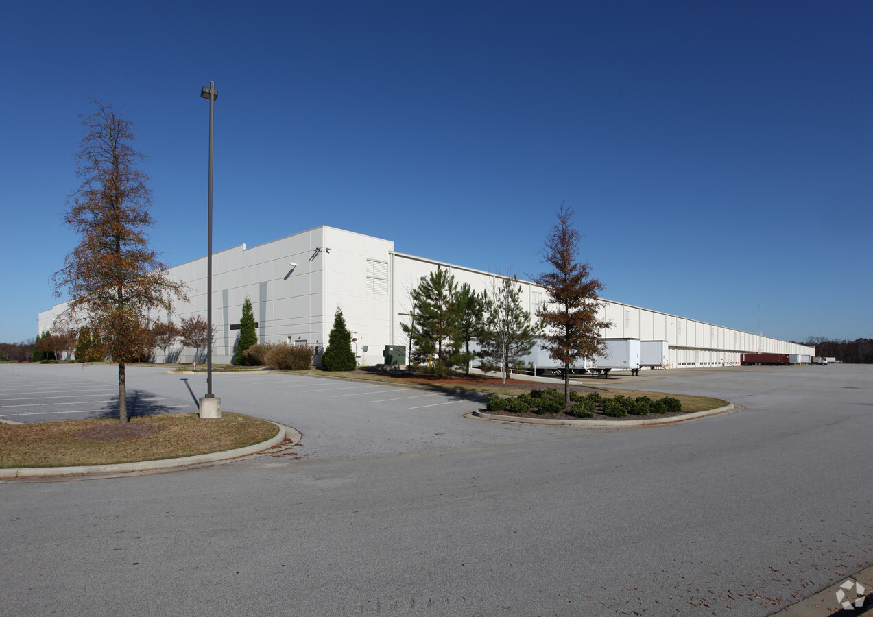
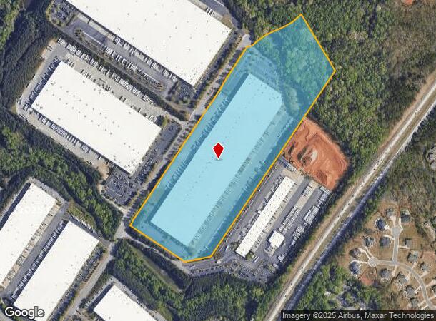
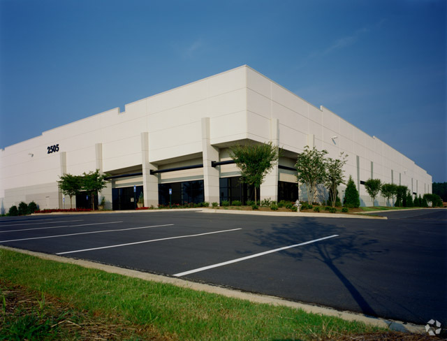
2505 Mill Center Pky, Buford, GA 30518

NEARBY LISTINGS FOR SALE OR LEASE
-
-
-
-
-
-
-
No Photo
-
-
-
View all Buford listings for sale on LoopNet.com
Property Detail
2505 Mill Center Pky
Atlanta-Sandy Springs-Roswell, GA
Hamilton Mill Business Center
7-262-059
L4 BB HAMILTON MILL BUSINESS CENTER #1
Warehouse
Gwinnett
X
Georgia
13135C0016G
4
2024
40.90 AC
2023
Duluth/Suwanee/Buford
050105
Atlanta
652,710 SF
DEMOGRAPHICS near 2505 Mill Center Pky
1 Mile
3 Mile
5 Mile
2024 Total Population
4,292
44,981
122,350
2029 Population
4,499
47,721
130,416
Pop Growth 2024-2029
+ 4.82%
+ 6.09%
+ 6.59%
Average Age
36
37
38
2024 Total Households
1,283
14,780
40,445
HH Growth 2024-2029
+ 5.07%
+ 6.24%
+ 6.75%
Median Household Inc
$78,345
$74,928
$85,607
Avg Household Size
3.30
3.00
3.00
2024 Avg HH Vehicles
2.00
2.00
2.00
Median Home Value
$353,584
$345,822
$334,819
Median Year Built
1993
2002
2002
Nearby Places
- Restaurants
- Banks
- Shops
- Fitness
- Groceries
Nearby Properties
Address
Land Use
TOTAL SIZE
Lot Size
Zoning
Address
Land Use
TOTAL SIZE
Lot Size
Zoning
285,000 SF
97.06 AC
M-I
Address
Land Use
TOTAL SIZE
Lot Size
Zoning
815,563 SF
58.80 AC
M-I
Address
Land Use
TOTAL SIZE
Lot Size
Zoning
101,632 SF
78.33 AC
M-I
Address
Land Use
TOTAL SIZE
Lot Size
Zoning
213,532 SF
44.32 AC
M-I
Address
Land Use
TOTAL SIZE
Lot Size
Zoning
286,520 SF
21.60 AC
P
Address
Land Use
TOTAL SIZE
Lot Size
Zoning
573,750 SF
43.94 AC
C1
Address
Land Use
TOTAL SIZE
Lot Size
Zoning
875,180 SF
58.69 AC
C1
Address
Land Use
TOTAL SIZE
Lot Size
Zoning
544,900 SF
46.95 AC
M1-LIGHT I
Address
Land Use
TOTAL SIZE
Lot Size
Zoning
427,000 SF
37.90 AC
M1
Address
Land Use
TOTAL SIZE
Lot Size
Zoning
357,698 SF
46.16 AC
HM1-LIGHT
Address
Land Use
TOTAL SIZE
Lot Size
Zoning
496,608 SF
29.68 AC
C2
Address
Land Use
TOTAL SIZE
Lot Size
Zoning
488,890 SF
59.62 AC
M1
Address
Land Use
TOTAL SIZE
Lot Size
Zoning
143,000 SF
41.30 AC
M-I
Address
Land Use
TOTAL SIZE
Lot Size
Zoning
641,180 SF
57.04 AC
M1
Address
Land Use
TOTAL SIZE
Lot Size
Zoning
422,933 SF
42.35 AC
M1
Address
Land Use
TOTAL SIZE
Lot Size
Zoning
150,591 SF
24.39 AC
P
Address
Land Use
TOTAL SIZE
Lot Size
Zoning
458,256 SF
26.39 AC
M-I
Address
Land Use
TOTAL SIZE
Lot Size
Zoning
461,700 SF
43.77 AC
C2
Address
Land Use
TOTAL SIZE
Lot Size
Zoning
300,000 SF
23.03 AC
M-II
Address
Land Use
TOTAL SIZE
Lot Size
Zoning
72,304 SF
83.10 AC
R100
Address
Land Use
TOTAL SIZE
Lot Size
Zoning
371,843 SF
35.60 AC
M1
Address
Land Use
TOTAL SIZE
Lot Size
Zoning
353,241 SF
33.16 AC
C2
Address
Land Use
TOTAL SIZE
Lot Size
Zoning
92,789 SF
8.93 AC
C2
Address
Land Use
TOTAL SIZE
Lot Size
Zoning
339,600 SF
50.35 AC
M1
Address
Land Use
TOTAL SIZE
Lot Size
Zoning
445,214 SF
54.83 AC
C2
Address
Land Use
TOTAL SIZE
Lot Size
Zoning
274,018 SF
25.57 AC
M1
Address
Land Use
TOTAL SIZE
Lot Size
Zoning
162,013 SF
20.23 AC
RA200
Address
Land Use
TOTAL SIZE
Lot Size
Zoning
303,526 SF
19.77 AC
M1
Address
Land Use
TOTAL SIZE
Lot Size
Zoning
250,444 SF
32.04 AC
M1
The World's #1 Commercial Real Estate Marketplace
Connect with us
© 2025 CoStar Group
The information above has been obtained from sources believed reliable. While we do not doubt its accuracy we have not verified it and make no guarantee, warranty or representation about it. It is your responsibility to independently confirm its accuracy and completeness. Any projections, opinions, assumptions, or estimates used are for example only and do not represent the current or future performance of the property. The value of this transaction to you depends on tax and other factors which should be evaluated by your tax, financial, and legal advisors. You and your advisors should conduct a careful, independent investigation of the property to determine to your satisfaction the suitability of the property for your needs.