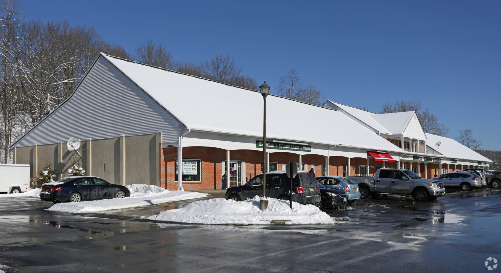
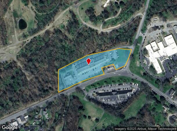
Property Record
2509 Route 44, Salt Point, NY 12578
NEARBY LISTINGS FOR SALE OR LEASE
Property Detail
2509 Route 44
134400-6565-04-710007-0000
3.5 AC
Regionalshoppingcenterormallwithanchorstore
Dutchess
A
New York
36027C0292E
710
2024
3.50 AC
2023
Fishkill
130005
Westchester/So Connecticut
25,148 SF
Dutchess County-Putnam County, NY
DEMOGRAPHICS near 2509 Route 44
1 Mile
3 Mile
5 Mile
2024 Total Population
223
4,230
13,785
2029 Population
222
4,208
13,682
Pop Growth 2024-2029
(0.45%)
(0.52%)
(0.75%)
Average Age
44
44
44
2024 Total Households
86
1,610
5,500
HH Growth 2024-2029
0.00%
(0.56%)
(0.87%)
Median Household Inc
$89,062
$94,802
$92,481
Avg Household Size
2.50
2.60
2.40
2024 Avg HH Vehicles
2.00
2.00
2.00
Median Home Value
$377,499
$375,776
$394,518
Median Year Built
1958
1965
1971
Nearby Places
- Restaurants
- Banks
- Shops
- Fitness
- Groceries
PUBLIC TRANSPORTATION
AIRPORT
New York Stewart International
DRIVE
WALK
Distance
New York Stewart International
52 min
35.8 mi
Freight Ports
Port of New Haven
DRIVE
WALK
Distance
Port of New Haven
110 min
79.7 mi
SALE & LEASE HISTORY
LISTING DATE
SALE/LEASE

Sep 26, 2016
For Lease
May 13, 2024
For Lease
Nearby Properties
Address
Land Use
TOTAL SIZE
Lot Size
Zoning
Address
Land Use
TOTAL SIZE
Lot Size
Zoning
40,113 SF
212.96 AC
RU
Address
Land Use
TOTAL SIZE
Lot Size
Zoning
41 SF
50.29 AC
RM2
Address
Land Use
TOTAL SIZE
Lot Size
Zoning
6,256 SF
356.60 AC
RR10
Address
Land Use
TOTAL SIZE
Lot Size
Zoning
3,814 SF
391 AC
RR10
Address
Land Use
TOTAL SIZE
Lot Size
Zoning
4,434 SF
6.20 AC
RU
Address
Land Use
TOTAL SIZE
Lot Size
Zoning
10,363 SF
326.90 AC
RR10
Address
Land Use
TOTAL SIZE
Lot Size
Zoning
9,069 SF
233.40 AC
RL5
Address
Land Use
TOTAL SIZE
Lot Size
Zoning
41 SF
6.90 AC
RL5
Address
Land Use
TOTAL SIZE
Lot Size
Zoning
53,084 SF
15.80 AC
H-WH
Address
Land Use
TOTAL SIZE
Lot Size
Zoning
2,472 SF
190 AC
RR10
Address
Land Use
TOTAL SIZE
Lot Size
Zoning
9.61 AC
RM2
Address
Land Use
TOTAL SIZE
Lot Size
Zoning
7,479 SF
194.40 AC
RL5
Address
Land Use
TOTAL SIZE
Lot Size
Zoning
198.06 AC
Q
Address
Land Use
TOTAL SIZE
Lot Size
Zoning
1.10 AC
LDR
Address
Land Use
TOTAL SIZE
Lot Size
Zoning
2,950 SF
159.76 AC
AR5A
Address
Land Use
TOTAL SIZE
Lot Size
Zoning
25,106 SF
31.98 AC
RM2
Address
Land Use
TOTAL SIZE
Lot Size
Zoning
23,344 SF
5.67 AC
MC
Address
Land Use
TOTAL SIZE
Lot Size
Zoning
49,462 SF
3.60 AC
H-WH
Address
Land Use
TOTAL SIZE
Lot Size
Zoning
6,174 SF
52.70 AC
RL5
Address
Land Use
TOTAL SIZE
Lot Size
Zoning
5,967 SF
15.09 AC
RL5
Address
Land Use
TOTAL SIZE
Lot Size
Zoning
5.67 AC
CR1A
Address
Land Use
TOTAL SIZE
Lot Size
Zoning
13,230 SF
1.13 AC
RL5
Address
Land Use
TOTAL SIZE
Lot Size
Zoning
7,782 SF
33.76 AC
RL5
Address
Land Use
TOTAL SIZE
Lot Size
Zoning
6,176 SF
77.50 AC
RS5
Address
Land Use
TOTAL SIZE
Lot Size
Zoning
4,921 SF
40 AC
AR5A
Address
Land Use
TOTAL SIZE
Lot Size
Zoning
20,195 SF
282.63 AC
RA
Address
Land Use
TOTAL SIZE
Lot Size
Zoning
8,440 SF
53.45 AC
RL5
Address
Land Use
TOTAL SIZE
Lot Size
Zoning
5,350 SF
78.78 AC
RL5
Address
Land Use
TOTAL SIZE
Lot Size
Zoning
4,211 SF
121.33 AC
RA
The World's #1 Commercial Real Estate Marketplace
Connect with us
© 2025 CoStar Group
The information above has been obtained from sources believed reliable. While we do not doubt its accuracy we have not verified it and make no guarantee, warranty or representation about it. It is your responsibility to independently confirm its accuracy and completeness. Any projections, opinions, assumptions, or estimates used are for example only and do not represent the current or future performance of the property. The value of this transaction to you depends on tax and other factors which should be evaluated by your tax, financial, and legal advisors. You and your advisors should conduct a careful, independent investigation of the property to determine to your satisfaction the suitability of the property for your needs.