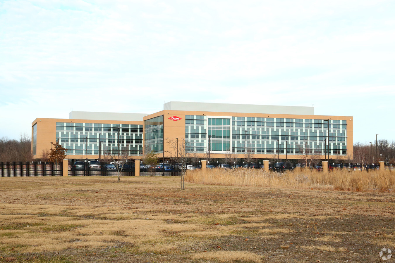
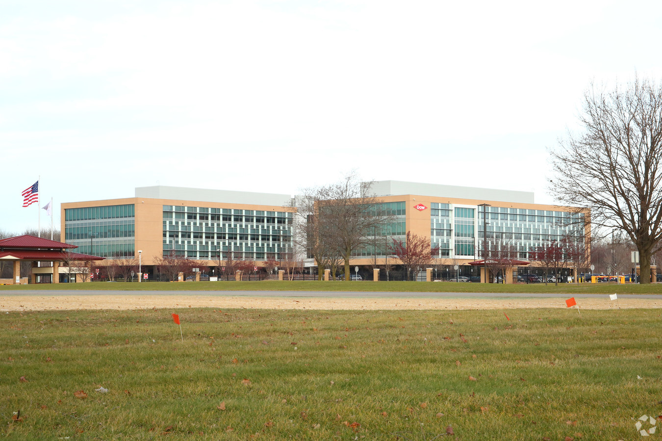
Property Record
2511 E Patrick Rd, Midland, MI 48642

NEARBY LISTINGS FOR SALE OR LEASE
Property Detail
2511 E Patrick Rd
14-14-40-400
COM AT S 1/4 COR SEC 14, T14N-R2E, TH W 67.55 FT ALG S SEC LN, N 1264.05 FT, E1510.46 FT, TH S 111 FT, S 35D 00M 00S E 359
Officebuilding
Midland
X
Michigan
26111C0277E
47.21 AC
2024
Midland/Flint
2024
Other Market Areas
290902
Midland, MI
203,835 SF
DEMOGRAPHICS near 2511 E Patrick Rd
1 Mile
3 Mile
5 Mile
2024 Total Population
6,867
30,865
47,148
2029 Population
7,069
30,926
47,146
Pop Growth 2024-2029
+ 2.94%
+ 0.20%
0.00%
Average Age
40
42
42
2024 Total Households
3,101
13,362
19,758
HH Growth 2024-2029
+ 3.06%
+ 0.25%
+ 0.04%
Median Household Inc
$50,980
$61,251
$67,832
Avg Household Size
2.10
2.20
2.30
2024 Avg HH Vehicles
1.00
2.00
2.00
Median Home Value
$151,340
$161,283
$174,840
Median Year Built
1973
1967
1970
Nearby Places
- Restaurants
- Banks
- Shops
- Fitness
- Groceries
PUBLIC TRANSPORTATION
AIRPORT
MBS International
DRIVE
WALK
Distance
MBS International
19 min
11.0 mi
Freight Ports
Port of Toledo
DRIVE
WALK
Distance
Port of Toledo
194 min
169.5 mi
Nearby Properties
Address
Land Use
TOTAL SIZE
Lot Size
Zoning
Address
Land Use
TOTAL SIZE
Lot Size
Zoning
1,586,189 SF
242.68 AC
IB
Address
Land Use
TOTAL SIZE
Lot Size
Zoning
444,697 SF
52.33 AC
IA
Address
Land Use
TOTAL SIZE
Lot Size
Zoning
218,000 SF
5.02 AC
D
Address
Land Use
TOTAL SIZE
Lot Size
Zoning
58,714 SF
382.63 AC
COM
Address
Land Use
TOTAL SIZE
Lot Size
Zoning
192,945 SF
15.02 AC
LCMR
Address
Land Use
TOTAL SIZE
Lot Size
Zoning
Address
Land Use
TOTAL SIZE
Lot Size
Zoning
202,789 SF
139.19 AC
NC
Address
Land Use
TOTAL SIZE
Lot Size
Zoning
116,057 SF
120 AC
RA-1
Address
Land Use
TOTAL SIZE
Lot Size
Zoning
145,690 SF
1.69 AC
D
Address
Land Use
TOTAL SIZE
Lot Size
Zoning
49,903 SF
Address
Land Use
TOTAL SIZE
Lot Size
Zoning
219,270 SF
20 AC
RB
Address
Land Use
TOTAL SIZE
Lot Size
Zoning
115,878 SF
7.53 AC
RB
Address
Land Use
TOTAL SIZE
Lot Size
Zoning
167,772 SF
21.10 AC
LCMR
Address
Land Use
TOTAL SIZE
Lot Size
Zoning
12.90 AC
C
Address
Land Use
TOTAL SIZE
Lot Size
Zoning
Address
Land Use
TOTAL SIZE
Lot Size
Zoning
124,777 SF
9.69 AC
LCMR
Address
Land Use
TOTAL SIZE
Lot Size
Zoning
2,800 SF
8.52 AC
IB
Address
Land Use
TOTAL SIZE
Lot Size
Zoning
52,574 SF
5.61 AC
IA
Address
Land Use
TOTAL SIZE
Lot Size
Zoning
44,639 SF
0.66 AC
D
Address
Land Use
TOTAL SIZE
Lot Size
Zoning
53,319 SF
3.24 AC
RC
Address
Land Use
TOTAL SIZE
Lot Size
Zoning
76,333 SF
10 AC
RB
Address
Land Use
TOTAL SIZE
Lot Size
Zoning
126,335 SF
11.79 AC
RC
Address
Land Use
TOTAL SIZE
Lot Size
Zoning
99,327 SF
7.96 AC
RB
Address
Land Use
TOTAL SIZE
Lot Size
Zoning
43,068 SF
1.32 AC
D
Address
Land Use
TOTAL SIZE
Lot Size
Zoning
3,684 SF
Address
Land Use
TOTAL SIZE
Lot Size
Zoning
50,720 SF
226.37 AC
IB
Address
Land Use
TOTAL SIZE
Lot Size
Zoning
115,790 SF
6.04 AC
RB
Address
Land Use
TOTAL SIZE
Lot Size
Zoning
81,373 SF
8.93 AC
RC
Address
Land Use
TOTAL SIZE
Lot Size
Zoning
135,082 SF
10.34 AC
IA
The World's #1 Commercial Real Estate Marketplace
Connect with us
© 2025 CoStar Group
The information above has been obtained from sources believed reliable. While we do not doubt its accuracy we have not verified it and make no guarantee, warranty or representation about it. It is your responsibility to independently confirm its accuracy and completeness. Any projections, opinions, assumptions, or estimates used are for example only and do not represent the current or future performance of the property. The value of this transaction to you depends on tax and other factors which should be evaluated by your tax, financial, and legal advisors. You and your advisors should conduct a careful, independent investigation of the property to determine to your satisfaction the suitability of the property for your needs.