Property Record
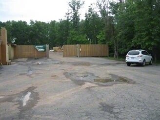
25173 Arcola Mills Dr, Sterling, VA 20166


NEARBY LISTINGS FOR SALE OR LEASE
Property Detail
25173 Arcola Mills Dr
Washington-Arlington-Alexandria, DC-VA-MD-WV
Hutchison Sub Div
162-19-1757
B B HUTCHISON SUB DIV NO.1 LOT 9 200702160012539 D/G 200512150140660
Commercialnec
Loudoun
X
Virginia
51107C0360E
9
2025
1 AC
2025
Route 28 Corridor North
611812
Washington, DC
2,112 SF
DEMOGRAPHICS near 25173 Arcola Mills Dr
1 Mile
3 Mile
5 Mile
2024 Total Population
3,062
77,168
142,299
2029 Population
3,416
83,604
153,882
Pop Growth 2024-2029
+ 11.56%
+ 8.34%
+ 8.14%
Average Age
33
34
34
2024 Total Households
1,111
23,400
43,297
HH Growth 2024-2029
+ 11.97%
+ 8.48%
+ 8.32%
Median Household Inc
$141,182
$185,229
$183,424
Avg Household Size
2.70
3.30
3.30
2024 Avg HH Vehicles
2.00
2.00
2.00
Median Home Value
$670,977
$717,243
$732,844
Median Year Built
2011
2010
2010
Nearby Places
Map Layers
Map Styles
 Street
 Aerial
- Restaurants
- Banks
- Shops
- Fitness
- Groceries
PUBLIC TRANSPORTATION
AIRPORT
Washington Dulles International
DRIVE
WALK
Distance
Washington Dulles International
19 min
9.0 mi
Ronald Reagan Washington Ntl
DRIVE
WALK
Distance
Ronald Reagan Washington Ntl
49 min
32.6 mi
Freight Ports
Port of Baltimore
DRIVE
WALK
Distance
Port of Baltimore
92 min
66.8 mi
Nearby Properties
Address
Land Use
TOTAL SIZE
Lot Size
Zoning
Address
Land Use
TOTAL SIZE
Lot Size
Zoning
525,482 SF
39.73 AC
PDGI
Address
Land Use
TOTAL SIZE
Lot Size
Zoning
669,358 SF
39.88 AC
IP
Address
Land Use
TOTAL SIZE
Lot Size
Zoning
538,565 SF
135.31 AC
PDIP
Address
Land Use
TOTAL SIZE
Lot Size
Zoning
784,204 SF
128.54 AC
GI
Address
Land Use
TOTAL SIZE
Lot Size
Zoning
778,426 SF
48.02 AC
CLI
Address
Land Use
TOTAL SIZE
Lot Size
Zoning
695,321 SF
63.54 AC
PDGI
Address
Land Use
TOTAL SIZE
Lot Size
Zoning
204,014 SF
23.47 AC
PDIP
Address
Land Use
TOTAL SIZE
Lot Size
Zoning
252,600 SF
33.26 AC
PDIP
Address
Land Use
TOTAL SIZE
Lot Size
Zoning
759,405 SF
64.76 AC
IP
Address
Land Use
TOTAL SIZE
Lot Size
Zoning
274,000 SF
82.17 AC
PDGI
Address
Land Use
TOTAL SIZE
Lot Size
Zoning
767,464 SF
GI
Address
Land Use
TOTAL SIZE
Lot Size
Zoning
49.36 AC
IP
Address
Land Use
TOTAL SIZE
Lot Size
Zoning
415,477 SF
97.76 AC
TR1UBF
Address
Land Use
TOTAL SIZE
Lot Size
Zoning
326.06 AC
GI
Address
Land Use
TOTAL SIZE
Lot Size
Zoning
222,313 SF
36.21 AC
PDOP
Address
Land Use
TOTAL SIZE
Lot Size
Zoning
378,278 SF
112.87 AC
PDGI
Address
Land Use
TOTAL SIZE
Lot Size
Zoning
422,597 SF
85.43 AC
TR3UBF
Address
Land Use
TOTAL SIZE
Lot Size
Zoning
327,400 SF
37.53 AC
PDGI
Address
Land Use
TOTAL SIZE
Lot Size
Zoning
48.30 AC
PDIP
Address
Land Use
TOTAL SIZE
Lot Size
Zoning
59.20 AC
IP
Address
Land Use
TOTAL SIZE
Lot Size
Zoning
230.43 AC
PDGI
Address
Land Use
TOTAL SIZE
Lot Size
Zoning
181,718 SF
10.23 AC
R16
Address
Land Use
TOTAL SIZE
Lot Size
Zoning
303,168 SF
41.95 AC
PDCCRC
Address
Land Use
TOTAL SIZE
Lot Size
Zoning
264,902 SF
60.25 AC
PDH4
Address
Land Use
TOTAL SIZE
Lot Size
Zoning
54 AC
PDTC
Address
Land Use
TOTAL SIZE
Lot Size
Zoning
234,264 SF
66.14 AC
PDGI
Address
Land Use
TOTAL SIZE
Lot Size
Zoning
39.89 AC
PDGI
The World's #1 Commercial Real Estate Marketplace
Connect with us
© 2026 CoStar Group
The information above has been obtained from sources believed reliable. While we do not doubt its accuracy we have not verified it and make no guarantee, warranty or representation about it. It is your responsibility to independently confirm its accuracy and completeness. Any projections, opinions, assumptions, or estimates used are for example only and do not represent the current or future performance of the property. The value of this transaction to you depends on tax and other factors which should be evaluated by your tax, financial, and legal advisors. You and your advisors should conduct a careful, independent investigation of the property to determine to your satisfaction the suitability of the property for your needs.